
A new study uses species distribution modelling to map high-risk areas of human-elephant interactions in Wayanad, Kerala.The model uses an ensemble of ten machine-learning algorithms to analyse human-related, climatic and landscape variables, and predict where and when human-elephant interactions are likely to occur.The researchers aim to add social tolerance and conservation expertise layers to their model to provide a “true projection” of human-wildlife conflict.
See All Key Ideas
In the last 15 years, there have been 1,527 human deaths from wildlife encounters in Kerala, according to the data from the state forest department. While snake bites accounted for 75 percent of the casualties, elephants claimed 276 lives, wild pigs were responsible for 63 lives and conflict with tigers and gaurs resulted in the loss of 11 and 10 lives, respectively.
The case count has been steadily rising; between 2021 and 2025, human interaction with elephants claimed 103 lives, wild pigs claimed 35 lives, and tigers claimed four lives.
It is fair to say that Kerala, one of the most densely populated states in the country, has been in the eye of the storm, with cases of human-wildlife conflict — crop damage, livestock depredation and human casualties — being reported almost every day.
Epicentre of human-elephant conflict in Kerala
The Wayanad district, which recorded 450 human-wildlife conflict incidents in the last year alone, is one of the most conflict-prone regions in the state.
The north-east district shares borders with both Karnataka and Tamil Nadu, and forms part of the Brahmagiri-Nilgiri-Eastern Ghats elephant landscape, which boasts the highest density of elephants in Asia, with an estimated population of 6,000 to 8,000 individuals.
The Wayanad plateau, with its network of wetlands and perennial streams, has always been a valuable refuge for elephants in the dry season. However, with an expanding human population and a pronounced change in land use over the years, the region has become a hotspot for human-elephant conflict.
Land use change is the fundamental issue, shares M. Ananda Kumar, a senior scientist who leads the Anamalai Elephant Programme at the Nature Conservation Foundation. “In the Hassan region, where we have worked for the last decade, the major landscape change happened when people started putting fences around coffee, which then pushed the elephants into villages where there were no fences. Then those villages put up fences, which again pushed elephants into newer areas,” he said.
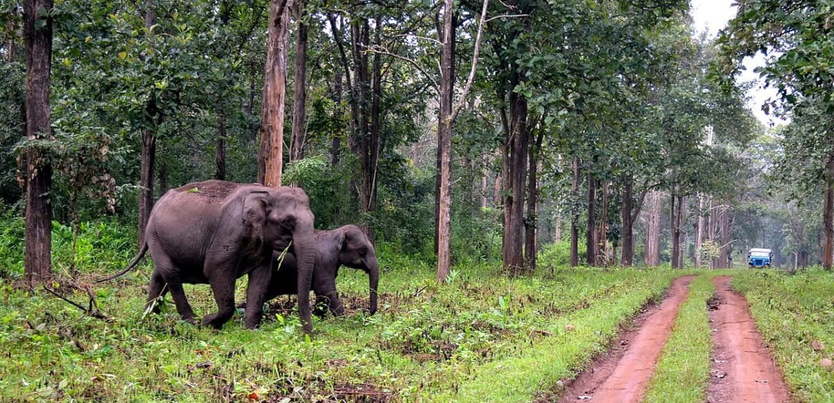 Elephants in Wayanad cross a trail as a vehicle approaches. In the last 15 years, 276 out of a total of 1,527 human deaths from wildlife encounters in Kerala were caused by elephants, according to data from the state forest department. Image by Raghavan G. via Wikimedia Commons (CC BY-SA 4.0).
There have been efforts by the government and other agencies to resolve the conflict in Wayanad, but like in numerous other landscapes, they have proven ineffective. “Most of the interventions are done from a human perspective,” Kumar said. “How well can they protect livelihoods? How well can they protect the land? Elephants are not even a part of the equation.”
The gap in the knowledge of elephant behaviour and ecology means that interventions planned lack scientific backing, says Mayukh Chatterjee, Asia programme manager at the Chester Zoo and one of the authors of the paper.
“Wayanad is a classic example where an umpteen number of fences and barriers have been placed,” Chatterjee said. “A lot of these interventions have been carried out in good faith, but in haste and without testing for scientific rigour.”
Predicting and interpreting conflict from datasets
Published in the Global Ecology and Conservation journal, the paper by researchers from the Chester Zoo, the University of Oxford, and the Wildlife Trust of India uses species distribution modelling to map areas at high risk of human-elephant interactions in Wayanad.
Species distribution models (SDMs) are statistical tools used in ecology to analyse and predict the geographic distribution of species based on different human-related and environmental variables. Of late, their application has expanded to the field of human-wildlife conflict.
“It isn’t a new concept,” says Jacqueline Morrison, a senior conservation scientist at the Chester Zoo and a research associate with the University of Oxford, who is also one of the authors of the paper. “But what we’ve done differently is, instead of using just a single machine-learning algorithm like MaxEnt (maximum entropy), we’ve used ten different algorithms to create an ensemble model that corrects for the different biases.”
The study compiled 1,942 conflict incident reports from Wayanad between 2011 and 2014, manually sourced from the state forest departmental compensation records. The researchers had identified 15 ecological variables in the literature that are considered important predictors of interactions between people and Asian elephants, divided into three classes, namely, anthropogenic, climatic, and landscape.
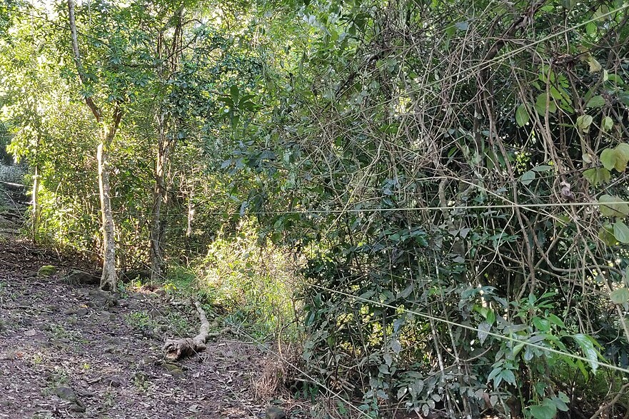 A electric fence fragments a forest patch in Anamalai Tiger Reserve. Experts point to land use change as a link to human-elephant conflict, especially in the form of electric fences installed around coffee plantations and villages. These force elephants into newer areas. Image by T. R. Shankar Raman via Wikimedia Commons (CC BY 4.0).
The research team was then able to assemble time-series datasets for each predictor variable, with the help of Google Earth Engine and sometimes by manually curating from scratch. Morrison spent 15 months compiling the different datasets and validating every data point to ensure maximum precision and accuracy.
“While SDMs tend to use decadal averages of predictor variables, we extracted the closest available data to that date, to be able to capture the real change in dynamics,” Morrison said. “For example, if we have a record from the forest department on March 16, 2011, we extract the closest available data to that date.”
“I don’t think anybody has done this in modelling conflict,” she added.
Human density and proximity to protected areas
With the ensemble modelling framework, the research team was able to construct predictive distribution models for the wet and dry seasons from 2011 to 2023 and identify the regions in Wayanad at consistent risk of negative human-elephant interactions.
During the dry season, Kidanganad, Nulpuzha and Pulpalli demonstrated the highest risk. Conversely, Tirunelli and Trisshaleri were identified to be at risk during the wet season. According to the model, since 2020, high-risk areas during the dry season have decreased and stabilised, whereas wet season risk has remained variable.
Human population density was the most influential variable in predicting the likelihood of negative human-elephant interactions. While risk is lowest when population density is below 200 people/km², it increases as human density increases up to 400 people/km², before declining sharply in more densely populated areas such as towns.
The proximity to protected areas was another crucial predictor. The risk tends to increase up to 15 km away from protected areas, which the authors attribute to the higher tolerance of people (indigenous communities) living closer to forests. The risk declines after 15 km, due to reduced elephant presence away from the forest and closer to human-inhabited areas.
Chatterjee points out that while their study boasts a robust analytical approach, what it conveys and how it conveys it are equally important. “A key change in our approach [when compared to other studies] is the conscious omission of the word ‘conflict’,” he said. “We use ‘negative human-elephant interactions’ to refer to crop raiding events.”
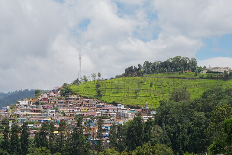 A tea estate neighbouring human settlements. A recent study used species distribution modelling to map areas at high risk of human-elephant interactions in Wayanad, and found that human population density was the most influential variable in predicting the likelihood of negative interactions. Representative image by Timothy A. Gonsalves via Wikimedia Commons (CC BY-SA 4.0).
Achieving “true” conflict projection
The research team is careful to highlight that the current version of the prediction model does not offer a “true” projection of human-wildlife conflict in the region. “In a simplistic way, we have named areas where projected crop raiding can potentially go up, but again, it’s a projection; it doesn’t mean that it will go up,” Chatterjee said. They hope that conservation managers can use these findings to guide their monitoring efforts in the region.
“True conflict projection can happen when we bring in social dynamics as a layer,” Chatterjee shared. “That will allow us to differentiate and predict both damage and conflict.”
To achieve this, the research team is adopting the willingness to coexist index, as defined by Divya Vasudev and Varun Goswami, into their model. “The willingness to coexist index is simply the propensity of a person to be willing to live with an animal in their neighbourhood,” Divya Vasudev, a senior scientist at Conservation Initiatives, a Guwahati-based not-for-profit trust, said.
Although conservationists have been looking at people’s perspectives and attitudes towards animals for a long time, Vasudev points out that their method allows for a robust and comparable way to quantify social tolerance. “A person may love elephants notionally, but that may or may not translate to them wanting to share space with elephants,” she said. “The index separates broader attitudes towards the animal from a willingness to coexist with the animal, and accounts for misreporting.”
Alongside the willingness to coexist index, the research team aims to incorporate expert opinions as another layer into the model. “What does the forest department think? What does a conservationist or researcher think? We want to build a holistic approach to understanding and interpreting human-wildlife conflict,” Chatterjee said.
The researchers see this published paper as the first step in a long-term project towards reimagining conflict assessment. “We understand that we can’t do everything by ourselves. Collaborating with other stakeholders will be key,” Morrison said.
They hope to work with partners on the ground and take the discourse back to the people, where they can conduct workshops and start working on solutions.
Chatterjee accepts that stakeholder participation will be key. “Getting people in one room and getting them to agree on something, that has always been the biggest challenge in conservation,” he said.
Read more: Expanding elephant range fuels human-wildlife conflict
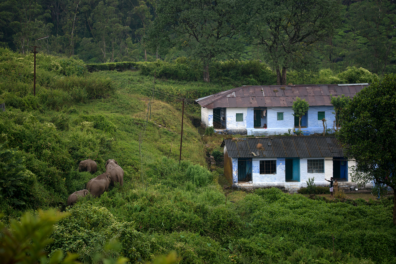
Banner image: An elephant herd walks along a non-functioning electric fence to pass households as people watch them move without disturbing them. Image by Ganesh Raghunathan via Flickr (CC BY-NC-ND 2.0).