
Ex-Tropical Cyclone Koji has crossed the north Queensland coast between the towns of Ayr and Bowen and has weakened into a tropical low pressure system.
But the Bureau of Meteorology (BOM) said intense rainfall was expected to batter the region after the system, which made landfall between the Burdekin River and Cape Upstart north of Bowen.
Flash flooding is likely in coastal areas between Ayr and St Lawrence and the danger could extend south towards Rockhampton from Monday, according to the BOM.
“It’s a lot of rain and there’s a lot more still to come, so absolutely buckle down and stay put,” forecaster Angus Hines said.
More than 14,000 homes are without power, with most outages reported in the Whitsundays and Mackay region, according to Ergon Energy.
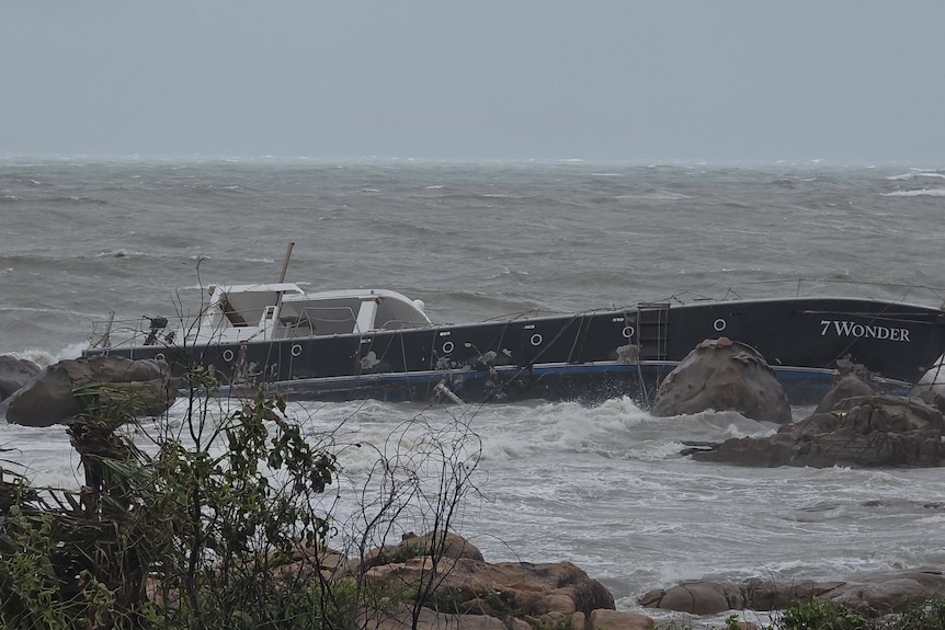
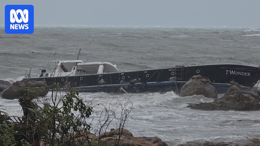
A large boat washed onto rocks as Ex-Tropical Cyclone Koji hit Bowen on Sunday morning. (Supplied: Chris Georgieff )
Strong winds and rough ocean conditions have led to several boats in Airlie Beach breaking free of their anchorages and being pushed on to shore.
The BOM has cancelled its warning for Townsville and said strong winds from the cyclone of up to 100kmh have been observed in the Whitsunday Islands.
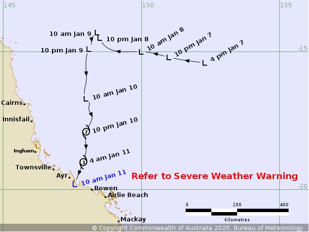
Impacts from the Ex-Tropical Cyclone Koji are expected to be felt from Ayr south to Mackay. (BOM)
Mr Hines said the worst of strong winds was expected to be “done and dusted” by midday.
Ex-Tropical Cyclone Koji had been downgraded from a category two system overnight.
Loading…”Rain is going to be the main focal point really as today progresses,” Mr Hines said.331mm of rain in six hours
Major flood warnings are in place for north Queensland catchments including the Pioneer River, Georgina River and Flinders River.
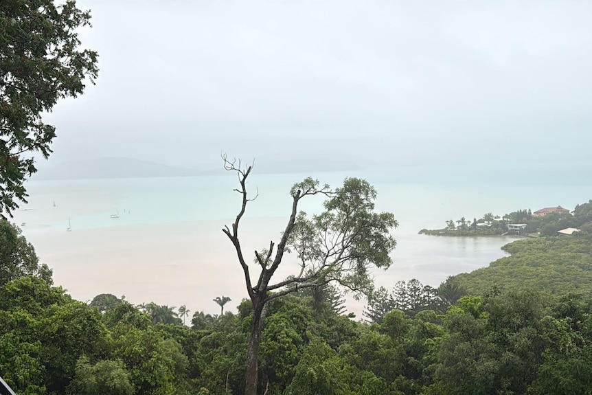
Whitsundays residents say they’re feeling the first impacts ahead of Tropical Cyclone Koji. (Supplied: Kerri Smit)
The heaviest falls so far include Clarke Range, inland of Mackay, which recorded 362mm of rain in the 24 hours to 9am on Sunday and Mattie O’Neil Bridge which received 331mm in six hours.
Peter Faust Dam, near Proserpine, received 369mm in the 24 hours to 9am.
Mackay Mayor Greg Williamson said authorities were closely monitoring the falls and urged people to be wary of floodwater.
“We’re really concerned about the amount of water that’s associated with this cyclone,” Cr Williamson said.
“The big message is, if it’s flooded, forget it. Don’t go sightseeing. There’s a real chance of flash flooding in some areas.
“We’re not out of the woods yet.”
Mr Hines said falls between 100mm and 200mm could fall across a large part of the north Queensland, with falls as far south as Rockhampton.
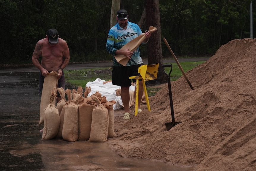
Residents at Toolakea Beach prepared sandbags yesterday before the cylclone hit north Queensland. (ABC North Queensland: Baz Ruddick )
Mr Hines said the storm appeared to be a “lopsided” system with most of the rainfall dumped south of the storm, where six-hourly rainfall totals of up to 150mm could be experienced.
“The persistent heavy rain and potential for flooding is really on the southern flank of this system.”
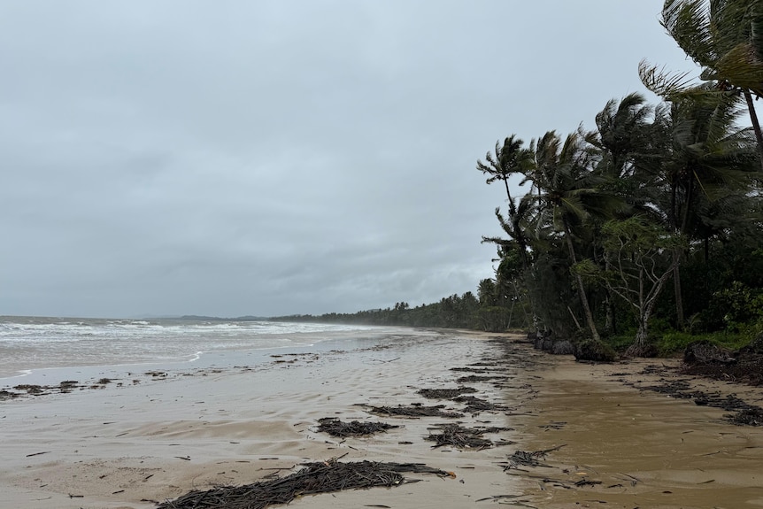
Mission Beach began feeling the impact of Cyclone Koji yesterday. (ABC Far North Qld: Chris Testa )
Extra SES members, as well as Queensland Police and Ambulance officers, have been placed in the Whitsunday Islands in anticipation of the cyclone’s impact.
In an emergency phone Triple Zero
Whitsundays Mayor Ry Collins said the impact of the storm was being felt.
“It’s howling out there at the moment,” he said.
Mr Collins said the area had already received about 150mm of rain and some roads are already impacted by floodwaters, including a section of the Bruce Highway just outside of Bowen.
“We encourage everybody throughout the region to take the advice and make sure they’re prepared for what’s coming.”
Ergon Energy spokesperson Justin Coomber urged residents to report and stay away from any downed powerlines and treat them as if they are live.
“We’ll get out and restore power as soon as it’s safe to do so,” he said.