
The National Oceanic and Atmospheric Administration’s Geostationary Operational Environmental Satellites network (GOES) captured a number of natural phenomena high above Earth this year, including unusual snow events, wildfires, volcanoes and numerous northern lights.
As “eyes in the sky” to monitor the weather in the Western Hemisphere, NASA’s GOES satellites continually transmit high-resolution imagery and data for weather forecasting, severe storm tracking, fire monitoring, and space weather prediction.
Here’s a sampling of its amazing images captured this year:
January 2025: Rare snowstorm blankets Southern US
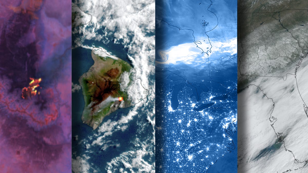
On Jan. 21, an Arctic blast hit the southeastern United States, coinciding with the year’s on-average coldest period. In addition to bringing record-low temperatures, it fueled a winter storm that caused unusual snowfall in certain Southern states, according to NOAA Climate.gov. NASA’s GOES-16 satellite captured the Southeastern U.S. blanketed with snow.
July 2025: Historic Grand Canyon Lodge destroyed by Dragon Bravo fire
On July 4, NASA’s GOES-18 satellite captured the Dragon Bravo fire in Arizona’s Grand Canyon National Park which started with a lightning strike and quickly became a roaring wildfire. The fire destroyed over 70 historic buildings, including the iconic Grand Canyon Lodge.
July 2025: Catastrophic flooding in Central Texas
On the night of July 3 and the early morning of July 4, the GOES-19 satellite captured a convergence of heavy storms and inundated waterways that led to catastrophic flooding, which claimed dozens of lives across Central Texas. The system unleashed even heavier rainfall in areas west of Kerrville, Texas. In just a few hours, massive amounts of rain fell, with some areas reaching over 12 inches of rain in a very short amount of time. As a result, over 135 people lost their lives.
September 2025: The northern lights
On September 30, three NOAA satellites captured this dazzling display of the northern lights (also known as the aurora borealis) along the U.S. border with Canada, which was caused by high solar activity from the sun’s 11-year solar cycle. In mid-November, there was a significant geomagnetic storm that delivered vibrant colors and extensive visibility of the phenomenon, even in the southern U.S.
December 2025: An erupting volcano and an atmospheric river
Hawaii’s active volcano: Kilauea, one of the world’s most active volcanoes, has been erupting since Dec. 23, 2024, according to the Hawaiian Volcano Observatory. The volcano has been very active in December, with intense lava fountain episodes. NASA’s GOES satellite captured this imagery of Kilauea’s eruption on Dec. 6 and Dec. 7.
Atmospheric river impacts Pacific Northwest: Washington and the West Coast have been dealing with a back-to-back atmospheric river pattern, inundating communities with heavy rain. The pattern is sometimes called the “Pineapple express” because it originates in the region around Hawaii. Rainfall totals have exceeded 12 inches in the Olympic Mountains and the Washington Cascades, causing the threat of flooding and mudslides in several areas, according to AccuWeather.
SOURCE: NASA, CIRA and USA TODAY research