
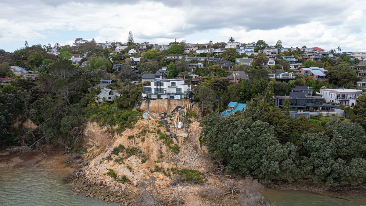
An aerial view of landslide damage in Muriwai following Cyclone Gabrielle, which is discussed in the new report. Photo / Auckland Council report
An in-depth Auckland Council report into landslide risks has revealed nearly 20% of the region is at “high” or “very high” risk of being impacted by landslides. Photo / Auckland Council report
The council report shows damage already caused by landslides near dwellings and suggests there will be more to come in future. Photo / Auckland Council report
“Susceptible to rock fall and toppling”
The Auckland Region was divided into 11 colour coded sub-regions for the study. Photo / Auckland Council report
Some of these Shore Rd, Remuera homes were red-stickered after extensive flooding and damage in the Auckland region in early 2023. Photo / Brett Phibbs
Islands on the Hauraki Gulf – including Great Barrier Island – have been identified as very prone to landslides. Photo / NZME
Landslides are Auckland region’s “most significant natural hazards”
Landslides threaten homes on Colwill Rd, Massey, in early 2023. Photo / NZME
smaller scale and shallow, andlarger scale events that “can cause damage across a wider area, often over a longer period”.
The two darkest shades of grey highlight areas where the risk is “very high” or “high”. Photo / Auckland Council report
Roads are vulnerable to landslides, as this photo of damage to the Manukau Heads Rd shows. Photo / Auckland Council report
Six people lost their lives after last month’s slip at Mt Maunganui, and two more in a second landslide in nearby Pāpāmoa. Photo / Jason Dorday