
Wildfires in Arctic Alaska now outrun anything the region has seen in the last 3,000 years, according to a new reconstruction built from modern satellite records.
That jump signals that the Arctic tundra is no longer protected by cold, wet ground that once kept flames rare, and it marks the start of a hotter, more flammable fire era driven by drying soils and spreading shrubs.
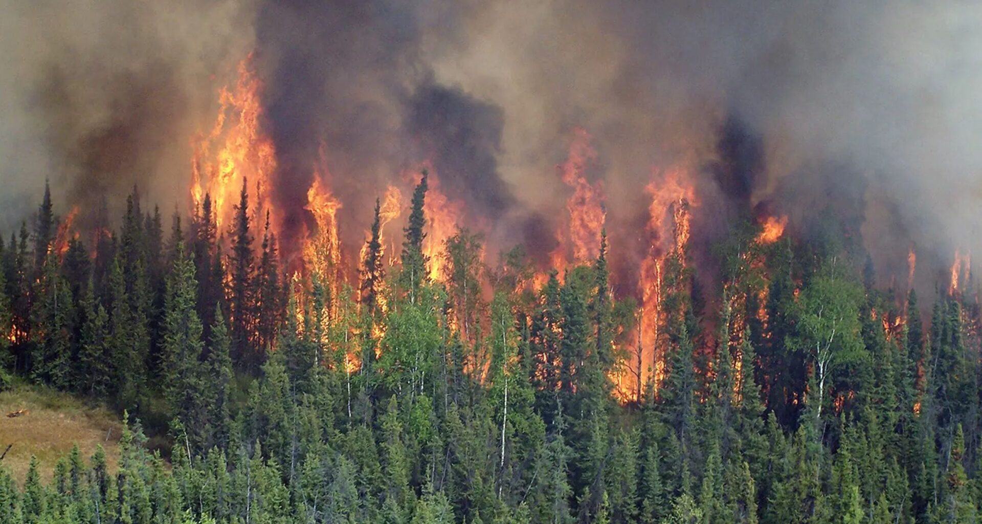
Alaska wildfire history

Layers of peat, thick soils built from partly decayed plants, stored tiny charcoal traces across northern Alaska, and a new paper shows how those traces track wildfire change.
By pairing peat layers with satellite records, Angelica Feurdean, a senior researcher at Goethe University in Germany, tracked the surge after 1950.
Field teams from the University of Alaska Fairbanks (UAF) pulled nine cores about 20 inches deep along Alaska’s Dalton Highway. With that long record in hand, the next clue came from changes in soil moisture and plant cover.
For the first two thousand years of the record, fires stayed scarce across tundra north of the Brooks Range in northern Alaska.
Charcoal specks in the older layers showed long gaps between burns, even when soils dried modestly around A.D. 1000 to 1200.
After that short bump, the signal faded again and stayed low for about 700 years, matching a long stretch of fire absence.
“The interlinked changes across millennia mean recent fires are indicators of a system undergoing rapid transformation,” said Feurdean.
Why soils dried out
Warming pushes the ground to hold less water, and that dryness gives sparks a better chance. As permafrost, ground that stays frozen for at least two years, thaws, water drains deeper and soils dry.
By mid-century, peat surfaces reached extreme dryness at multiple sites, and fire activity climbed higher soon after.
Once peat surfaces dry out, lightning or a stray ember can drive flames across ground that used to resist burning.
Shrubs drive Alaska wildfires
Shrub growth has turned parts of the tundra from sparse grass into thicker, woodier patches that catch fire.
Woody encroachment in the study area favored Ericaceous shrubs, low woody plants in the heather family, which burn readily when dry.
More shrubs meant more above-ground fuel, and the peat cores showed their rise lined up with the fire spike.
That extra fuel matters most during hot, dry summers, because flames can move through brush that once stayed too wet.
Satellites confirm the surge
Modern satellite records back up the charcoal signal and show frequent burns across Alaska’s North Slope since the late 1960s.
Using the Alaska Interagency Coordination Center dataset, they matched burn perimeters to nearby core sites.
Several periods stood out in the satellite record, with clusters of fires in the 1990s and again in the 2000s-2010s.
Still, satellites cover only recent decades, so the peat record sets a baseline for judging how unusual today is.
When fires burn hotter
Size alone did not explain the charcoal patterns, because some of the biggest modern fires left surprisingly weak charcoal traces.
High heat can consume plants almost completely, turning more plant material into ash and leaving less charcoal to settle later. The pattern may indicate a shifting fire regime, with fires now burning much hotter.
Hotter burns also muddy the long record, since a severe fire can erase its own charcoal signature.
Carbon stored underground
In the Arctic, thick soils can lock away carbon for centuries, so fires here carry a global impact. Some Arctic wetlands stack fuel over centuries, and these peatlands, wetlands built from partly decayed plants, can smolder underground.
During 2007, the Anaktuvuk River fire in Alaska burned about 401 square miles, releasing roughly 4.6 billion pounds of carbon.
More frequent tundra fires can turn stored soil carbon into air pollution and heat-trapping gases, raising the stakes well beyond Alaska.
Risks beyond the tundra
Smoke from far-north fires can travel hundreds of miles, and people downwind still breathe those particles.
Burning into thick organic soils adds extra fuel, so a single tundra fire can smolder and smoke for days.
Remote terrain limits firefighting options, and crews often protect roads, pipelines, and camps rather than chase every flame.
Afterward, burned ground absorbs more sunlight, which can speed thaw and keep future summers drier in the same spot.
Future of Alaska wildfires
Long records help land managers stop treating Arctic fires as rare surprises and start planning for regular seasons.
Combining peat histories with modern maps lets UAF scientists flag places where dry soils and shrubs make the next ignition likely.
Better monitoring of soil moisture and shrub cover can guide staffing plans and protect key sites during lightning storms.
Even with smarter planning, cutting greenhouse gas emissions remains the only way to slow the drying that fuels this new fire era.
Across peat layers and satellite maps, tundra fire now runs on dry ground and woody fuel that once stayed limited.
Future work will track whether hotter burns keep reducing charcoal signals, which could hide the true scale of coming fires.
The study is published in Biogeosciences.
—–
Like what you read? Subscribe to our newsletter for engaging articles, exclusive content, and the latest updates.
Check us out on EarthSnap, a free app brought to you by Eric Ralls and Earth.com.
—–