

A key satellite in northern Australia’s bushfire warning detection system is “dying”, according to the service and could have a blind spot of up to 12 hours each day.
Rural land managers in Queensland, Northern Territory, South Australia and Western Australia rely on a network of eight international satellites via the Northern Australian Fire Information (NAFI) service to spot fires.
But NAFI service manager Peter Jacklyn said a “quite important” satellite that orbited over Australia in the late morning was encountering problems.
“It’s dying,” he said.
“It’s 25 years old [and] it’s a minor miracle it’s still operating.”
The satellite, called Terra, was launched by NASA in December 1999.
It was one of the first to simultaneously collect land, ocean and atmosphere data from space.
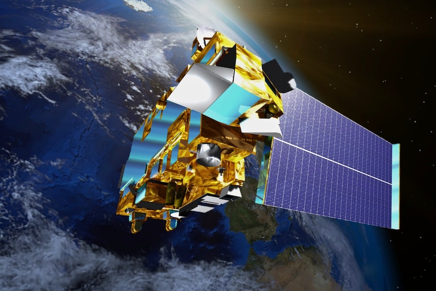
An artist’s impression of NASA’s Terra satellite, which passes over Australia every morning. (Supplied: NASA)
Mr Jacklyn said Terra was running out of power, which was affecting the reliability of some of its data collection instruments.
“It’s now detecting a lot fewer hot spots than it used to, and that means it’s much more prone to, we think, missing fires in the morning,” he said.
Mr Jacklyn said the fault was creating gaps in the fire detection software, which meant it could take 10 or 12 hours for a fire to be detected in some cases.
“A fire that was last detected before dawn, say, doesn’t get picked up again until the main satellites pass overheard in the afternoon.”
‘We couldn’t pull it up’
Queensland grazier Cameron Tickell said a series of failed detections had shaken his confidence in the system.
Mr Tickell said the system failed to detect several large grassfires over summer, including a blaze that started on a neighbour’s property.
“We saw a bit of smoke pop up at what looked like one of the neighbours,” he said.
The Charleville-based cattle producer said by the time he had figured out where the fire was and arrived to fight it, it was already a “proper good” blaze reaching metres into the sky.
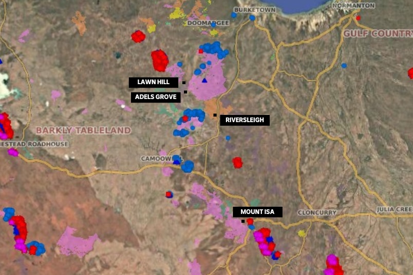
Heat maps like this one, showing fires burning in Queensland’s north west in 2024, are relied on for information. (Supplied: Northern Australia Fire Information)
“We couldn’t pull it up,” he said.
He said he was lucky to receive 5 millimetres of rain, which was enough to get the fire under control.
“We probably fought it for six to eight hours, and it never even popped up on the NAFI site,” Mr Tickell said.
Mr Tickell said land managers needed a reliable system for the early detection of fires.
“We don’t have the people living out here in the bush anymore for that bush telegraph to pass [information] around, so we’re relying on these sites now to work out where the fires are,” he said.
Old satellite ‘drifts’ closer to Earth
All satellites used by NAFI are owned and operated by American, European or Japanese space agencies, providing data to Australia through data-sharing arrangements.
While a new satellite has been launched by the European Space Agency to replace the old satellite, Mr Jacklyn said hot spot data may not be active until the middle of the year.
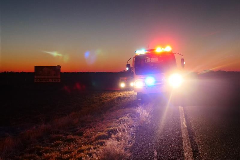
Early detection is critical for remote fire brigades to respond quickly to threatening blazes. (ABC News: Grace Nakamura)
“That’s because here in Australia we need to develop our own little algorithm that looks at an image [from] a satellite and picks out those active fires in the image,” he said.
“And that will take a while to develop.”
Outcry as rural land managers fight to save NAFI website
A NASA spokesperson said the Terra satellite was “still producing science” but was moved to an orbit five kilometres closer to the Earth to conserve fuel in 2022.
The space agency said “power-based limitations” after the change in orbit and reduced solar panel efficiency was affecting some sensors, including the satellite’s thermal telescope (ASTER TIR).
The NAFI website said the satellite network was the only way of detecting and recording fires in line with the “management needs” of many rural and remote land managers.