
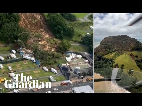
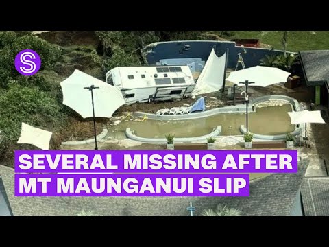
The rainfall-triggered landslide struck the eastern flank of Mauao at approximately 09:30 LT on January 22, descending into the beachfront campground at the base of the 232 m (761 feet) lava dome. Six people were killed when debris buried tents, cabins, vehicles, and campground infrastructure.
Nearly a month after the incident, WorkSafe, a government agency responsible for promoting and enforcing safe work practices across all industries, launched a formal investigation, with a focus on work-related matters in the lead-up to the landslide.
Central regional manager Nigel Formosa said the agency has clarified the limits of its remit and will examine whether businesses and organisations connected to the holiday park’s operation breached the Health and Safety at Work Act 2015.
The investigation will involve engaging technical experts and gathering information from multiple sources to assess decisions and conditions that shaped the work environment prior to the collapse.
WorkSafe has begun engaging with Tauranga City Council in its capacity as operator of the holiday park. The roles of other parties will also be considered. The health and safety investigation is independent of the Government’s announced inquiry into the fatal Bay of Plenty landslides and separate from Tauranga City Council’s external review led by former High Court judge Paul Davison KC.
“We welcome WorkSafe’s independent investigation and are committed to fully supporting that process. This has been an incredibly difficult time for our community. Our thoughts remain with the victims, their whānau, and all those impacted by this devastating event,” Tauranga City Council Chief Executive Marty Grenfell said.
The investigations can take up to 12 months from the date of an incident. Given the volume of information and the technical analysis required, the agency expects the Mauao investigation to take a full year.
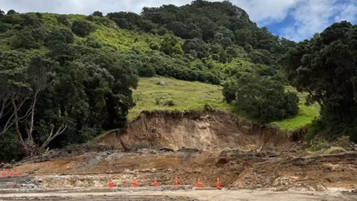
Geotechnical inspections conducted since the event have identified 42 landslides on Mauao.
Twelve failures are classified as severe and require complex engineering intervention. Impacts include rotational and translational slope failures, track undermining, exposed scarps, and debris deposition along established walking tracks that traverse and encircle the cone.
Several areas at the base of Mauao remain restricted while engineers continue slope-stability assessments. Some surrounding roads have reopened following evaluation, but public access to affected tracks remains limited.
In addition, a slope monitoring system has been installed on Mauao, including cameras and ground-based sensors designed to detect movement in near real time during remediation planning.
Satellite imagery captured on January 15, analyzed by landslides expert Dr. Dave Petley, shows intact vegetation cover prior to the rainfall event.
Imagery from January 27 reveals multiple fresh scarps on the eastern, northern, and southwestern flanks. The fatal landslide site is clearly visible on the eastern face, with additional smaller failures distributed across the cone.
According to Tom Robinson of the University of Canterbury, historical analyses indicate approximately 1 800 landslide-related deaths nationwide over the past two centuries — twice the number killed by volcanoes and earthquakes combined.
Heavy rainfall across parts of the North Island in February has renewed concern about slope stability in already saturated terrain. Authorities have advised that steep slopes remain vulnerable during sustained or high-intensity precipitation.
Mauao consists primarily of weathered rhyolitic volcanic material overlain by soil mantles and vegetation. Prolonged rainfall reduces effective stress in shallow soils, increasing susceptibility to debris and translational failures on steep gradients.
References:
1 WorkSafe launches investigation into Mount Maunganui landslide – WorkSafe – February 20, 2025
2 Landslides on Mauao in New Zealand following the 22 January 2026 rainfall event – The Landslides Blog – February 19, 2026