
A major nor’easter storm that stands to potentially cripple coastal cities like New York City and Boston will only graze the Western New York region, reminding us it’s still winter with a dusting or so of snow.
Only minor accumulations are forecast for the Buffalo metro area, with more measurable but manageable snowfall expected across the higher terrain of the southern tier.
It will be snowy across western and north-central NY to start the week. Widespread wet snow will move across the region today with minor accumulations. Lake enhancement will begin tonight and heavy snow is possible across Chautauqua County through Monday night. pic.twitter.com/KAhvaLv71n
— NWS Buffalo (@NWSBUFFALO) February 22, 2026
“Anywhere between 2 and 4 inches of snow for the Wyoming hills, and even areas south and east in the Boston Hills,” NWS meteorologist Dave Thomas tells WBEN. “That’s where we’re expecting the greatest snowfall for today and into the evening hours.”
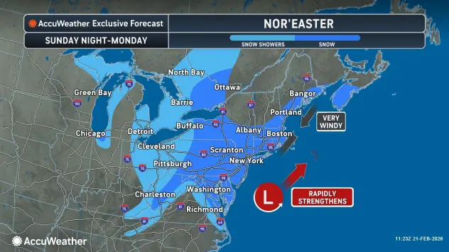
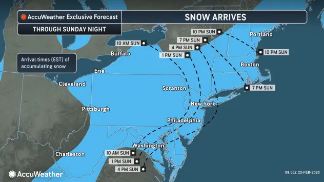
Photo credit AccuWeather.com
More light snowfall is expected Sunday night into Monday, with heavier lake-enhanced accumulations across the Chautauqua Ridge region, where a Winter Storm Watch is posted.
A Winter Weather Advisory is posted for southern Erie, Wyoming and Cattaraugus counties Sunday evening through early Tuesday.
More light snow is in the forecast to kick off the work week Monday.
A weather system moving into the region late in the week will largely dictate how much of a warmup and overall rain or snow we see across the eastern Great Lakes region, NWS forecasters say. The advertised warm-up is becoming shorter and shorter with one day in the Long Term (Saturday) in the 40s. The pattern suggests temperatures falling back to near or below normal into next week.
WINTER WEATHER ADVISORY IN EFFECT FROM 7 PM THIS EVENING TO 6 AM EST TUESDAY
* WHAT…Snow expected. Total snow accumulations of 4 to 8 inches across the higher terrain of the Boston Hills, ridges of Wyoming County, and northern Cattaraugus County. Accumulations will be much lower in the valleys and lower elevations, where only 2 to 4 inches is expected.
* WHERE…Wyoming, Cattaraugus, and Southern Erie Counties. The greatest accumulations will be across higher terrain.
* WHEN…From 7 PM this evening to 6 AM EST Tuesday.
* IMPACTS…Travel will be difficult at times with snow covered roads and reduced visibility. The hazardous conditions will impact the Monday morning and evening commutes.
PRECAUTIONARY/PREPAREDNESS ACTIONS…
Periods of snow will result in snow covered roads and limited visibilities. Slow down and use caution while driving.
WINTER STORM WATCH REMAINS IN EFFECT FROM THIS EVENING THROUGH LATE MONDAY NIGHT
* WHAT…Heavy lake enhanced snow possible. Potential for 7 inches or more of accumulation.
* WHERE…Chautauqua County. Greatest snow accumulation will be found upon the Chautauqua Ridge axis.
* WHEN…From this evening through late Monday night.
* IMPACTS…Travel could be difficult. The hazardous conditions could impact the Monday morning and evening commutes.
* ADDITIONAL DETAILS…Light snow today and this early evening across the county, transitioning to heavy snow tonight through Monday night, with the focus upon the upslope Chautauqua Ridge axis for greatest accumulations.
PRECAUTIONARY/PREPAREDNESS ACTIONS…
Narrow bands of heavy snow could bring rapidly changing road conditions and visibilities. Localized travel problems will be possible.
Featured Image Photo Credit: AccuWeather.com