
Photo: NZ Metservice
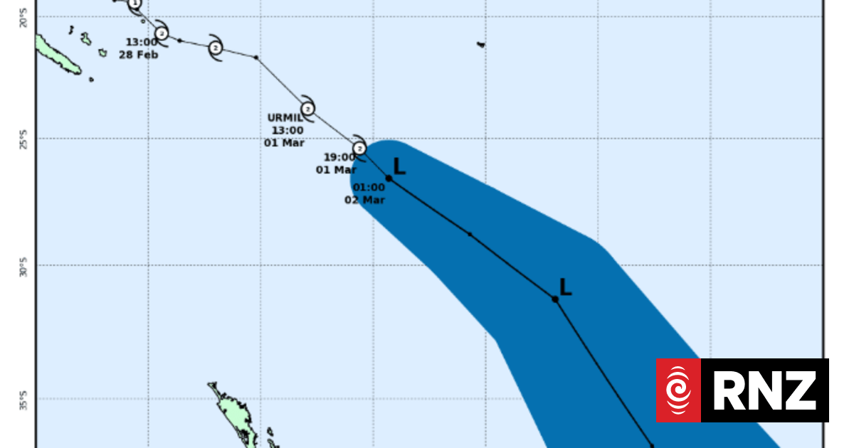
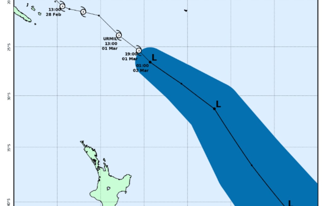
New Zealand’s metservice says former Tropical Cyclone Urmil transferred into an extra-tropical low about midnight on Sunday night.
The remnants of the system should lie to the east of Aotearoa.
“It should continue to move southeast as an extra-tropical system today and pose no impact to New Zealand,” the service said.
The Fiji Metservice said associated rainbands remain over the Fiji group.
Urmil caused flooding and power outages at the weekend.
Occasional rain, which may be heavy at times, is still expected, with a heavy rain warning issued for the whole Fiji group early on Monday morning.
There is still an elevated risk of flooding, particularly in the Western Division and more so during high tide periods.
“Residents in flood-prone areas are urged to remain vigilant,” Fiji Met said.
“While conditions there are forecast to gradually ease, unsettled weather will likely persist until Wednesday.”
As of 8am Monday local time, a flash flood warning for Vitilevu and a flash flood alert for Vanualevu remained in place.
A flood warning was in force for low-lying flood-prone areas near Nakauvadra River (Rakiraki town), Naseyani at Yaqara River, Tavua River and the flood plains of Ba River.
An alert is in place for low-lying flood-prone areas near Nadi River, Nawaka River, and Tuva River in Nadroga.
Schools are closed in Fiji on Monday.
Tonga’s meteorological service said warnings for heavy rains, flash floods and strong to gale force winds remain in place throughout the kingdom.
Meanwhile, the New Zealand Metservice said there is a risk of a tropical cyclone developing in the Coral Sea during Thursday and Friday.