
MetService is forecasting “warm, windy, and wet” conditions for the upper North Island from Thursday, as a low-pressure system moves close to the country and impacts our shores later this week.
The system is expected to move towards the area on Wednesday, and while its centre will remain north-west of the country, associated weather is forecast to cause some impacts.
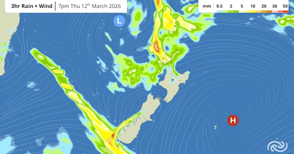
MetService meteorologist Samkelo Magwala said there is “still a lot of uncertainty” about the path the low would take, which meant there “is some risk of severe weather”.
“We are keeping a close eye on it and will provide updates as needed.”
Currently, the low is expected to bring these conditions to Northland and Auckland, and the risk of more severe weather remained low at this stage.
Magwala said beachgoers in Northland will also want to watch out for larger-than-usual waves down the east coast on Wednesday and Thursday.
Meanwhile, another cold front is forecast to affect the southern regions of the South Island towards the end of the week, as it moves towards Fiordland.
MetService said while those in the south and west are in for wet and windy conditions, eastern areas would see a bump in temperatures.
A mixed start to the week
MetService said cloudy, cool, and wet conditions will impact some areas today as a front moved across the southern North Island.
People in the eastern regions of the North Island could expect more of this weather during this afternoon and evening, it added.
However, on Tuesday, there would be plenty of fine spells and a gradual warming of temperatures on Tuesday. Daytime temperatures would range from the low to mid-20s, and some lingering morning showers would still be possible.