
QUICK FACTS
Where is it? Etosha Pan, Namibia [-18.5946865, 16.04684972]
What’s in the photo? A series of colorful, ephemeral lakes that appeared after a flooding event
Who took the photo? An unnamed astronaut on board the International Space Station (ISS)
When was it taken? Dec. 30, 2011
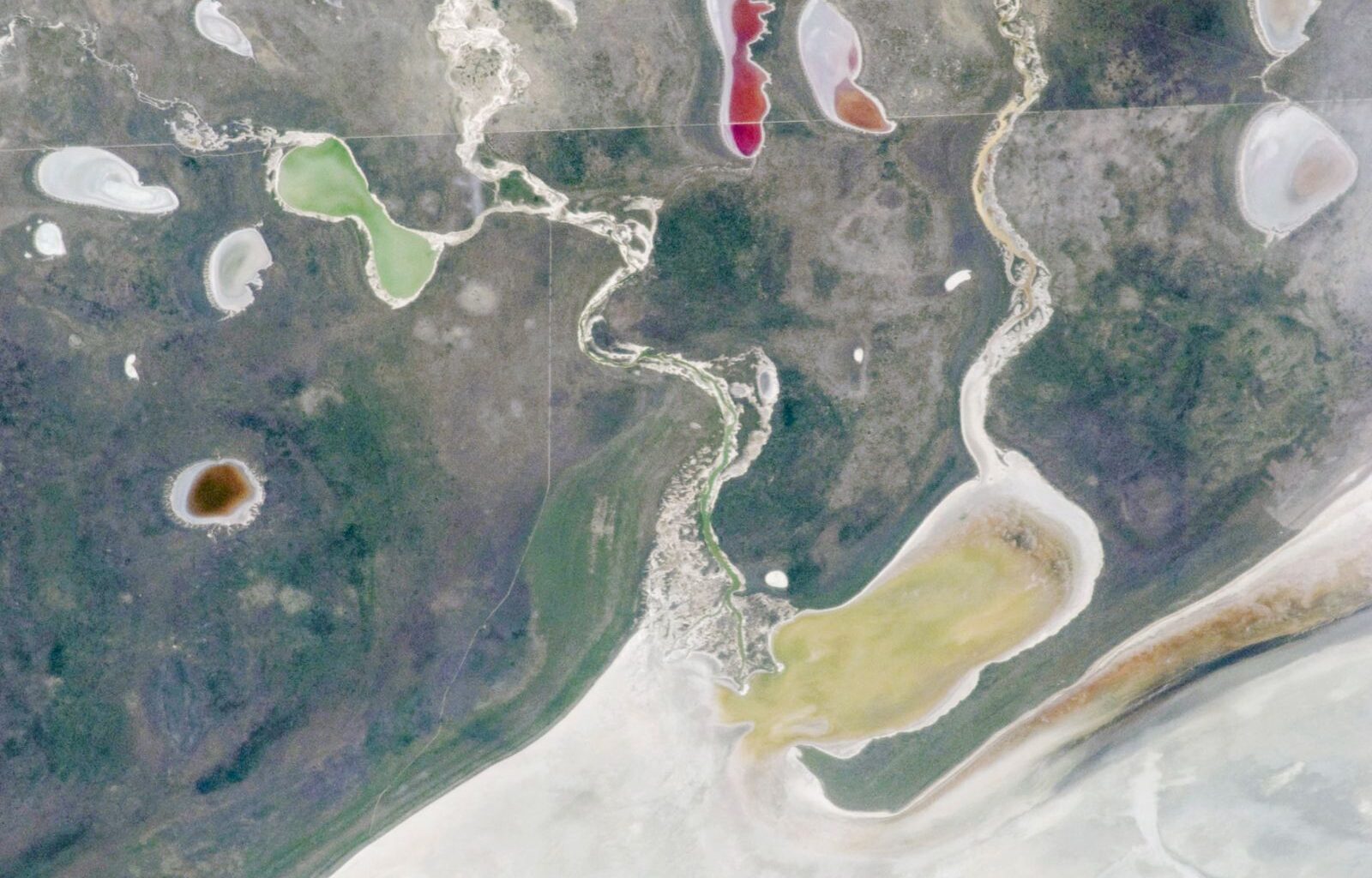
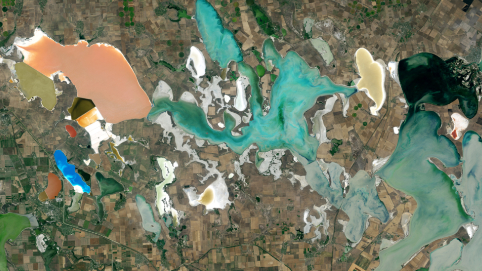
This intriguing astronaut photo shows off the contrasting colors of five ephemeral lakes that emerged around the edges of a giant salt pan after a major flooding event in southwest Africa.
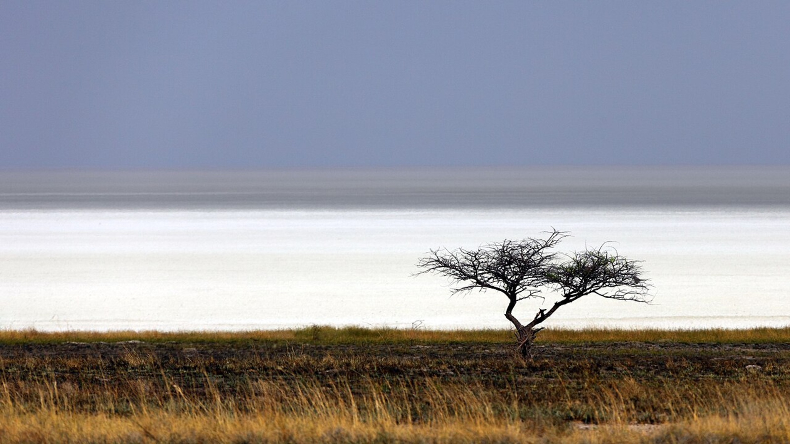
The kaleidoscopic scene occurred in the northwest corner of the Etosha Pan — Africa’s largest salt flat, or mineral pan, which covers around 1,800 square miles (4,730 square kilometers) in northern Namibia. The name Etosha roughly translates to “Great White Place” in an Indigenous Namibian language, and the ghostly expanse is located roughly 250 miles (400 kilometers) from the country’s capital, Windhoek.
The satellite photo shows a snaking pair of ephemeral rivers that drain into the Etosha Pan: the Ekuma River (left) and the Oshigambo River (right). These winding waterways are surrounded by roughly a dozen bowl-like depressions that occasionally fill with water when the rivers sporadically flood their banks.
Article continues below
You may like
When the image was taken, both rivers had recently flooded due to heavy rains in the region, causing around half of these pale depressions to fill with water. The rest of the lakes remained empty and are the same pale hue as the rest of the Etosha Pan.
The contrasting colors of the newly filled lakes — which include yellow, green, brown, red and pink — are likely the result of different species of algae that bloomed within their shallow waters, according to NASA’s Earth Observatory. (For scale, the green lake is around 4 miles (6.5 km) long at its widest point.)
Etosha means “Great White Place” in an Indigenous Namibian language. (Image credit: Alchemist-hp via Wikimedia)
The Etosha Pan likely formed around 10 million years ago and has been a freshwater lake for most of that time. But around 16,000 years ago, toward the end of the last ice age, tectonic activity diverted one of the major rivers that fed into the lake, causing it to dry out.
As the water slowly evaporated, it left behind a thick layer of minerals, which covered the lake bed. Most of the pan’s surface is covered by honeycomb-like hexagonal structures that are common among salt flats across the globe.
During flooding events, a thin layer of water can briefly lie within the pan, transforming it back into a shallow lake. However, this rarely happens, even when its rivers flood.
The last time a majority of the pan flooded was in 2006, which was also captured from space by ISS astronauts.
Wildlife haven
Despite the Etosha Pan’s extreme dryness and salinity, which make it largely inhospitable to life, the area surrounding the ancient lake is covered with rich grassland and woodland.
This diverse ecosystem is protected as part of Etosha National Park, which covers 8,900 square miles (23,000 square km), and is home to a variety of animals, including lions, giraffes, zebras, hyenas, impalas, elephants, rhinos, springboks, wildebeests and ostriches, according to iNaturalist.
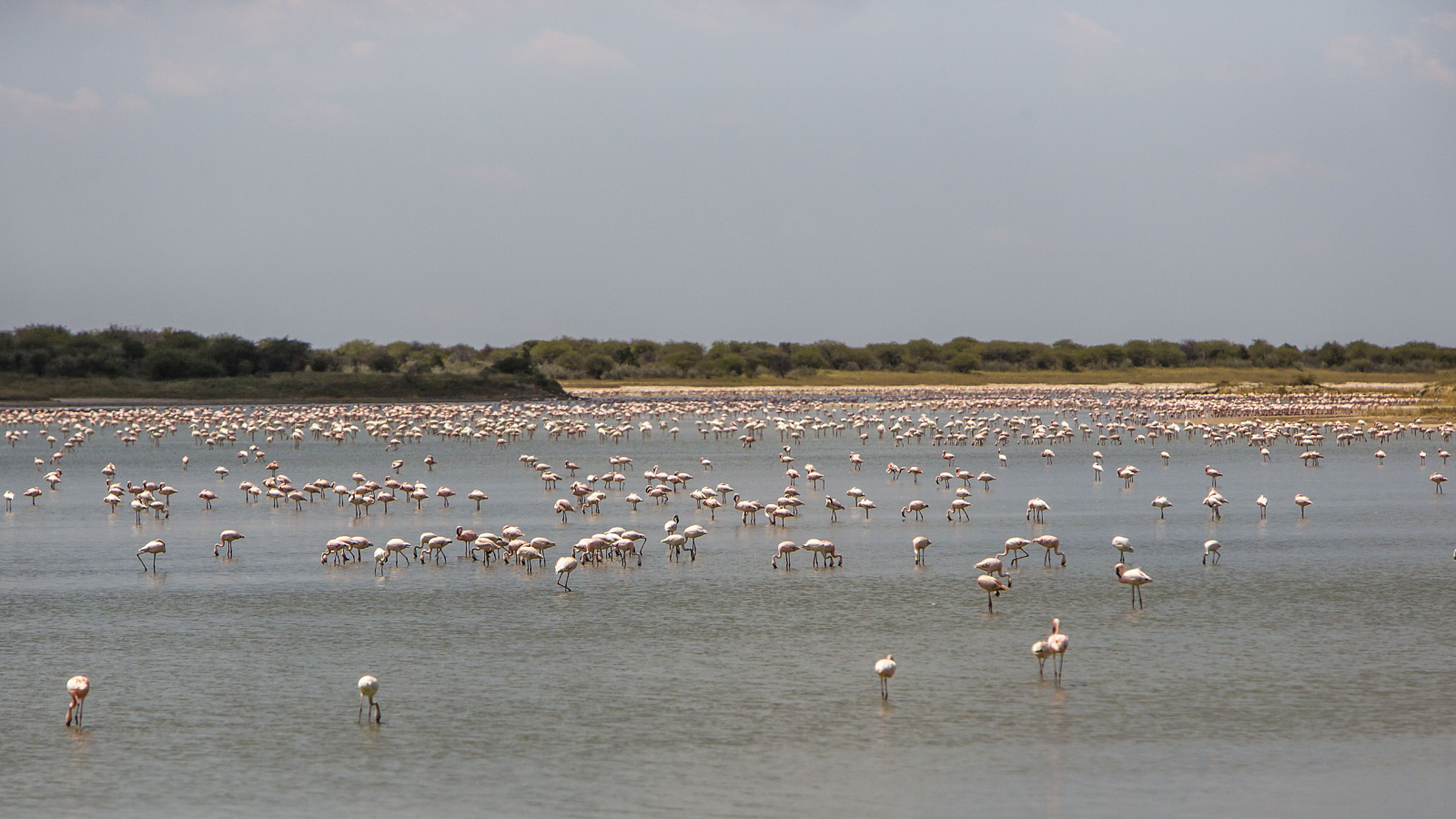
Thousands of flamingos descend on the Etosha Pan each year during their breeding season. This photo shows some of them enjoying a flooded section of the salt flats in 2013. (Image credit: Hoberman/Universal Images Group via Getty Images)
The salt flats themselves are also an important breeding site for flamingos, and up to 1 million of the pink birds congregate there at a time, according to the Etosha National Park website.
If you look closely at the astronaut photo, you can see the park’s northern fence running across the image from left to right — just above the green lake and bisecting the red and pink lakes. This 10-foot-tall (3 meters) barrier stops the park’s animals from wandering outside the woodlands where they could be targeted by poachers, according to the Earth Observatory.
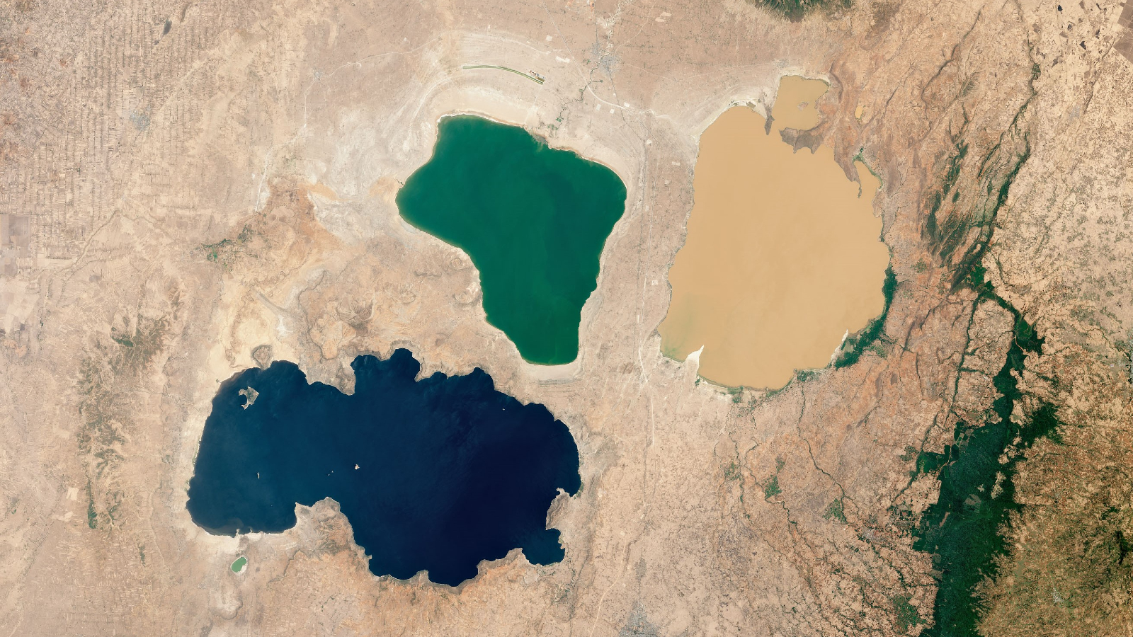
Trio of multicolor African lakes
A 2023 satellite photo shows three closely grouped lakes in Ethiopia’s Great Rift Valley. They have distinctly different hues thanks to a combination of biological and geological factors.
Rainbow-colored ‘putrid sea’ in Crimea
A 2014 satellite photo of the Sivash region shows off the kaleidoscopic colors of a series of shallow, hypersaline lagoons — each filled with a different kind of algae.
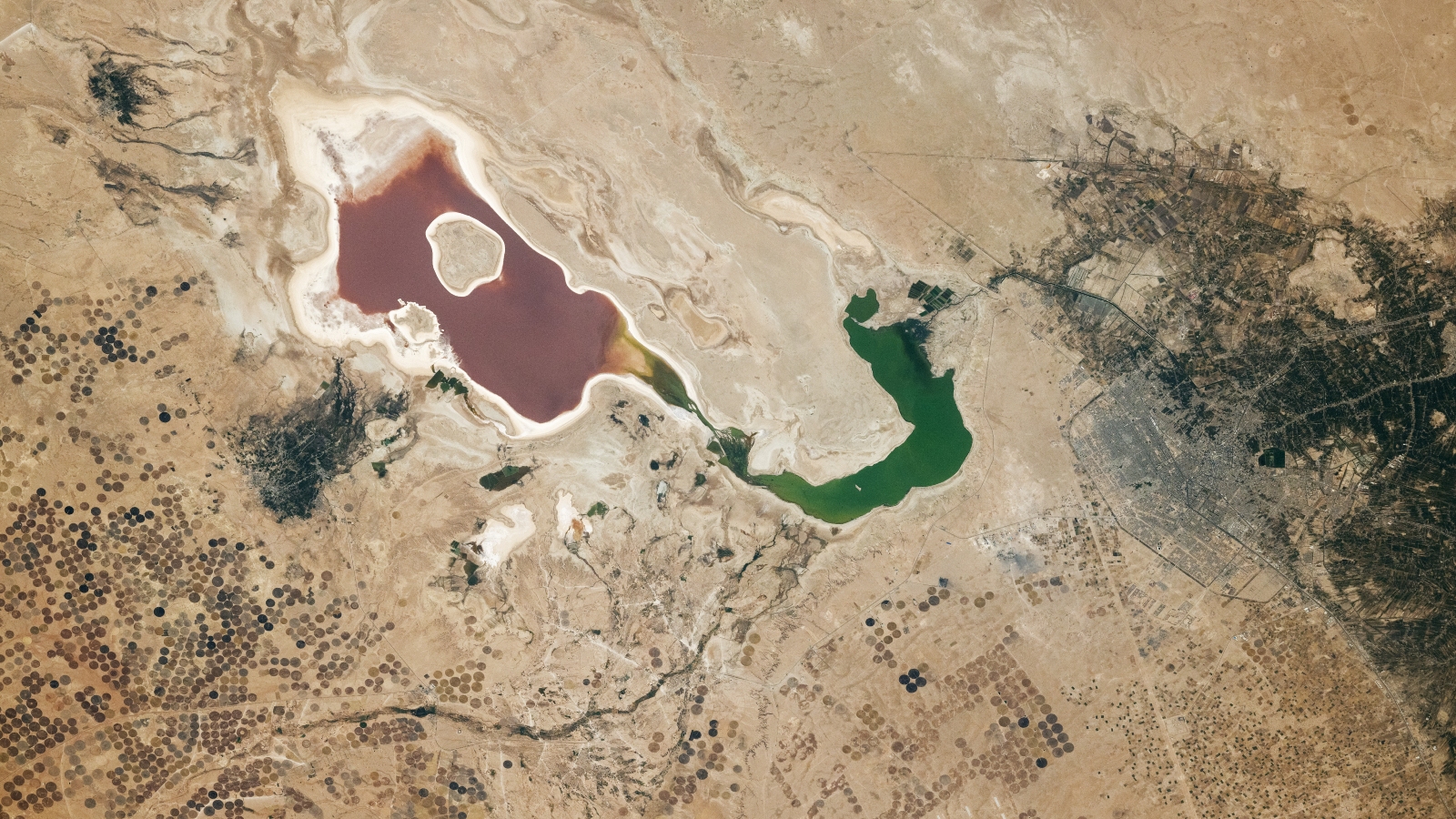
Iraq’s multicolor ‘sea of salt’
A 2024 astronaut photo shows off the striking contrasting colors of Iraq’s Razazah Lake, which is surrounded by a host of strange “crop circles.”