
By Alicia Perera and Courtney Barrett Peters, ABC
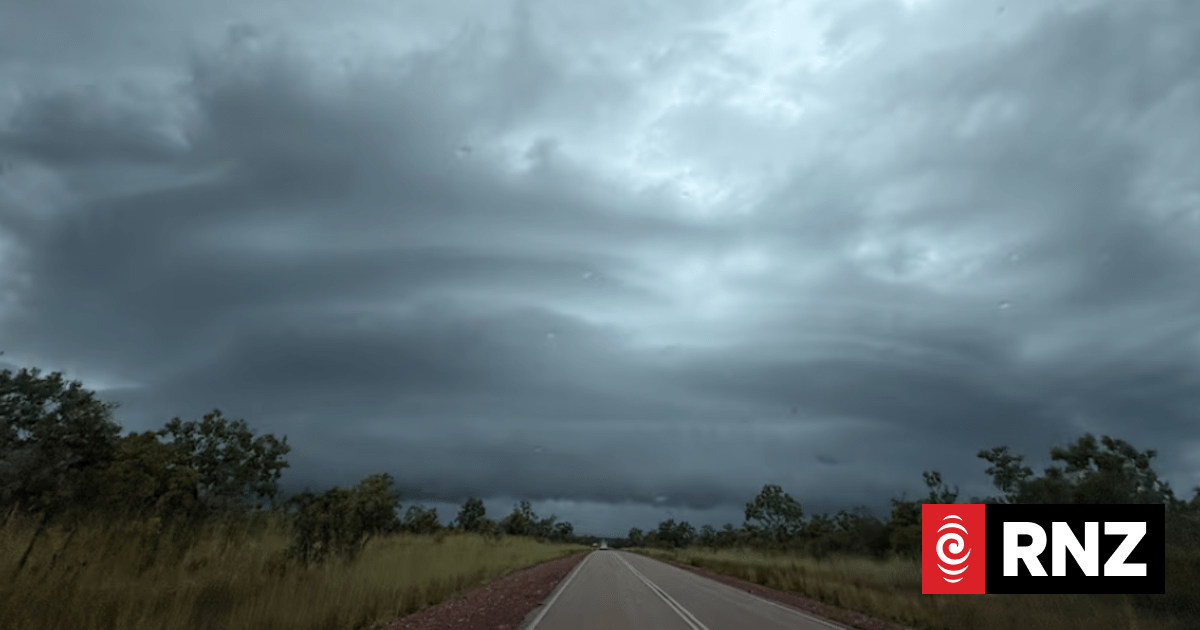
Severe Tropical Cyclone Narelle is expected to cross into the NT from Saturday.
Photo: ABC / Olivana Lathouris
The Bureau of Meteorology (BOM) has issued a cyclone watch for eastern parts of the Northern Territory’s Top End, as Severe Tropical Cyclone Narelle continues moving towards Queensland and the NT.
The category five system is currently moving west towards the Far North Queensland coast and is expected to move across Queensland and into the Gulf of Carpentaria over the next few days.
The BOM said after moving past Queensland, Narelle is expected to cross the NT coast as a category three system on Saturday.
The cyclone watch covers Groote Eylandt and south of Nhulunbuy to Port McArthur, including Borroloola, Ngukurr, Gapuwiyak, Bulman and Numbulwar, but not Nhulunbuy itself.
Tropical Cyclone Narelle is expected to make landfall on Groote Eylandt from as early as Saturday afternoon before moving into the eastern Top End on Sunday.
Numbulwar and Ngukurr are expected to be some of the first mainland communities impacted, with about 500 people from Numbulwar being evacuated to Nightcliff High School in Darwin.
The system is forecast to be downgraded to a tropical low as it tracks near Katherine and Beswick on Sunday and into Monday.
However, a flood watch has also been issued for large parts of the Top End, with heavy rainfall expected to see local creek and river rises, including renewed rises in areas that have already experienced flooding.
In a statement on Wednesday night, emergency service agency SecureNT said the entire community of Numbulwar would be evacuated “over the coming days”, in a “precautionary measure to ensure the safety of all residents”.
“Preparations are now underway, with evacuation to take place by air,” the statement said.
A government spokesperson said the Numbulwar evacuees would be accommodated at a “temporary evacuation staging centre” at the Nightcliff High School gym.

Shenagh Gamble from the Bureau of Meterology says the cyclone will make landfall in the NT as a category three system.
Photo: ABC / Dane Hirst
NT communities urged to prepare
Residents of NT communities in the cyclone’s path are being urged to use the days before its territory crossing to prepare, with authorities calling on locals to take the situation seriously.
The system is approaching the NT just weeks after major flooding in Katherine and nearby Beswick, both of which are in the cyclone’s likely path.
Emergency services are stepping up preparations in the days before the system’s NT crossing, with the territory emergency operations centre ready and staff assessing the state of cyclone shelters.
Residents in communities likely to be impacted are being asked to start preparing now, from readying their cyclone kits to knowing their nearest cyclone shelter and staying up to date with warnings.
“While we have a couple of days to prepare, it’s a really good opportunity for community residents to start working on their cyclone emergency kits, particularly for those communities that may have already been impacted [by weather events], that may have depleted water, food, medication, batteries, torches, all that type of stuff,” NT Emergency Service deputy chief officer Greg Jarvis said yesterday.
“This is an opportunity to start preparing, to take a big deep breath, acknowledge that we’re all very tired and we have been working for a long time, but we have to go again.”
Incident controller Kirsten Engels said authorities were asking anyone who might be impacted “to begin their preparations now, and to take this really seriously”.
“It’s a very dynamic situation and it’s unfolding right now,” she said.
“We know that it’s starting to get tedious, we know that we’ve been together a long time now talking about weather, but we really need you to keep your focus going and prepare for what we know is going to strike this weekend.”
Residents in flood-affected Katherine and Beswick have been warned to expect moderate flooding, with the cyclone forecast to bring heavy rainfall as it crosses.
A flood watch has also been issued for catchments across the Top End, from the West Australian border up to east Arnhem land, with heavy to locally intense rainfall expected during the week.
Flood warnings remain current for the Katherine, Lower Daly, and Waterhouse rivers, with the rain expected to see renewed river level rises after recent flooding.
The BOM’s Jude Scott, however, said the fast-moving system was expected to cross the whole of the NT “within a 24-hour period”, giving it “less opportunity … to stall and produce the heavier falls that can lead to prolonged and major flooding”.
‘Sense of anxiety’ on Groote Eylandt
One of the communities sitting right in Tropical Cyclone Narelle’s projected path through the NT is the small community living on Groote Eylandt.
Its last cyclone impact was just under two years ago, when Tropical Cyclone Megan hit in March 2024, devastating the town’s economy and causing extensive damage to its manganese mine and wharf.
Anindilyakwa Land Council chief executive Kupa Teao said local authorities were taking the situation “one day at a time”, but residents were feeling a great deal of trepidation.
“We’re feeling obviously this sense of anxiety, the sense of unknown,” he said.
“No doubt if this cyclone hits the island, it will impact infrastructure and assets and obviously will have an effect on the economy as well.”
Teao said strong communication would be key as the community braced for the cyclone.
“There’s been high-level discussions with the Northern Territory government around the emergency management plan,” he said.
“It’s going to be a layered approach … managing and coordinating [emergency] processes.”
Relocation and rent pauses for evacuated communities
Flood evacuees from Nauiyu/Daly River and Palumpa will be transferred to accommodation facilities at the Batchelor Outdoor Education Unit in the coming days.
The move from Darwin’s Foskey Pavilion is aimed at providing greater privacy and better access to schools and essential services.
Batchelor Institute CEO Renee Long said evacuees will stay in student accommodation at the Indigenous tertiary provider.
“At the moment we’re working on the basis that people will be with us up to three months and we can accommodate them for that period of time,” she said.
We had a talk with the Kungarakan community through our elder on campus, and they’re all so pleased to have people on campus.
“They said we did it about 10 years ago, and it’d be great to have everybody on campus again.”
Meanwhile, public housing residents evacuated from flooded communities will have their rents paused until they are able to return home, the government has announced.
Pastoralists affected by the flooding can also apply to have their pastoral rent waived and relieved for a period of up to a year.
Deputy chief minister Gerard Maley said the two policies have been enacted under existing laws, meaning they don’t need to be approved by Parliament.
“We realise how important it is to make sure that you get back home or get your business up and running as soon as possible,” he said.
-ABC