
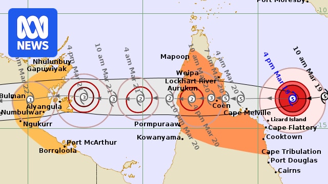
Severe Tropical Cyclone Narelle is expected to cross the Queensland coast on Friday morning as a category five system, with winds near its eye more than 300 kilometres per hour.
In updated advice on Thursday evening, the Bureau of Meteorology (BOM) said the system would retain its category five strength when it makes landfall between Lockhart River and Cape Melville about 7am on Friday.
The storm is 240 kilometres north-east of Cooktown, travelling west at 27km/h.
Severe Tropical Cyclone Narelle approaches the Queensland coast on Thursday. (Supplied: BOM)
The BOM warns the system is creating destructive wind gusts of up to 315km/h near its centre, with consistent winds of 220km/h.
The weather bureau said it “remains to be seen” whether the cyclone will make landfall as a category five system or weaken to a category four by the time it reaches the coastline.
Severe Tropical Cyclone Narelle live updates: For the latest news on the cyclone, read our blog.
The cyclone warning zone is between Lockhart River and Cape Tribulation, and between Mapoon and Pormpuraaw, including Coen, Cooktown, Weipa and Aurukun.
A watch zone is active for Nhulunby to Port McArthur, Borroloola, Numbulwar, Alyangula and Ngukurr.
Watch and Act warnings have been issued for multiple regions across Cape York Peninsula, with an emergency warning issued Thursday evening for Wujal Wujal.
Communities advised to prepare to take shelter include Cook Shire, Portland Roads, Hope Vale, Coen and Port Stewart area and Lockhart River.
A prepare now alert was also issued for Mapoon, Napranum, Weipa and the Aurukun local government area.
Those on the water are being told to expect hurricane-force winds, the most serious warning available, with winds above 64 knots, and the potential to create waves in coastal waters topping 11 metres.
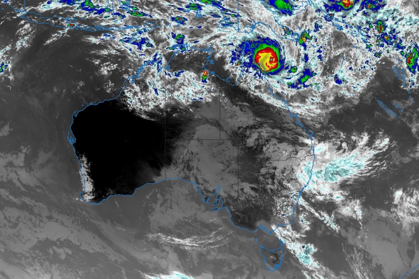
Wind direction and intensity of Tropical Cyclone Narelle. (Supplied: Nullschool; MIT Licence)
Authorities are warning residents within the zone to urgently prepare their homes, boats and cyclone kits for the severe event.
Senior meteorologist Christie Johnson said beyond the cyclone watch and warning zones, other areas were likely to face severe thunderstorms from today.
“We could start to see the risk of some severe thunderstorms sort of south of that warning area around Port Douglas, maybe around Cairns,” she said.
They could extend south to Ingham into Friday, she said.
“There is some modelling [showing] 150 to 200 millimetres along parts of the north tropical coast.”
Premier David Crisafulli said if the cyclone did cross the coast as a category five, as forecast, it would be just the fourth time that had happened in 50 years.
It will also be the first time in 100 years that a category five cyclone has made landfall in that area.
“I can’t sugarcoat this; the damage will be widespread with a system of that size,” he said.
Hurricane-force winds
Tropical Cyclone Narelle is the latest severe weather system to impact parts of Queensland in less than two months.
A hurricane-force wind warning has been issued for the Peninsula and Cooktown coasts, and a gale warning for the Cairns coast.
BOM predicts “very destructive wind gusts” of more than 250km/h are possible near the centre of the storm as it crosses the coast from Friday morning.
It warns heavy to locally intense rainfall to develop across the far north and north tropical coasts today, with wind gusts of up to 160km/h from Lockhart River to Cape Flattery.
Cooktown may also be forced to endure the high winds if the system’s path shifts slightly south.
Gale-force winds of up to 120km/h are also forecast.
Heavy rainfall, which could lead to flash flooding between Cape Melville and Cape Tribulation, is expected from Thursday evening, extending into inland areas west of Coen through Friday.
Locally intense rainfall is also likely in parts of the Peninsula bounded by Lockhart River, Cape Flattery, Pormpuraaw and Weipa on Friday.
Damaging waves and dangerous flooding are expected at Princess Charlotte Bay, with a “dangerous storm tide” likely as Narelle approaches.
As it crosses the Cape York Peninsula, Tropical Cyclone Narelle is predicted to weaken to category two strength before heading into the Gulf of Carpentaria, where it is expected to re-strengthen over warm waters.
It is predicted to make landfall for a second time in the Northern Territory over the weekend and possibly in Western Australia next week.
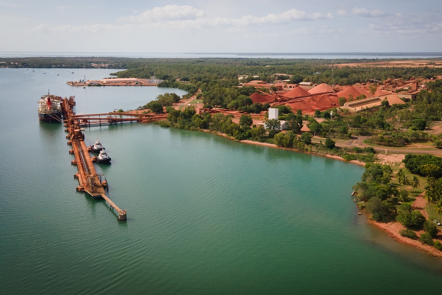
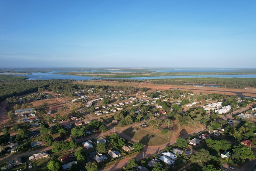
Western Cape York Peninsula towns, including Weipa, are expected to experience a category two system. (ABC Far North: Brendan Mounter)
‘Right up there with the worst’
In Cooktown, lure-shop owner and commander of the local coast guard, Russell Bowman, has been busy helping shift boats to safer waters.
About a dozen boats were moved further up the Endeavour River on Wednesday, with about 20 more still to go on Thursday.
“We’ve been through bad events before, but this is probably right up there with the worst we’ll be facing, hopefully in this lifetime,” he said.
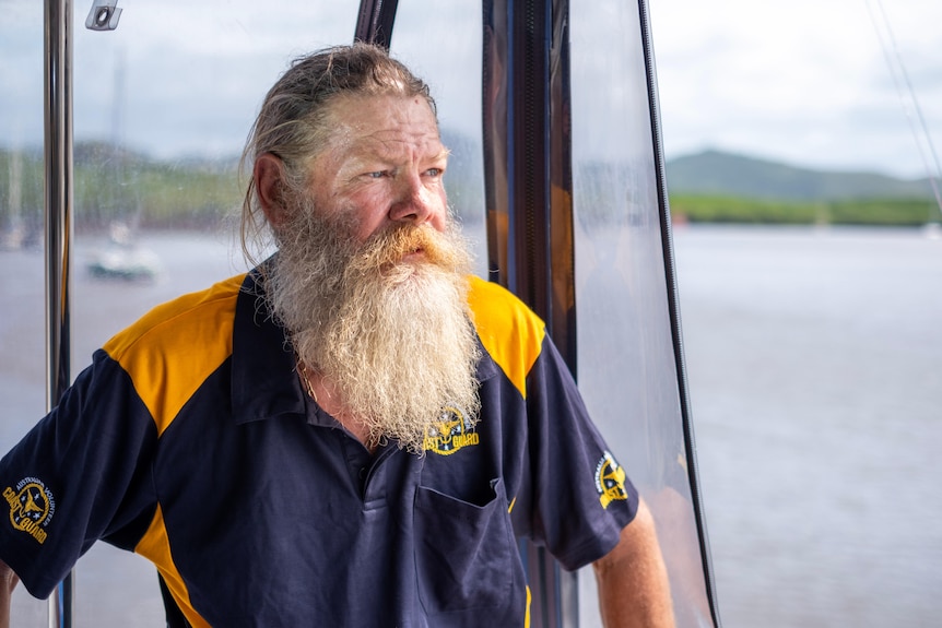
Coastguard commander Russell Bowman fears Tropical Cyclone Narelle could be the worst storm his town ever faces. (ABC News: Christopher Testa)
Mr Bowman said the prospect of a category four cyclone was a nervy one, even for a town used to severe weather.
“A three is about the closest we’ve had, but not a direct hit,” he said.
Mr Bowman planned to spend the night on a coastguard boat as the cyclone hit.
“It’s a very sleepless night, and you just hope you don’t get that rogue log coming down the river, or a line snap, or someone else’s line snap,” he said.
“So much can go right, and there’s so much that can go wrong in a heartbeat.”
Remote communities band together
Towns have been evacuated, schools shut, and flights cancelled across the Cape York Peninsula as residents prepare.
The fewer than 400 residents of Coen, 550km north of Cairns, have been buying food and emergency supplies from the local store.
Residents in the Northern Cape region have been told to store water as the Coen water treatment plant will be shut down.
Residents of Cape York town Coen have made preparations for Tropical Cyclone Narelle. (ABC News: Casey Briggs)
“I’m quite nervous, a bit scared, a bit worried — worried about our old people, worried about our country,” Southern Kaanju, Ayapathu, Umpila and Lama Lama woman and Coen community leader Donna Creek said.
“Everybody is out and about, fuelling up their cars … fuelling up their generators, stocking up on all their emergency goods.”
Though the town is in a cyclone-prone region, Ms Creek said she was worried older homes might not withstand the gusts, which could be the most severe conditions experienced at Coen in many years.
“The elders were saying over 60 years ago, there was a big cyclone that actually did tremendous damage here in Coen,” Ms Creek said.
Coen Regional Aboriginal Corporation has provided locals with emergency packs that included torches, food and water ahead of the cyclone.
Several schools across the region have closed for Thursday and Friday, and airline Hinterland Aviation has cancelled flights to Coen and Lockhart River on Friday.

Cook Shire Council mayor Robyn Holmes says Port Stewart has been evacuated. (ABC News: Conor Byrne)
Cook Shire Council Mayor Robyn Holmes said community members were being encouraged to stay with relatives or attend the local wellbeing centre, as Coen did not have a cyclone shelter.
“The safest building there is the Community Wellbeing Centre,” she said.
“If anyone doesn’t feel safe, there will be provisions made.”
The coastal community of Port Stewart, which has fewer than 20 people, was evacuated on Wednesday, with residents taken to Coen.
“It’s not a huge community … but it doesn’t really matter, it’s still really important that they get treated equally,” Cr Holmes said.
Aurukun is on the western side of Cape York and can be cut off by road for several months during the wet season. (ABC News: Billy Cooper)
To the west, local leaders in the remote Cape York Peninsula town of Aurukun said the community was well prepared for the severe weather.
“We’ve got plenty of fuel, we’ve got plenty of food, we’ve purchased six new backup generators,” Aurukun Council chief executive Jack Dempsey said.