
The major access closures because of flooding were via SH12 at Waimāmaku, SH15 through Mangakāhia Valley, SH1 at Whakapara, SH10 via Kāeo and council roads in southeast via the Broadwood–Awaroa Rd Mangamukas detour option in the west, Ngāiotonga and Kāretu/Waikare in the southeast and Mōtatau–Matawaia in the central south of the district.
Floodwaters surround Wesleydale Memorial Church in Kāeo. Photo / Jason Dorday
On Friday afternoon, New Zealand Transport Agency (NZTA) advised access via SH1 over the Mangamukas was expected to be open by 3pm. There had been small overslips but lengthy recent repairs had held up.
Meanwhile, roading crews were putting in temporary repairs to SH1 at Whakapara with it expected to be open by 3pm.
SH15 access via the Mangahakia Valley into Kaikohe was still cut off between Titoki and Parakao with floodwaters expected to linger over the weekend.
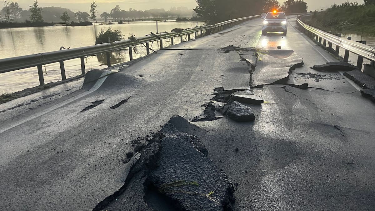
Drivers were warned of slippery conditions from sediment left behind when floodwaters receded.
SH10 via Kaeo has now opened but caution is advised.
Tepania said Broadwood-Awaroa Rd in the west was now also open.
Tepania said people should not feel whakamā (shame) from reaching out for help.
“It’s okay to put a hand out for a hand up.”
Tepania urged his community to stay strong.
He said the council was prioritising getting its roading network sorted.
“Our roads are our lifelines for our communities.”
MetService meteorologist Devlin Lynden said the triangle from Kaikohe and Kerikeri north to about halfway up Ninety Mile Beach received Northland’s heaviest rainfall during the 36-hour weather event that hit the region. Kerikeri received 225.4mm of rain.
He said another incoming low-pressure system would start hitting Northland about 9pm on Sunday and between 75mm and 100mm of rain would fall across the region.
Lynden said rainfall would not be as sustained or significant as the region had experienced this week.
But even at expected levels, it would potentially have flooding and slip impacts because of already-sodden roads and the wider region.
Flooded paddocks off north of Kawakawa. Northland on Friday morning. Photo / Jason Dorday
Tepania said there were 10 council rapid response teams out across the district, with the New Zealand Defence Force and Urban Search and Rescue crews people could connect with.
Tepania said on Friday that 33 Far North council roads were closed, or open for four-wheel-drive access only because of flooding and slips.
These roads were across the district from Te Hāpua near Cape Rēinga to Waimamaku in the district’s southwest, Ngāiotonga in its southeast and Matawaia in its southern centre.
“This is a very significant community impact as a result of road closures and flooding.
Tepania said people from across the Far North’s 250 communities were impacted – including in North and South Hokianga, Pawarenga, Aupōuri Peninsula, Doubtless Bay and the Bay of Islands.
He said 24 council roads had reopened after being checked.
NZTA journey manager Kingston Brands said multiple crews were checking conditions and responding to impacts throughout the weather event and again from first light.
Far North mayor Moko Tepania. Photo / NZME
“Due to their hard work, and an improving weather system, most routes are reopening in Northland today, as floodwaters recede, and as soon as it’s safe to do so,” Brands said.
Tepania said the situation was more widespread than 2023’s Cyclone Gabrielle,whose roading impacts to date were $45 million and likely to climb. The council was finishing the final of 145 slips across the district caused by the cyclone.
“And now this.”
January’s weather had also impacted roading.
Tepania said ongoing severe weather impacted the people of the Far North physically through infrastructure, spiritually and psychologically.
“We always seem to be on the back end of significant weather events and Civil Defence emergencies.
He said people were recovering, only to be hit again this week.
It was good to see floodwaters receding in some areas, he said.
■ LDR is local body journalism co-funded by RNZ and NZ On Air.