
A tsunami triggered by a 2025 earthquake off Russia’s Kamchatka Peninsula carried a second, shorter wave signal that exposes rupture within 6 miles of the trench.
That hidden tail, discovered in a new study, turns the tsunami itself into a sharper record of where the 8.8 magnitude earthquake broke and why coastal risk can be misread.
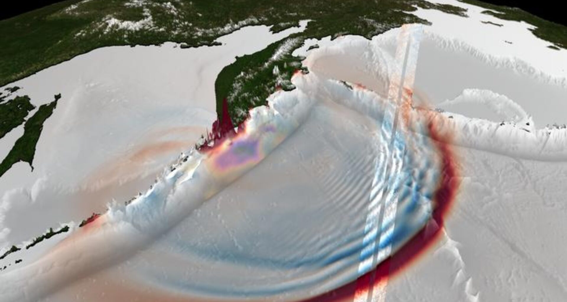
A visible signature after the earthquake

About 70 minutes after the earthquake, the sea off Kamchatka still held the signature of that shallow rupture in a broad train of trailing waves.
A team led by Ignacio Sepúlveda at San Diego State University (SDSU) analyzed images from the Surface Water and Ocean Topography satellite (SWOT).
The researchers documented short waves following the first crest. Those disturbances showed that the rupture reached the shallowest part of the fault, a zone that standard earthquake and ocean records often blur.
The satellite view pinpointed the signal to a section of the fault that other observations struggle to resolve, revealing the physics driving the trailing waves.
Identifying the source
Longer tsunami waves raced ahead while shorter ones lagged, creating dispersion, when wave speed changes with wavelength.
Because the trailing wave packets extended about 31 miles, they behaved differently from the main front and retained a clear, readable signature.
The pattern narrowed the likely source to a short band along the trench off southern Kamchatka.
Such detail is hard to pull from sparse instruments alone, which is why the satellite view changed the case.
What deep-ocean sensors missed
Five nearby Deep-ocean Assessment and Reporting of Tsunamis sensors, or DART sensors, caught the first front at separated points.
The closest instrument measured about 4.3 feet from crest to trough, confirming a powerful wave – but not its full shape.
DART pressure records lose some shorter signals in very deep water, and wide gaps leave the space between stations unresolved.
Satellite data filled that hole by showing direction, curvature, and spacing across the surface instead of one reading at a time.
A slip near the trench
Kamchatka sits on a subduction zone, where one plate slides beneath another and can suddenly thrust the seafloor upward.
When the rupture pushes close to the trench, the uplift zone becomes shorter and steeper, which seeds shorter wavelengths.
Scientists had long predicted that kind of source would leave a choppy tail behind the leading wave.
Here, the event provided the first direct space-based link between that tail and the shallow part of the rupture.
Testing the models
The team combined the satellite scene with land movement and offshore wave records, and then built competing versions of the earthquake.
One version kept motion near the trench, while another removed it and forced motion deeper under the plate.
Only the shallow version recreated the trailing packets, while a model built for the long leading wave missed them.
The side-by-side result pinned the odd wave train on near-trench motion rather than noise or background ocean movement.
A broader pattern of short-wave tails
An earlier paper on a 2023 tsunami near the Loyalty Islands in the southwest Pacific had already shown that SWOT could map a wave pattern in two dimensions.
Closer to the source, the satellite saw the disturbance soon enough to say something about the rupture itself.
The SDSU team described another detection near Drake Passage, the waters between South America and Antarctica, hinting that these short-wave tails may not be rare.
Instead, scientists may have overlooked them, since a satellite must pass over the right stretch of ocean at precisely the right time.
New insights into earthquakes
Better source estimates matter because warning systems start with a guess about how the seafloor moved.
If that first guess misses motion near the trench, forecasts can underestimate where water will pile up fastest near exposed coasts.
“We’re illuminating properties of earthquakes that advance our knowledge and may clarify scientific questions for the community,” said Sepúlveda.
His team argued that models near the source should include those delayed short waves whenever observations show them.
Warnings from space
Unlike older altimetry, measuring sea-surface height from orbit, SWOT scans a broad strip of ocean instead of one narrow line.
From that wider view, researchers read wave direction and curvature at once, clues single-line passes often miss.
“This discovery shows the importance of the U.S. and the world investing in satellite capacity measuring what is happening on our planet regarding geo-hazards,” Sepúlveda said.
More complete early pictures will not stop a tsunami, but they can sharpen the forecasts that guide evacuations.
Not a stand-alone warning system
The Kamchatka event sent waves across the Pacific, but the near-source pass still happened by chance.
SWOT revisits most places about every 11 days on average, so most tsunamis will still rely on other tools.
Even so, when the timing works, the satellite can cross-check seafloor sensors, coastal gauges, and seismic data.
Each lucky overpass becomes scientifically rich, even if it cannot serve as a stand-alone warning system.
Seen from orbit, the Kamchatka rupture gave scientists a look at tsunami birth that usually stays hidden.
Future overpasses will not replace ground sensors, but they could make tsunami source models faster, tighter, and more realistic.
The study is published in the journal Science.
Image Credit: Bjarke Nilsson
—–
Like what you read? Subscribe to our newsletter for engaging articles, exclusive content, and the latest updates.
Check us out on EarthSnap, a free app brought to you by Eric Ralls and Earth.com.
—–