
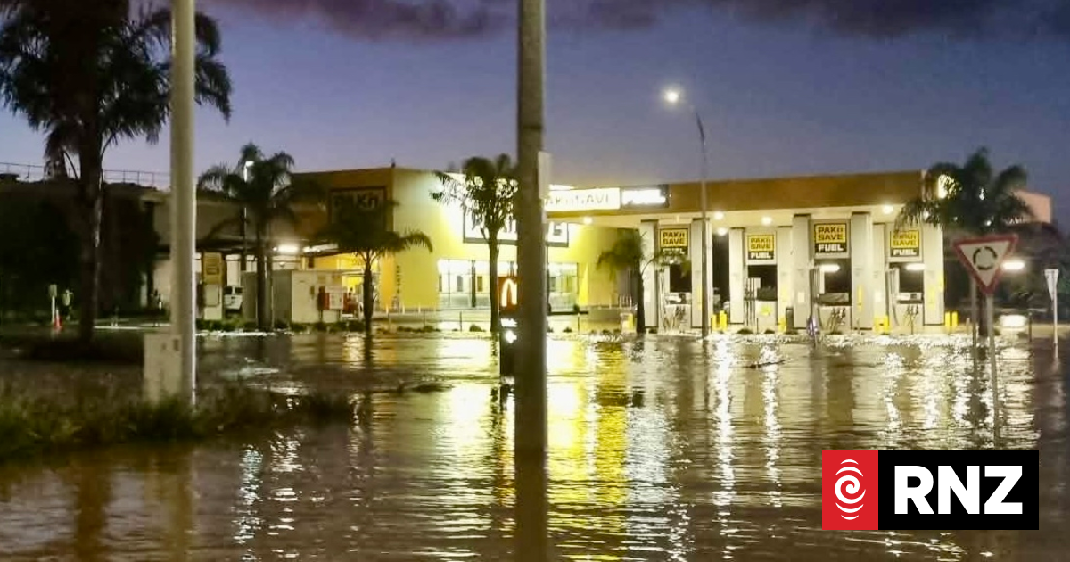
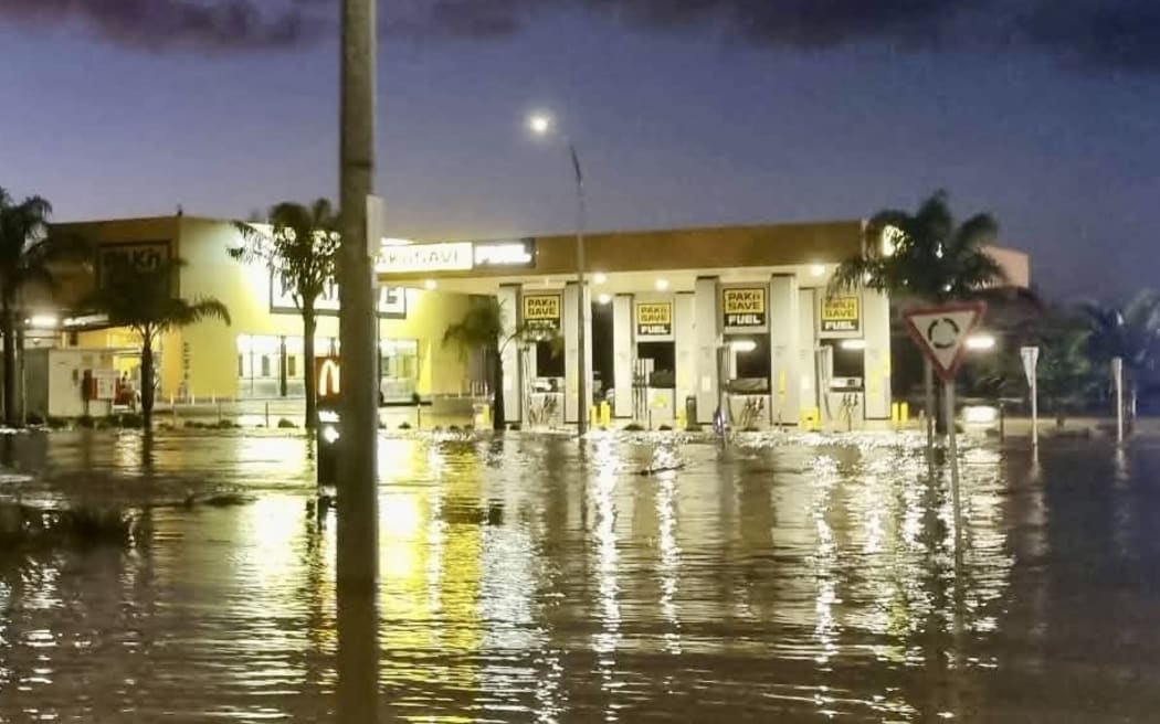
Kaitāia’s Pak’nSave, McDonald’s, car wash and Bells Produce stores were inundated this week, with water from the Awanui River, which runs behind the area.
Photo: Supplied / Toto Nicholson
Major upgrades to Kaitāia’s flood-control scheme prevented loss of life in the town this week, Northland Civil Defence chair Colin “Toss” Kitchen says.
His comments come after 400 people were evacuated in the dark from their homes in north Kaitāia at 9.30pm on Thursday, after “unprecedented” amounts of water poured through the Awanui River catchment. Water levels rose rapidly and began spilling over stopbanks.
Kitchen, Northland’s top Civil Defence leader, said it was not an exaggeration to say the upgrades had potentially saved lives and millions of dollars in damage in the town of 6000 people.
MetService figures show Kaitāia received 210mm of rain in 10 hours, from 10pm Wednesday to 8pm Thursday, as a major tropical depression hit.

Northland Civil Defence chair Colin “Toss” Kitchen
Photo: Local Democracy Reporting/ Susan Botting
“This was an extraordinary event with very intense hourly rainfall which tested the [flood protection] scheme to its limits,” Kitchen, who is also a Northland Regional Council (NRC) councillor, said.
Far North District Council Civil Defence declared a state of emergency on Thursday.
In pictures: Aftermath of the storm in the upper North Island
Four hundred people were evacuated from 118 homes in the north of Kaitāia, after a joint decision by Civil Defence, New Zealand Police and Fire and Emergency New Zealand.
Most stayed with family and friends, but 44 people spent the night at an emergency evacuation centre set up at Kaitāia College.
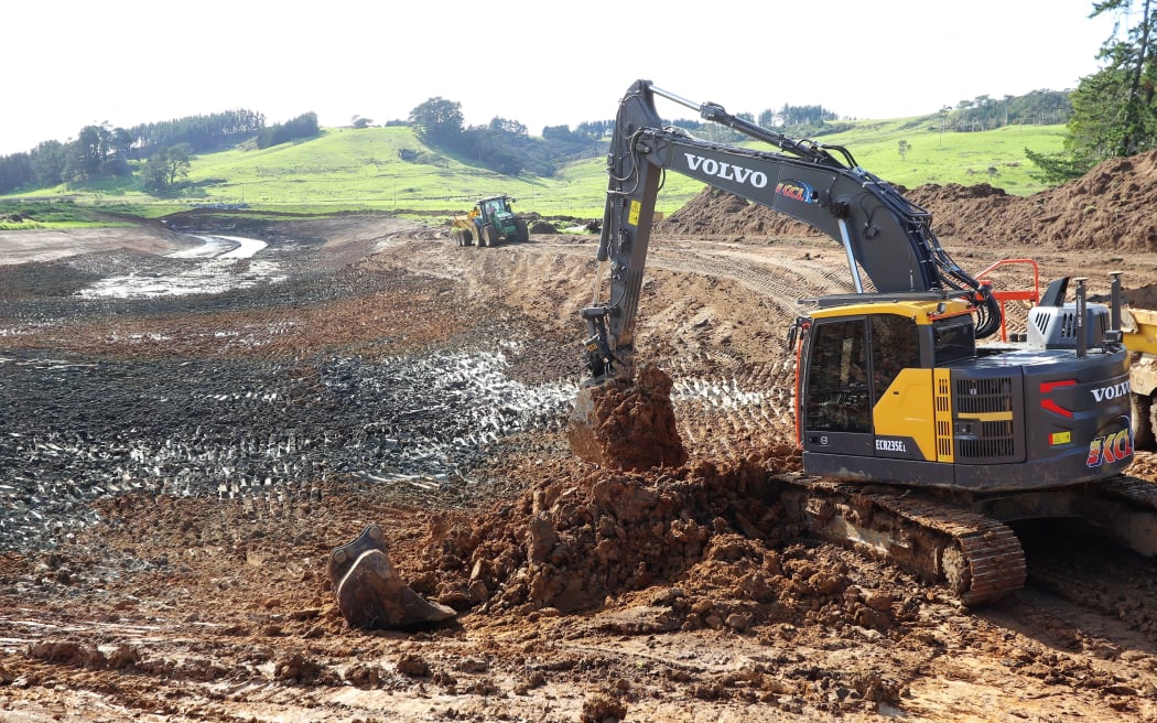
Upgrade work carried out earlier on the Awanui flood management scheme has helped protect lives during flooding in Northland, a councillor says.
Photo: Supplied via LDR/ Northland Regional Council
Provisional Northland Regional Council figures show this week’s deluge pushed almost twice the volume of water through the Awanui River, compared with the catastrophic 1958 flood that inundated the town’s central streets, forming 1 metre deep-standing waves.
About 410 cubic metres of floodwater flowed down the river every second during this week’s storm, compared with 220 cubic metres a second during the 1958 flood.
This week’s Awanui River volumes also compared to the 258 cubic metres a second measured in July 2007, when Kaitāia flooded and people were evacuated.
NRC infrastructure committee deputy chair Joe Carr said much of Kaitāia escaped serious damage despite this week’s vast and unprecedented flows.
Carr acknowledged there had been some stopbank overtopping this week, but said it was mainly in part of the scheme yet to be, or being, upgraded.

Joe Carr, who is chairman of the Awanui River working party.
Photo: NZME/ Northern Advocate – Michael Cunningham
“There was some costly flooding and associated evacuations, as stopbanks did overtop, both upstream and downstream of SH1 Bridge Waikuruki and in the lower Whangatāne spillway, all of which are works in progress.
“But overall the $15 million-plus, multi-year scheme upgrade performed very well,” Carr, an NRC councillor and Awanui River Working Group chair said.
While some had overtopped, the stopbanks remained intact.
The scheme also protected the Claud Switzer Residential Care home, a major concern in previous floods given the complex nature any evacuation required there.
Carr said the regional council had assumed responsibility for the scheme 20 years ago.
Much of the upgrades that begun in 2018 were designed to protect Kaitāia township, and $2.5 million of work is still underway or is planned to take place in the next two years to remove weak points.
Work to date included 6 kilometres of stopbanks, 5km of benching, 2.2km of spillways, 1.2km of scour protection, 200m of timber floodwalls, 750,000 cubic metres of earthworks, 15,000 cubic metres of rock stabilisation, the replacement or upgrading of 24 floodgates and the installation of an extra span at the Quarry Road bridge.
The scheme is predominantly ratepayer funded, but the government recently contributed $11.1 million to the project.
Deadly storms expose growing gap between disaster recovery and climate preparation
The Awanui River flood management scheme manages flood risk from rainfall and runoff, including major tributaries such as the Takahue River, Victoria River, Karemuhako Stream, and the Tarawhataroa (Whangatāne) Stream, as well as urban waterways like the Kaitāia Stream, which runs through the town.
Kaitāia lies in the lower Awanui River catchment, covering about 45,500 hectares of hill country, rural land, and tributary streams upstream of the town.
Its flood risk is driven by catchment-wide rainfall draining toward the lower river reaches and Kaitāia, even when there is little or no rain falling in the town itself.
Heavy rainfall upstream can rapidly send large volumes of water towards the town, creating flood risk driven by the whole catchment, not just local weather.
– LDR is local body journalism co-funded by RNZ and NZ On Air.