
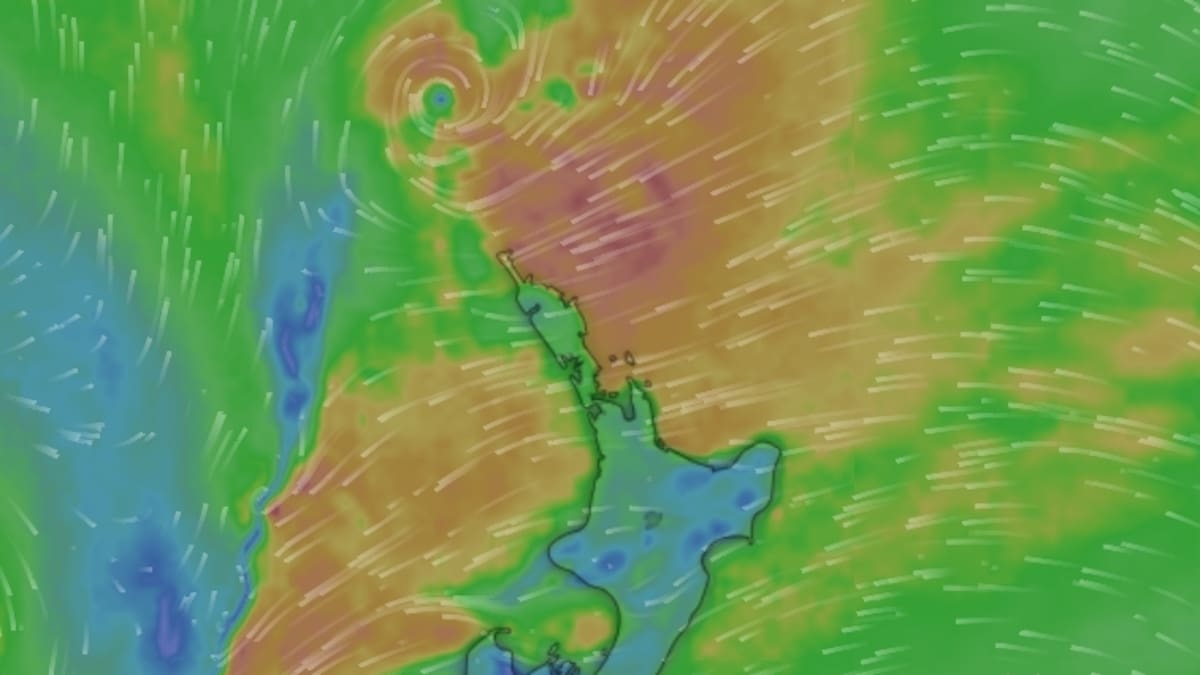
However, Burrows said there was a significant degree of uncertainty around the system’s intensity and exact path, which will determine how severe the impacts are and where they are felt most.
“There is still uncertainty on the exact intensity of this system or the position of this system, and that will affect the distribution of rain associated with it.”
That uncertainty is also reflected in the current severe weather outlook.
“In our severe weather outlook, we have a low confidence of a heavy rain warning for northern Northland late through Monday.”
By Tuesday, the low could move across the northern North Island, potentially bringing stronger winds and more widespread rain.
“That low might move over the northern North Island during the day, but there is still a lot of uncertainty with the depth and the position.
“At the moment, strong winds are possible for the north of the North Island, and there is a low confidence of severe gale northeasterlies affecting Northland and Auckland.”
Rain is expected to spread across northern and western regions, with some areas facing a moderate chance of reaching warning thresholds.
Burrows said regions including Northland, Auckland, the Coromandel Peninsula, western Tasman and the country’s western ranges were being monitored as the system develops.
The wettest conditions are likely to arrive midweek, as the low moves slowly across the country.
“It’s going to be a very wet day through Wednesday, before it starts to clear eastwards through Thursday, with a ridge of high pressure pushing back in.”
⚠️ Severe Weather Update ⚠️
🟡 A Heavy Rain Watch has been issued for Northland (10pm Mon – 4 pm Tue) 🌧️
🟡A Strong Wind Watch has been issued for Northland (3am – 5pm Tue) 💨
A low may form north of the country on Monday and then move over the northern North Island during… pic.twitter.com/k85cvl2xMA
— MetService NZ (@MetService) April 4, 2026
The reason these systems can deliver heavy rainfall lies in their tropical origins, Burrows said.
“[They] draw a lot of moisture down from the tropics and wrap it around the low,” she said.
“With warmer air from the tropics and more water vapour in the air mass, it can bring a lot of rain with it.”
While no official watches or warnings are in place for today, Burrows urged people to stay informed.
“MetService will issue watches and warnings, and we have push notifications on our app which will alert you if a warning or watch has gone out.”
She also encouraged practical steps and community awareness.
“Check in with your neighbours, family and friends.”
Despite the potential for wet weather, Burrows said one upside is the warmer-than-average overnight temperatures across much of the country early in the week.