
“A subtropical low is expected to approach the far north of the North Island overnight tonight, then move southwards, reaching the upper South Island during Tuesday evening,” MetService said.
Easterly gales were expected in Northland ahead of the low. A Strong Wind Watch is in place as east to northeast winds may approach severe gale in exposed places between 3am to 4pm tomorrow.
“People are advised to keep up to date with the latest forecasts.”
A heavy rain watch is in place for Auckland from 9am to 9pm tomorrow for areas north of Papakura and Great Barrier Island. There’s a moderate chance of the rainfall amounts to reach warning criteria, MetService said.
Parts of Bay of Plenty and Rotorua are also under a heavy rain watch, with forecasters warning conditions could worsen over the next two days.
Periods of heavy rain were forecast for areas west of Whakatāne, including Rotorua, from 3pm Tuesday until 6pm Wednesday.
Rainfall totals may exceed warning thresholds, with a high chance the watch could be upgraded to a heavy rain warning.
MetService meteorologist Alanna Burrows said yesterday the system is expected to form in the subtropics before gradually tracking south towards the country.
However, Burrows said there was a significant degree of uncertainty around the system’s intensity and exact path, which will determine how severe the impacts are and where they are felt most.
“There is still uncertainty on the exact intensity of this system or the position of this system, and that will affect the distribution of rain associated with it.”
Burrows said regions including Northland, Auckland, the Coromandel Peninsula, western Tasman and the country’s western ranges were being monitored as the system develops.
The wettest conditions are likely to arrive midweek, as the low moves slowly across the country.
“It’s going to be a very wet day through Wednesday, before it starts to clear eastwards through Thursday, with a ridge of high pressure pushing back in.”
MetService said there was a low chance of upgrading to a red warning.
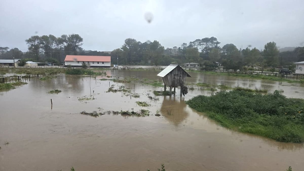
Northland was still recovering from last month’s severe weather that prompted a red warning – the most serious alert possible.
The region suffered widespread flooding, with settlements in Whangārei and the Far North cut off and more than 80 homes damaged.
Both districts declared states of emergency to trigger additional powers, however, both have since been lifted, with Whangārei and the Far North officially transitioning to recovery phases.
Civil Defence Northland is urging Northlanders to prepare their property and possessions ahead of the forecast downpours and gale.
“ … Take extreme care on the roads tomorrow, particularly in the morning when there is the possibility of surface flooding, debris and slips on the roads. And don’t take chances driving through floodwaters.”