
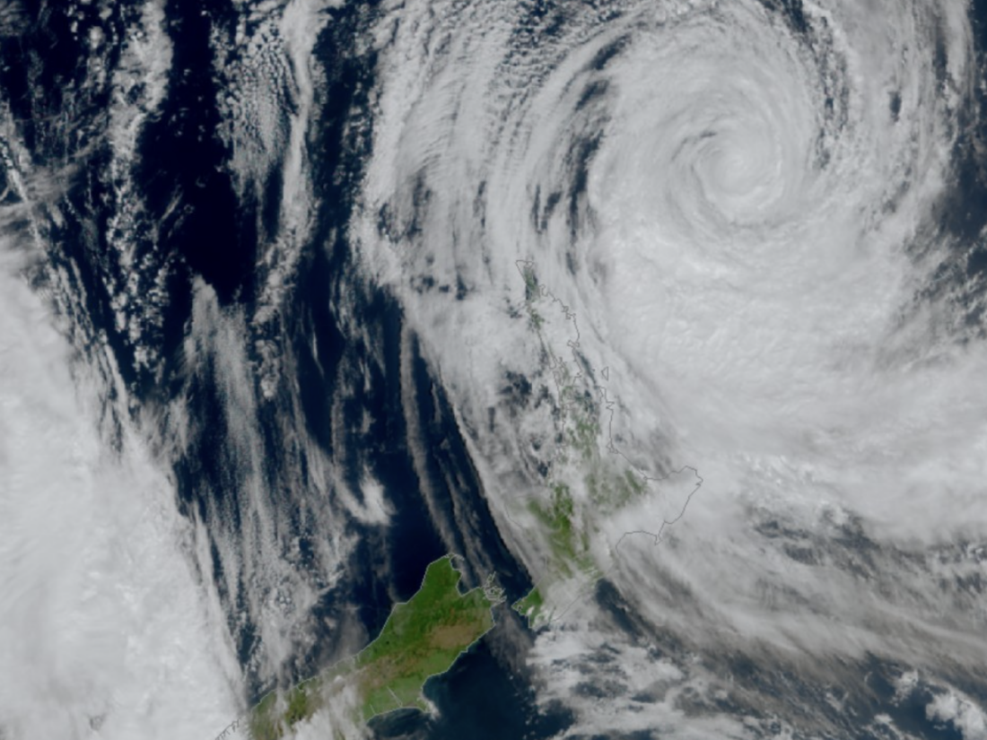
Tropical Cyclone Vaianu is tracking towards New Zealand, with forecasters warning of a potentially life threatening mix of damaging winds, heavy rain and coastal impacts from Saturday evening.
The storm was about 500 kilometres north of the country at 1:00pm on Saturday, but early effects were already being felt, with high cloud spreading across the North Island and winds strengthening offshore.
Gusts of more than 110kmh have already been recorded at Mokohinau Island and Great Mercury Island.
MetService has upgraded wind warnings for several regions, with a Red Strong Wind Warning now in place for the Bay of Plenty and Rotorua, where severe gales and gusts of up to 130kmh are expected on Sunday.
Red warnings also remain in place for the Coromandel Peninsula and Great Barrier Island from Saturday night through Sunday.
Much of the North Island is under Orange wind and rain warnings or Yellow watches, while an Orange Heavy Rain Warning has been issued for eastern Marlborough.
MetService meteorologist John Law said the system posed significant risks.
“Cyclone Vaianu remains on its path towards us and is set to bring damaging winds, heavy rain and large swells,” he said.
“The Red Severe Weather Warnings represent our highest level of alert. Winds of this strength could bring a threat to life from flying items and falling trees as well as widespread damage including powerlines and roofs.”
Law said winds were expected to shift direction rapidly as the cyclone moved across the country.
“The winds wrapping towards the centre of Vaianu mean that we will be seeing big changes in wind direction during Sunday,” he said.
“For spots like Auckland this will mean a swing from gale or even severe gale southeasterlies in the morning to severe gale westerlies in the afternoon.”
Heavy rain is expected to arrive across much of the North Island overnight on Saturday before easing during Sunday.
“For much of the North Island, Saturday will be a dry day before the rain arrives overnight. Thankfully, Vaianu looks to be a fleeting visitor with the rain clearing during Sunday,” Law said.
Forecasters said the combination of strong winds and large swells would create dangerous coastal conditions, particularly along north and eastern facing coastlines.
Authorities are warning of possible power outages, falling trees, flooding, slips, road closures and isolated communities, depending on the cyclone’s path.
Residents are being urged to stay up to date with the latest forecasts and take care in exposed coastal areas, especially around high tide.