
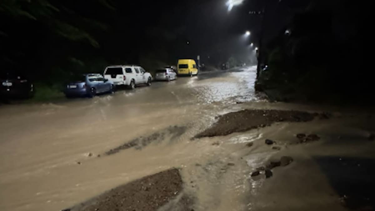
They told the Herald floodwaters had brought down a slip, with rocks partly burying and blocking cars.
“Very heavy rain can cause surface and/or flash flooding about streams, gullies and urban areas, and make driving conditions extremely hazardous,” the MetService warning says.
Severe thunderstorms have been detected over Wellington City, MetService says. Image / MetService
As storms approach people are warned to take shelter, preferably indoors away from windows; avoid sheltering under trees; get off the water; move cars under cover or away from trees; secure loose objects; check drains and gutters; and be ready to slow down or stop driving.
People are also warned to beware of fallen trees and powerlines, and avoid streams and drains as “you may be swept away in flash flooding”.
An earlier thunderstorm warning was issued just after 4am after thunderstorms were detected moving east over Hutt City and Wellington City.
The rain in Roseneath and Island Bay was “torrential”, according to commenters replying to a Wellington Region Emergency Management social media post warning of the impending downpours.
Heavy rain and thunderstorms are set to affect parts of the country as students head back to school for the first day of Term 2.
MetService says a complex and slow-moving low-pressure system and associated fronts are moving across the North Island, bringing unsettled weather.
The system has already caused flooding around the Whanganui River, Lower Hutt and parts of Ruapehu District.
States of emergency remain in place for Whanganui District and Ruapehu’s Ōhura Ward, where road access was shut off yesterday and residents were told to prepare to evacuate.
MetService meteorologist Katie Lyons said the low would begin tracking eastward today, bringing “thunderstorms and showers over the northern half of the North Island, including the Bay of Plenty, particularly from the afternoon”.
“Whanganui is on the leeward side of the action, so it should be more sheltered from the rain than places further east,” she said, though there was still a chance localised showers could develop.
As the system moves east, winds are also expected to shift, leaving eastern and central parts of the North Island in the “firing line” for a south to southeasterly flow, she said.
MetService has issued an orange heavy rain warning for the Tararua Range, Wairarapa and Tararua District south of Woodville, as well as Wellington south of Tawa and the Hutt Valley, with 33 hours of rain forecast from 3pm.
Between 80mm and 120mm of rain has been forecast before midnight on Wednesday, with up to 250mm possible in the ranges and coastal hills.
An orange heavy rain warning is in place for the Kaikōura Coast and ranges, the northern Canterbury ranges east of Lake Sumner, the Marlborough Sounds about and east of Havelock, including the hills north of Spring Creek, until 11pm.
A Strong Wind Watch is also in place for Wellington and the Marlborough Sounds, where south to southeasterly winds could approach severe gale strength from this afternoon.
Further west, Buller, Grey and Westland are under a separate Strong Wind Watch for 24 hours from 9am.
Lyons advised commuters and families heading back to school to keep an eye on local weather radar to avoid the heaviest showers.
“Emergency authorities are there to help, so people shouldn’t hesitate to reach out if they need it,” she said.
MetService says people should stay up to date with the latest forecasts as conditions develop.