
Thunderstorms lit up the sky over Eastern Bay of Plenty, with one resident saying there seemed to be two storms this morning.
Ōhōpe resident Damian Rahmann said the storm seemed to last around an hour from 6.45am, with an earlier storm hitting around 12.30am.
“[It was] a double wake-up call from Mother Nature. There were periods of torrential rain and strong winds that went along with it at times too,” Rahmann said.
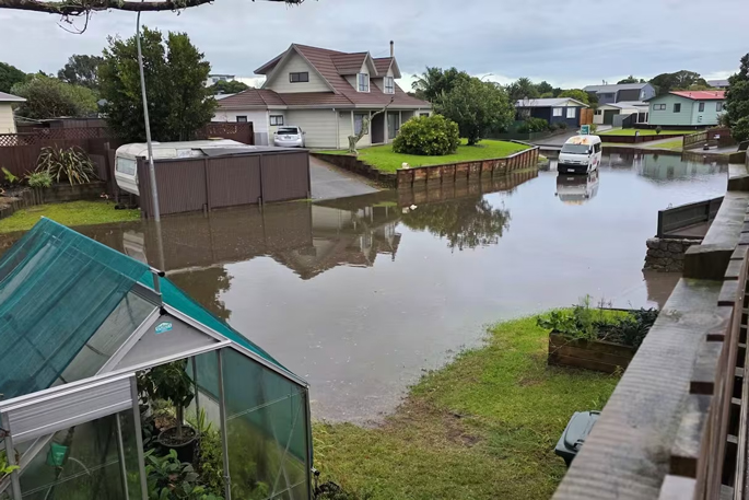
Whakatāne District Council said there was surface flooding on several streets with teams clearing slips and managing areas where water was still receding.
“Please take extra care near waterways, low-lying areas, and known trouble spots.”
So far today, 16.6mm of rain has fallen in Whakatāne with a today forecast of 41.3mm expected.
According to the MetService website, 12.8mm of rain fell in one hour from 8am.
The general forecast for Bay of Plenty and Rotorua today is for showers, possibly heavy with squally thunderstorms, hail and possible downpours.
It comes as the clean-up continues today after a tornado – or possibly tornadoes – ripped through Tauranga early yesterday.
Damage was reported in Ōtūmoetai, the central city, Maungatapu and Welcome Bay.
The damage included roofs torn off, trees snapped and a cabin lifted on to a car.
Downed trees on the road outside Maungatapu Marae after the Tauranga tornado. Photo / Rosalie Liddle Crawford
State Highway 2 through the Waioweka Gorge is closed this morning after additional slips came down overnight.
NZ Transport Agency Waka Kotahi (NZTA) said the road would remain closed until it was safe enough for crews to clear.
The Waioweka Gorge is closed due to slips and fallen trees. Photo / NZTA