
A cold front could bring a line of strong to severe storms to the Austin area on Sunday evening.
The main threats are hail generally less than 2 inches in diameter, winds exceeding 75 mph and pockets of rainfall as high as 2 to 4 inches, the National Weather Service said.
The largest hail is expected to fall north of the Austin area, closer to Abilene, NWS meteorologist Harrison Tran said Sunday morning. There is still hail risk for Austin, but it’s expected to decrease as the storms move south.
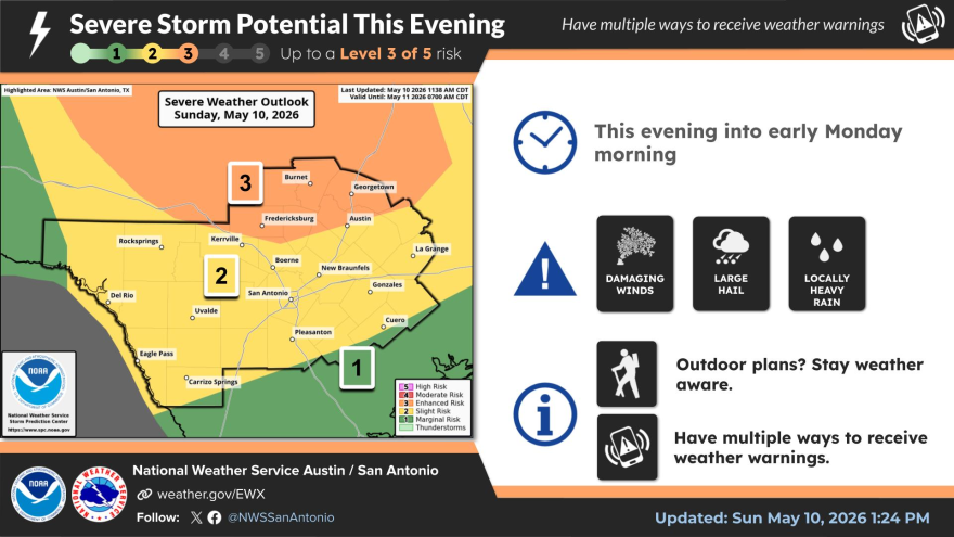
NWS has the western half of Williamson County, including Georgetown, and the northwest portion of Travis County under a 3 out of 5 “enhanced” storm risk Sunday. Tran said Travis County usually gets a handful of days with that risk designation per year.
The storms are forecast to hit parts of Travis, Williamson and Hays counties as early as 6 p.m., but they’re more likely to affect the Austin area after dark.
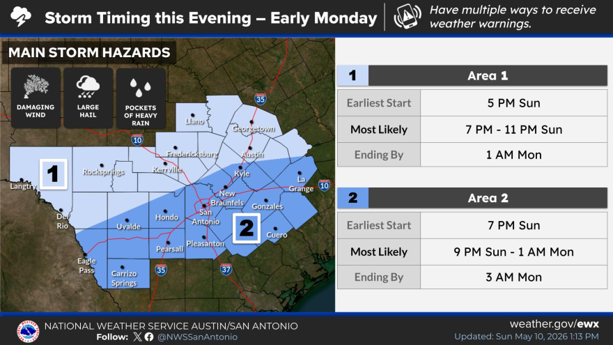
“There’s still a bit of variation as to when we expect the storms to arrive there,” Tran said. “There are some cases where, when we get a line of storms like this, they tend to move in a little faster than what’s modeled simply because once the winds pick up, those winds start to push the storms along and they kind of speed up.”
The storms are expected to end by Monday morning, setting the stage for cooler temperatures to start the week.
Here are a few ways to stay informed during severe weather: