
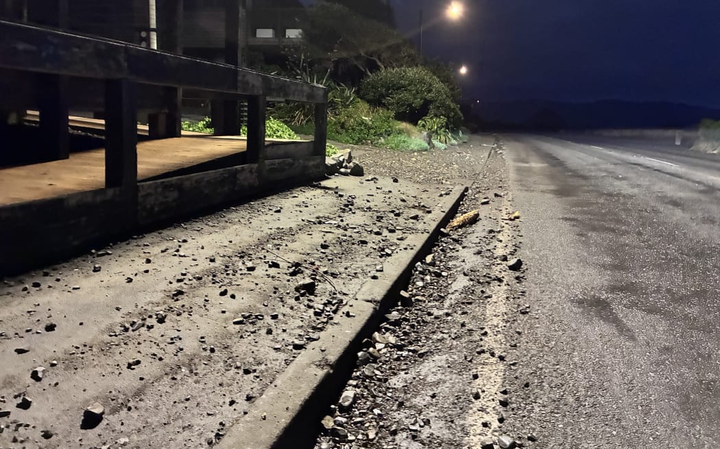
Island Bay Esplanade after a day of heavy swells.
Photo: Charlotte Cook / RNZ
Clean-up crews are expected to be out and about on south coast roads on Wednesday morning after the coastline was pounded by heavy swells on Tuesday.
High tide hit again overnight, but Mayor Andrew Little told RNZ there had been no reports yet of major damage.
In two parts of Ōwhiro Bay water crossed the road but did not appear to inundate any homes. Small bits of debris and sand littered the road after Tuesday’s huge swells.
It was a similar story along Island Bay’s Esplanade, where a debris waterline sat at the curb of the opposite side of the road outside Dive Wellington and BeachHouse Cafe.
A Wellington City Council spokesperson said staff would be looking for debris on the roads and assessing potential damage and coastal erosion.
The storm surge did not rise to the expected levels, and Wellington Mayor Andrew Little called off a state of emergency in the afternoon. He said the decision to call a state of emergency was not taken lightly.
“It’s taken in the face of advice that said there was a risk to the safety of people and a high risk that the seas would wash over the roads and dump debris on the roads and potentially threaten buildings. So on the basis of that, we have to act.”
Breaker Bay local Raymond Morgan said he stayed put because 14 years’ experience had told him storms from the southwest, like Tuesday’s were not as destructive as those from the southeast.
“So to me, that was going to be a non-event,” he told Morning Report. “I had family members calling me. My partner had multiple offers for us to go to other places outside of Wellington in case we needed somewhere to stay, but I stayed put.”
Even if things got worse, Morgan said he had a “tsunami escape route” into the hills.
“These weather events are going to occur more frequently with greater intensity, but we need to be more critical of the local impacts rather than making sweeping judgments that it’s going to affect the entire Wellington area, or particularly the south coast – evacuate so many people and cause so much disruption.”
Morgan, a professional diving instructor, said if 11m waves hit the coast as some believed, “buildings would be washed away”.
“I think there was some some alarming comments that were made on the radio. I listen to national radio continuously, and that’s where I get my alerts from… You’ve got to stand back and really question what was going on behind the scenes and who was making these calls.
“I mean, I understand the predicament that they don’t want to see people get hurt or injured or things like that, but there was no real reason to call a local state of emergency right across the south coast.”
He said Little likely had “poor advice” and so was “caught between a rock and a hard place, but really, he had to make a call, so he did, unfortunately”.
Still on alert
Wairarapa remained on alert for heavy swells. A heavy swell warning was in place until midday Wednesday, just before high tide for Palliser Bay.
South Wairarapa Mayor Fran Wilde said people should stay away while the warning was in place.

Fran Wilde.
Photo: Supplied
“Though I’m sure there’ll be nobody down there being a sightseer, they’re not prone to that sort of thing here.”
Wilde said crews would be out at first light to inspect the roads and decide if they could be reopened.
“Probably more damage likely to be down on the beachfront, where [Cape Palliser Road] runs pretty much along the edge of the beach and we will be able to make a decision then about whether the road is usable or not. “
Wilde said the road was important for fishers, surfers and tourists.
Some Wellingtonians were forced to evacuate ahead of the swells.
Meteorologist Silvia Martino said on Tuesday it was certainly windy – even by Wellington standards – and gusts of nearly 100km/h drove the height of the waves.
“The swells that we have are largely driven by strong winds over the ocean from a long distance… So we get swell waves and wind waves combining.
“In this situation the swell waves are so big that the wind waves are adding about an extra half a metre to a metre on top.”
Sign up for Ngā Pitopito Kōrero, a daily newsletter curated by our editors and delivered straight to your inbox every weekday.