
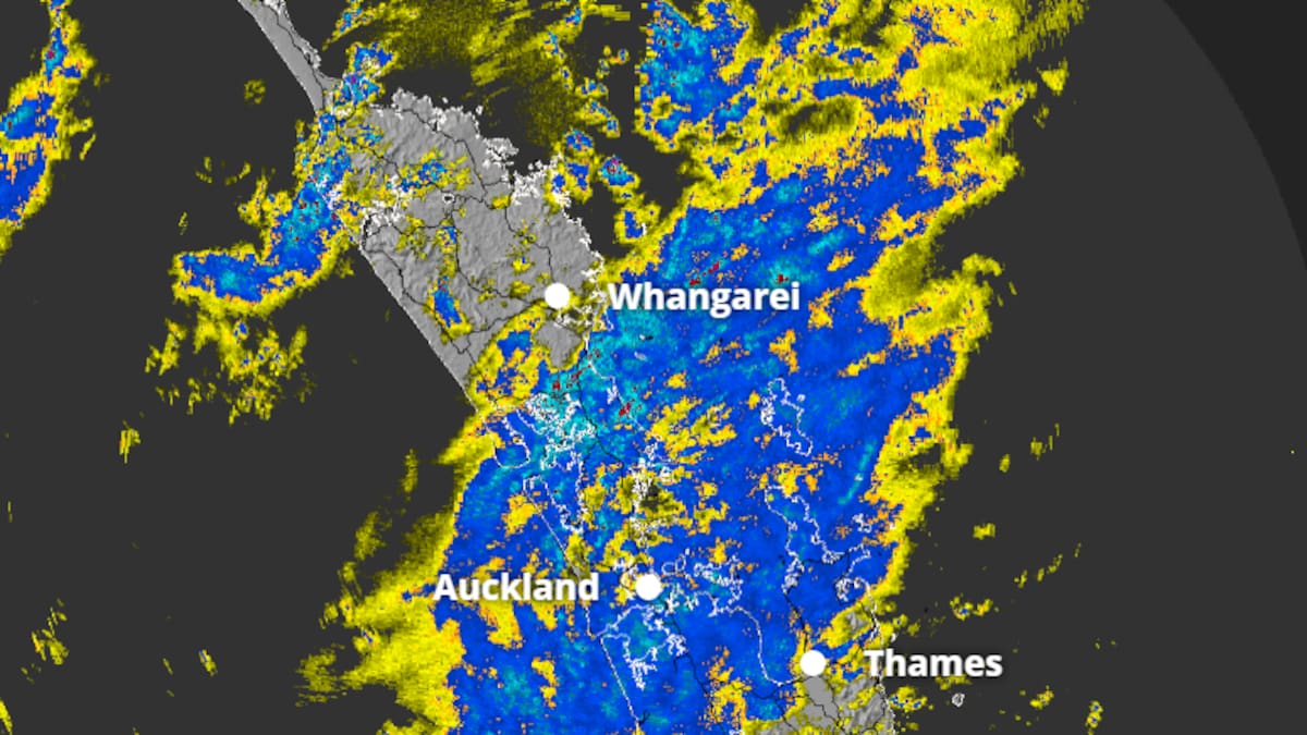
The MetService rain radar at 7.10am. Photo / MetService
Downpours disrupted commuters this morning as a crash on the Southern Motorway blocked two southbound lanes, before being cleared around 6am.
Multiple households in the West Auckland suburb of New Lynn have been hit by a power outage.
According to Vector’s website, the unplanned outage, caused by vegetation or debris on power lines, was reported around 8.34am.
Power is estimated to be restored around 11.30am-12.30pm.
Vector has been approached for comment.
MetService meteorologist John Law told the Herald gusts of 80km/h were recorded in Manukau Heads, while 25-30mm of rainfall was measured across the city.
Law said heavy bursts of localised downpours are possible throughout the day, while a chance of thunderstorms still remained.
As the heavy rain moves east, showers will follow.
“Even towards the evening time tonight, we’re not going to be completely clear of the wet weather.”
Heading into tomorrow, winds will change direction and start blowing from the southwest, Law said.
Orange heavy rain warnings are in place for Coromandel Peninsula and Bay of Plenty, west of Kawerau, today.
MetService said 70 to 120mm of rain could fall with peak rates of 25 to 40mm/h.
A heavy rain watch for Bay of Plenty, east of Kawerau, comes into effect at 3pm.
Law said heavy rain in the regions could raise river levels and cause flooding.
“In among that broad area of wet weather, could be some locally intense bursts of rainfall as well.
“So a great day to be keeping a close eye on the radar as we head through the rest of Wednesday.”
An orange strong wind warning for Wellington and parts of Marlborough comes into effect from 8pm tomorrow, with gusts of 120km/h expected in exposed places.
Strong wind watches, which begin tomorrow, have also been issued for parts of Northland, Taranaki, Horowhenua, Kapiti Coast, Buller, Grey, and Westland.
Watches and warnings issued around the country. Photo / MetService
MetService meteorologist Paris Marshall said yesterday a low-pressure system from the Tasman Sea, was bringing the rain, strong northeasterly winds and potential thunderstorms.
Marshall said today was looking to be “quite humid”, with warmer minimum temperatures.
“For example, in Whakatāne, their minimum temperatures will be 13C, which is quite different as they’ve been getting frost recently, which you need to have around three degrees air temperature to even start seeing frost. So yeah, it’s quite a difference.”
Meanwhile, in the South Island, snow is expected to fall on several roads at high altitudes.
Road snowfall warnings come into effect later today for Lewis Pass, Porters Pass and Milford Rd.
An orange rain warning for parts of Tasman west of Motueka, comes into effect at 11am.