

A cold snap is set to grip the Bay of Plenty this week, with frosty mornings, fog and chilly overnight temperatures forecast after a weekend of persistent southerly winds.
Tauranga and the wider region can expect fine but cold conditions to start the week, with highs around the mid-teens and overnight lows dropping into single digits, according to MetService forecasts.
Meteorologists say a high-pressure system moving over the country will bring clear skies and lighter winds overnight – a combination that encourages rapid cooling and widespread frost formation.
The result is likely to be crisp mornings across the Bay of Plenty, with valley fog and frost expected in low-lying inland areas as the week progresses.
Frost risk is forecast to extend as far north as Thames, signalling a colder-than-usual stretch for much of the upper North Island.
MetService meteorologist Michael Pawley said in a statement that the conditions could catch some off guard.
“Auckland might also see some frosts in sheltered places … we’re expecting similar temperatures for a few days in a row this week. Avid gardeners might want to cover up their veggies,” he said.
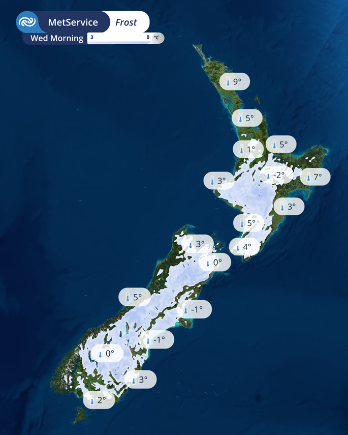 Image / MetService
While the Bay of Plenty avoids the worst of the country’s coldest temperatures, inland and southern areas are likely to see sharper overnight drops because of clear skies and calm winds allowing heat to escape more quickly.
Cold starts, fine days
Despite the frosty mornings, daytime conditions across the Bay of Plenty are expected to remain mostly settled through the working week.
Sunshine is forecast for western areas, while any lingering showers or drizzle in eastern regions early in the week are expected to clear as winds ease and turn northerly.
The shift will bring more settled weather midweek, giving residents a run of calm, crisp winter days.
Rain looms for school holidays
However, the settled spell is not expected to last.
MetService is warning of a change heading into the weekend, with cloud increasing followed by rain as a front moves in from the Tasman Sea.
The approaching system is expected to bring wetter and windier conditions across parts of the country, with the potential for heavy rain in western regions and strengthening northerlies in the east.
While the Bay of Plenty is not currently under any warnings, the change in weather could affect travel and outdoor plans as school holidays begin.
Forecasters say the incoming front will also bring slightly warmer overnight temperatures towards the end of the week, as cloud and wind reduce the risk of frost.