
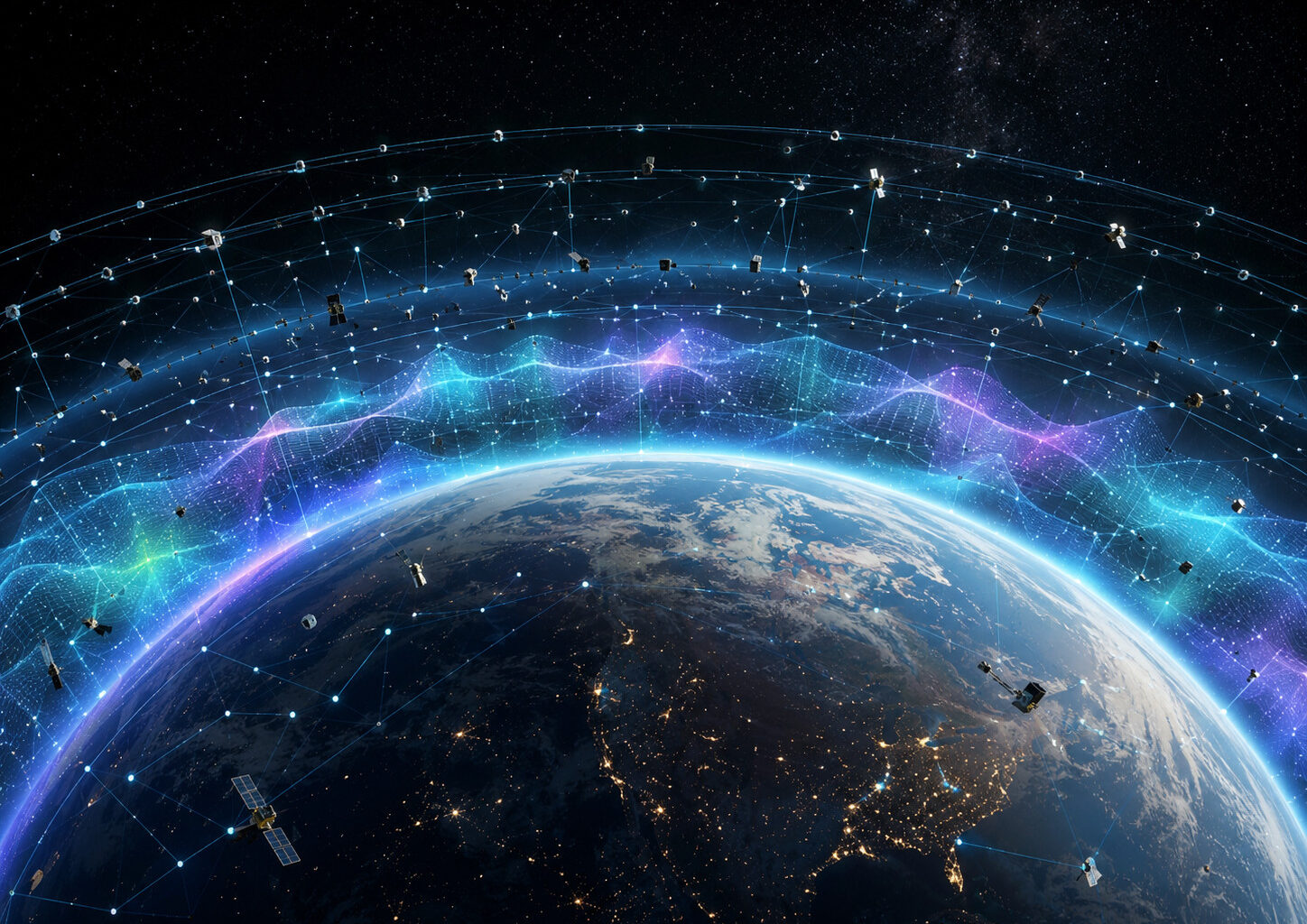
 Thousands of satellites and debris fragments could act as a distributed sensor network, revealing how the thermosphere changes across different altitudes and regions. Illustration: ZME Science.
On February 3, 2022, a SpaceX rocket released 49 Starlink satellites about 210 kilometres above Earth. Most of them would never reach their intended orbits.
A geomagnetic storm had disturbed the upper atmosphere. The air around the satellites remained extraordinarily thin, but it had become dense enough to produce far more drag than expected. Thirty-eight satellites lost altitude and eventually fell back toward Earth.
The incident exposed a difficult problem. Satellite operators can track eruptions on the Sun and measure disturbances in Earth’s magnetic field, but they cannot always predict what the atmosphere will do next — or how strongly a particular spacecraft will be affected.
Laura Aguilar, a doctoral researcher at University College London, wants to turn the satellites themselves into part of the forecast.
“What I’m proposing is to use the satellites in low Earth orbit as a distributed thermosphere sensor network,” Aguilar said during a presentation at the 2026 National Astronomy Meeting in Birmingham, UK.
Satellites are usually simply the victims of space weather. Aguilar wants to use their orbital movements as measurements of the atmospheric changes threatening them.
The idea rests on a simple observation. A satellite’s orbit changes when the atmosphere around it changes. If thousands of objects begin falling faster than expected, their collective movements could reveal where Earth’s upper atmosphere has expanded and how strongly it has responded to a solar storm.
Rather than placing thousands of new sensors in space, Aguilar wants to use a vast network that already exists.
×
Thank you! One more thing…
Please check your inbox and confirm your subscription.
The Atmosphere Doesn’t Have a Fixed Boundary
The layer Aguilar studies is called the thermosphere. It begins far above the clouds and extends through much of low Earth orbit, the region occupied by the International Space Station, Earth-observing spacecraft, communications constellations and enormous quantities of debris. Within this layer of the atmosphere, ultraviolet radiation causes photoionization of molecules, creating ions. The bulk of the ionosphere exists within the thermosphere.
Yet calling this region an atmosphere can feel misleading. It’s very rarefied, and its particles sit so far apart that a person exposed there wouldn’t feel anything resembling wind. But for satellites moving at several kilometres per second, even sparse particles exert a persistent drag. This drag can gradually lower the orbit of the satellites.
 A geomagnetic storm heats and expands Earth’s upper atmosphere, pushing denser air into the paths of satellites and increasing orbital drag. Illustration: ZME Science.
Solar activity can sharply accelerate that process. Energy from a geomagnetic storm heats the thermosphere, changing its density and pushing denser layers of air to greater altitudes.
Aguilar compares the effect to breathing.
“Basically, the atmosphere is not always at the same altitude. It kind of like breathes up and down,” she told ZME Science. “It doesn’t have a pure delimitation where, in one part, we’re in the atmosphere, and then suddenly we’re in space,” Aguilar added.
When the thermosphere expands upward, a satellite that had been moving through extremely sparse gas may suddenly encounter many more particles. The resulting drag can shorten its orbital lifetime and make its future position harder to calculate.
Satellite Math in the Thermosphere
The satellite type also matters. A broad, light spacecraft may respond strongly to drag at an altitude where a smaller, heavier object barely notices it. That makes the problem more difficult than forecasting a single atmospheric boundary. Engineers must consider an object’s mass, shape, orientation and exposed surface area, along with the changing density around it.
Many models simplify the calculation by treating satellites as basic shapes. To make matters even worse, we actually don’t have all that much data on the thermosphere itself, the researcher points out.
“The thermosphere is arguably the least sampled layer of the Earth’s atmosphere, but it’s one of the layers where we have the most orbiting active satellites now and in the next 20 plus years, so we have a problem,” Aguilar said at NAM2026.
Only a small number of specialised missions directly measure atmospheric density or the tiny forces acting on satellites in this region. Some of the most important have already been decommissioned. Meanwhile, the orbital population continues to grow.
“We’re sending so many satellites, but we don’t even understand how they’re behaving,” she told ZME Science.
 A satellite’s orbit can reveal changes in the upper atmosphere: when drag increases, its actual path begins to diverge from the orbit predicted under quiet conditions. Illustration: ZME Science.
A Sensor Network Hiding in Plain Sight
In essence Aguilar’s raw material is not a fleet of new scientific instruments. It is a public catalogue of objects already circling Earth.
Tracking organisations publish orbital records known as Two-Line Elements, or TLEs, for satellites, rocket stages and debris. By comparing those records over time, Aguilar can see whether an object is holding its altitude or falling faster than expected.
“I don’t need to send an instrument to measure what’s going on in the in the thermosphere,” she said at NAM2026.
The data are imperfect. Some objects receive only a few updates a day, tracking quality varies, and military or commercial organisations often hold the most precise observations privately. Aguilar is also testing the limits of how far you can push public data.
Her current proof of concept focuses on about 2,500 pieces of debris orbiting between 600 and 700 kilometres above Earth. Together, they provide roughly one million orbital records.
The longer-term ambition is much larger. Aguilar eventually wants to expand the system across the low-Earth-orbit catalogue, covering more than 20,000 objects between roughly 200 and 2,000 kilometres.
For now, debris offers an especially useful place to begin because it cannot maneuver. A working satellite may fire its engines, turn its body or change altitude, masking the effect of atmospheric drag. A dead fragment simply follows the forces acting on it.
“Debris are just showing me what the physics is doing in the thermosphere,” Aguilar said.
 As the thermosphere expands during a solar storm, satellites at different altitudes encounter changing levels of drag, almost as though they were riding a vast atmospheric swell. Illustration: ZME Science.
Of course, one fragment tells scientists little. Thousands of objects moving through different regions could reveal how the upper atmosphere swells across the planet. “The idea is to make kind of a heat map per altitude layer,” Aguilar said.
Rather than reducing an entire storm to one global number, the network could show what satellites actually experienced in different parts of low Earth orbit.
What’s “Normal”?
Before Aguilar can identify unusual behaviour, she must establish a reliable baseline.
“What I want to focus on is trying to understand what is the quiet behavior of a satellite when basically things are boring,” she said.
Even during quiet periods, orbits drift. The atmosphere changes with the seasons and the solar cycle, while every object responds differently depending on its mass, shape and surface area.
Aguilar trains a deep-learning model on quiet orbital histories. It learns how an object would normally lose altitude, then predicts what should happen next. When the real orbit departs sharply from that prediction, the model flags an anomaly.
“I’m interested in knowing what the satellites are doing in its normal decay behavior during this orbital lifetime. And whenever I find that it is different from that behavior during a quiet period, it’s going to be an anomaly,” Aguilar said.
That approach lets the objects speak for themselves.
Aguilar tested the approach on known disturbances, including the powerful geomagnetic storm of May 2024. As the thermosphere changed, debris began falling faster than the quiet baseline predicted.
She then compared those orbital anomalies with Kp, a widely used index of global geomagnetic activity. Objects sometimes showed different levels of decay under similar Kp conditions. That doesn’tt mean Kp is wrong. It just means a single planetary index cannot capture every condition experienced by satellites at different altitudes, inclinations and locations.
Aguilar’s early results suggest that the orbital catalogue may preserve finer signatures that global indices smooth over.
“I’m already seeing some things that wouldn’t be seen,” Aguilar said.
However, there’s no clear explanation as to why exactly this is happening, and Aguilar emphasizes it’s still a proof of concept.
Space Alerts
Ultimately, Aguilar wants the system to do more than detect unusual orbital behaviour.
A mature version could estimate how strongly the thermosphere is likely to affect particular orbital regions and types of spacecraft after a solar storm begins. Satellite operators could then use that information when deciding whether to delay a launch, adjust an orbit or prepare for increased drag.
That goal remains some distance away. Reaching it will require better validation, more precise tracking data and a larger research effort.
But the need is only growing. More satellites are entering low Earth orbit each year, even as scientists still struggle to predict the environment surrounding them. Humanity has crowded this region faster than it has learned to understand it.
Aguilar’s approach offers a way for science to catch up. The satellites and debris already circling Earth may help reveal how the upper atmosphere behaves, turning the very congestion that created the problem into part of the solution.