
“When you’ve got wind, that really pushes any fires along but also further enhances, I guess, that dryness of those fuels and availability of fuels to burn.”
Mitchell told the Herald that 98% of wildfires in New Zealand were started by people.
Because of New Zealand’s position, it means most areas, particularly the east and northeast, become drier while the southwest of the South Island is wetter. Photo / Christine Cornege
It is possible to have minimal fires during high-risk conditions but people must take the necessary precautions, he said.
People are “strongly encouraged” to clear their properties of vegetation, make sure fires are properly extinguished with water and always check the fire risk.
“Don’t leave those fires to smoulder for days after the main burn as you perhaps have always done.
“You might have got away with it last few seasons; you may not get away with it, or you’re unlikely to get away with it this season.”
People should also make sure their properties are accessible by fire truck, make water supplies accessible and have a plan in case a fire happens.
“There is a potential that we may have to evacuate more people this season.”
He said preparation is important because “once the smoke’s in the air it’s too late”.
Crews have been checking equipment and have increased foam and retardant stocks by 20,000 litres to carry 120,000 litres to brace for the possibility of more fires.
Fire and Emergency has also been in contact with the Department of Conservation, Forestry and the Defence Force on how they could co-ordinate their efforts.
The National Emergency Management Agency (Nema) hosted a forum last week where agencies discussed what they were expecting and how they would deal with the upcoming phenomenon.
The strongest in recorded history
ESNZ is expecting this El Niño, first declared in July, to be the “strongest in recorded history”, Brandolino said.
Although it has around 25% influence on the weather in New Zealand, its impacts can be significant.
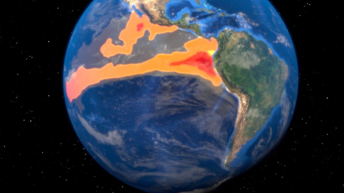
It is caused when warmer-than-normal water temperatures slow down trade winds in the eastern Pacific that would typically carry moisture to New Zealand and Australia.
Because of New Zealand’s position, it means most areas, particularly the east and northeast, become drier while the southwest of the South Island is wetter.
No human alive has seen an El Niño event this strong. In fact, it’s possible that no human in history has seen an event this strong.
Forecasts continue to project a 3.5-4.0°C ‘Super El Nino’.
Temperatures in the east Pacific are now widely 5°C above average, peaking at 6°C. pic.twitter.com/voKRoioBXT
— Met4Cast – UK Weather (@Met4CastUK) August 12, 2026
Temperatures could also vary, occasionally spiking “unusually high” for a few days at a time, Brandolino said.
Parts of the country could also reach 30C earlier in the spring, and some places could reach high temperatures not felt in “several years”, he said.
A “Super El Niño”, which this is likely to be, lasts longer and increases the odds for outcomes such as high temperatures, floods, heat, humidity and fires.
El Niño typically comes around every 10-15 years, while New Zealand has had five Super El El Niños since the early 1970s.
Agriculture impact
The Ministry for Primary Industries (MPI) is encouraging farmers and growers to have a plan, national response manager Andrew Curtis said.
“It’s important farmers make decisions early, including identifying feed deficits and assessing the potential for summer feed crops.
“It could also mean prioritising livestock for destocking early and feeding the remainder as well as possible.”
El Niño can bring increased risk of drought and water scarcity, wildfires, heat-related human and animal health concerns, as well as flooding, he said.
The ministry is working with sector groups to support farmers and growers to prepare, Curtis said.
Resources through levy organisations, talking to experts who have been through El Niño before, and information on the MPI website are tools farms and growers can use, he said.