
On State Highway 88 at Sawyers Bay, caution is being urged because of surface flooding.
The closures come amid a strong wind warning in Otago, with extra care required for high-sided vehicles like campervans, towing vehicles and motorcycles travelling through the area.
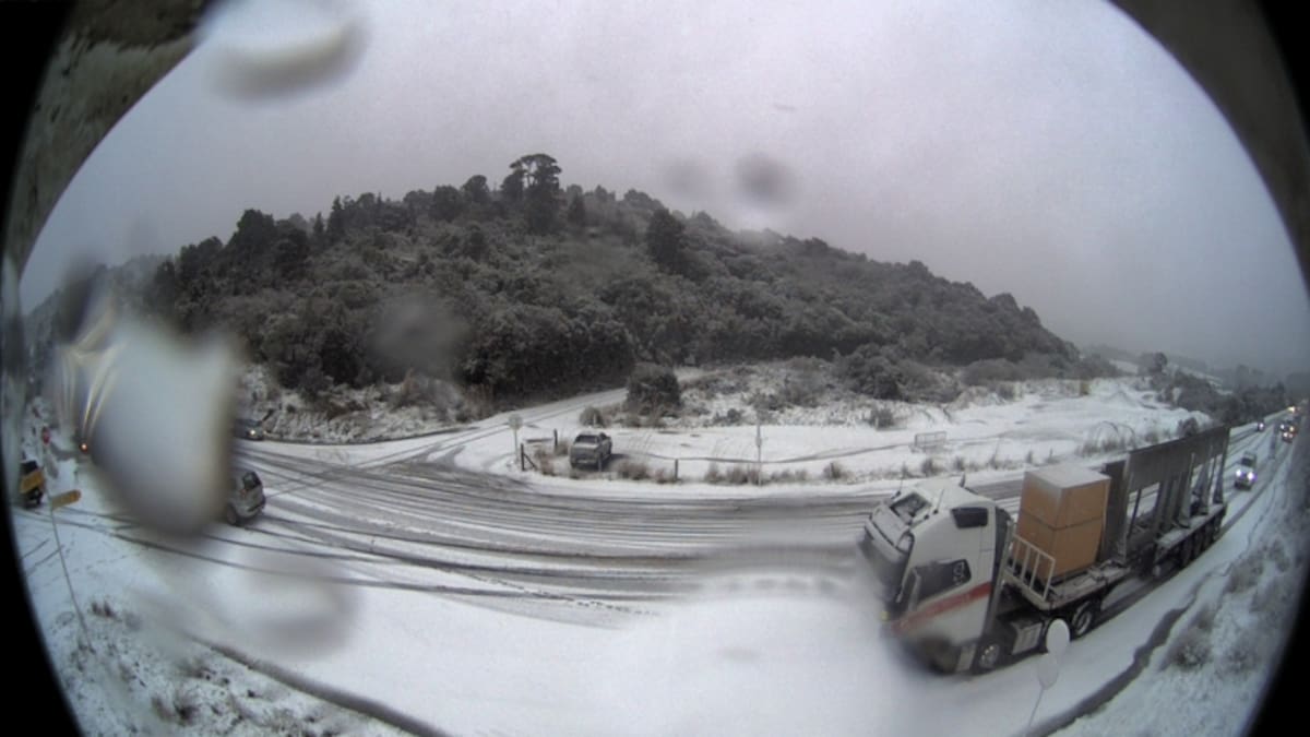
MetService’s Leith Saddle traffic camera showed cars and trucks stuck in snowy conditions.
NZ Transport Agency Waka Kotahi said roading crews will assist as needed until the road is reopened or in a state where vehicles could continue.
MetService meteorologist Samkelo Magwala told the Herald a “wet, snowy, and windy end of winter” is in store.
The South Island will bear the brunt of the wintry blast, as strong southwesterlies bring showers and low snow levels.
“Especially in the southern regions, your Central Otago, Southland, North Otago, even Dunedin, there’s a possibility of snow lowering to near sea level later today,” he said.
“Remember, the meteorological winter for New Zealand is a bit longer. It can extend into September.”
He said that late bursts of wintry weather were normal at this time of year.
Road snowfall warnings cover several southern routes. Up to 12cm could settle near the summit of Milford Rd and up to 8cm on the Crown Range Rd.
Snow could fall to 500m on both roads today. On Lindis Pass, the snow level could drop to 400m by this evening, with 2cm to 4cm possible.
The deep south could also be battered by heavy showers and small hail, while thunderstorms were considered less likely.
Southern Southland, Clutha and Dunedin remain under a strong wind watch until noon, while the same is in place for the Tasman District until 6pm, with westerlies potentially approaching severe gale in exposed places.
Magwala said there was a low chance both watches could be upgraded to a warning.
The southwest change will also be felt in the North Island today, though conditions will not be as severe as in the south.
Hawke’s Bay, south of Hastings, and the Tararua District are under an orange strong wind warning until 7pm.
Severe gale westerlies could gust to 120km/h in exposed places, with possible damage to trees, powerlines and unsecured structures.
Magwala said the winds could make travel difficult for high-sided vehicles and motorcyclists.
Isolated showers are forecast in western areas from Waikato to Northland, while eastern areas should enjoy fine spells.
For Northland, still drying out after weekend flooding, Magwala said incoming showers would not be as “hectic” and “not everyone will get a shower”.
Auckland could reach 17C today with isolated showers, Wellington 17C, with a possible evening shower, and Christchurch 19C during a mainly fine day.
Conditions should ease tomorrow before another system approaches on Wednesday.
Magwala said there was potential for heavy rain in western parts of the South Island and strong winds in the east, although confidence remained low.
“We just keep on monitoring it. As we near closer to the time, we’ll provide the updates.”
It comes after stormy conditions battered the South Island last week.
Residents were evacuated from flooded homes in Queenstown, while Wānaka recorded its wettest August day since 1992.
Various trails across the Queenstown Lakes District were damaged amid the turbulent weather.
Various trails across the Queenstown Lakes District were damaged amid the turbulent weather. Photo / Queenstown Lakes District Council
Queenstown Lakes District Council has closed walking tracks at Arrowtown River – True Right (Tobins Side), Swain Bridge (Arrowtown to Whitechapel Rd), One Mile Lower, Lake Hayes Loop, Cardrona River Track (The Hook) and Gladstone Track (From Johns Creek to Grandview Bridge).
Various trails across the Queenstown Lakes District were damaged amid the turbulent weather. Photo / Queenstown Lakes District Council
The council advised people to use caution on the Twin Rivers, Hugo Tunnel, Matakauri Wetlands and Wharehuanui (from Coronet Station Rd to Millbrook).
They said all closures would remain in place while assessments and remedial work are undertaken.
Sign up to The Daily H, a free newsletter curated by our editors and delivered to your inbox every weekday.