
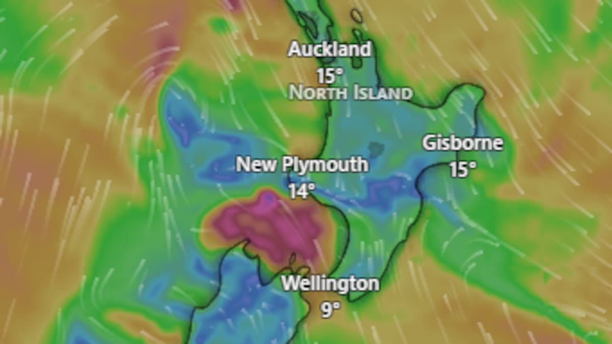
“And yes, there’s that possibility of flooding with the amount of rain that we are expecting.”
Aucklanders are also set to wake to rain tomorrow, although the heaviest falls weren’t expected until around 9am or 10am, Magwala said.
Earth Sciences New Zealand meteorologist Chester Lampkin described the incoming system as “pretty grunty”, with a line of thundery downpours expected to move across parts of the North Island tomorrow.
Some areas could receive a quick 10mm to 20mm of rain in the downpours, he said.
An orange heavy rain warning is in force for the Tararua Range for nearly 24 hours, from 5pm today until 3pm tomorrow, with up to 150mm forecast.
Peak rates of 15-20mm an hour are expected tonight and before dawn.
Magwala said the ranges would receive particularly heavy rain because of the terrain and could be “very difficult to navigate”.
Heavy rain watches are also in place for Taranaki and the Ruahine Range into tomorrow.
Heavy rain, snow disrupts travel in south
NZ Transport Agency Waka Kotahi (NZTA) said travel across western and central parts of the South Island had been disrupted today by widespread surface flooding, fallen trees and slips.
State Highway 6 between Punakaiki and the Fox River on the West Coast was closed by a slip but had since reopened to a single lane.
Flooding had affected sections of SH6 in the Lower Buller Gorge and SH7 between Greymouth and Reefton, as well as SH7 and SH65 between the Hanmer Springs turnoff and Murchison.
Fallen trees have also been reported on highways near Westport, Berlins and the Inangahua Junction.
Further inland, a separate slip had closed State Highway 65 between O’Sullivan’s Bridge and Shenandoah. Motorists were advised to avoid this route or delay their journey.
A slip has blocked State Highway 65 near Mātakitaki.
Woman, dog rescued from flooded gorge
A woman and her dog were rescued from floodwaters at the Waimakariri Gorge this evening.
Police were called at about 5.10pm after she became stuck in rising chest-high waters.
Firefighters were able to bring the pair to safety about 30 minutes later.
Further south, snow was already affecting the Lindis Pass in Otago this afternoon.
Road snowfall warnings are in force for the Crown Range Rd, Lindis, Porters, Arthurs Pass and the Lewis Pass.
Magwala said snow was already falling in some areas and there would be more overnight.
“We can potentially see some road closures there before the system moves even further northeast,” he said.
The snow is expected to ease further south this evening and north of Christchurch tomorrow morning, with several centimetres possible around some alpine passes.
An orange heavy rain warning also remains in place for the Grey and Buller districts and Nelson Lakes until 1am tomorrow.
Unsettled spell will be brief – MetService
Despite the wet, windy and snowy start to the week, Magwala said the unsettled spell would be relatively short-lived.
“It’s more of a spring-like situation where we find this wet and snowy event, but a bit quicker,” he said.
“It’s a two-day event. Already from tomorrow, we see the easing of all of this event.”
He described it as a “wet, windy second start to spring”.
Conditions are expected to improve first over the South Island and later across the North Island, although a weaker front is forecast to affect western parts of the country around Wednesday and Thursday.