
Reading Time: 3 minutes

As we get closer to October we’re now at the time of year when things can dry out fast due to more daylight hours, higher temperatures and more windy westerlies.
New Zealand is still getting frequent rainmakers but from week to week the soil moisture deficit maps show constant change. Back in the depths of winter one week to the next didn’t tend to see much difference, unless heavy rain fell. Now we’re seeing the drier areas emerge a little more, especially around the North Island.
In recent weeks two things have been occurring climate-wise. The highs around southern and eastern Australia have been large in size and powerful in air pressure, bringing significantly widespread dry weather to large parts of the continent.
Air pressure has been higher than normal for this time of year, and that isn’t too surprising considering El Niño tends to do this to our side of the Pacific.
While air pressure has been higher than the historical norm for this time of year around Australia and the Tasman Sea, we’ve seen the opposite occur over the Southern Ocean. Air pressure over the past month has been lower than normal there.
So between higher air pressure to our west, and lower pressure to our south, that puts NZ between it all – bringing us the surges in westerly-driven weather since August.
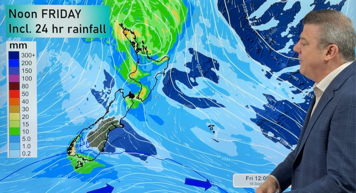
As we head towards the end of September we see even more high pressure in the NZ area. Most highs have not been centred over NZ – most have been to our west or just to our north. By mid to late this week high pressure from the Tasman Sea may move further into the NZ area, with a chance of it tracking over the upper North Island late week – but at the same time another surge of windy westerlies kicks back into the South Island.
By next week we may again be back to high pressure right across the subtropical region to our north, and more high pressure out over the Tasman Sea and southern and eastern parts of Australia.
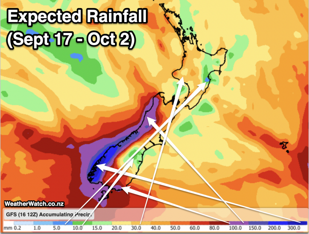 Rainfall for the rest of September – not totally dry, but not super wet for many either. Image: WeatherWatch.co.nz
I said a few months back that one of the things to look for as we go into spring is for high-pressure zones to all connect up – with no lows in between. When this happens we tend to get a ceiling of high pressure north and west of NZ, which keeps the cold fronts still coming into the South Island but limits how much wet weather makes to northern NZ and some eastern parts of both main islands.
This means Southland is likely to continue leaning windier, colder and wetter this month – and likely going into October. Northland, however, leans drier, calmer and milder.
There is no immediate end in sight to this pattern or the uptick in these high-pressure zones to our north and west all connecting and limiting rain makers.
Put short, it appears we’re now entering drier phases of weather for more places. The west to sou’west flow means the West Coast and Southland still have rain and the western North Island still has showers.
The long range rain maps to early October show the bulk of the rain (300mm+) coming to Fiordland and maybe south Westland. A hundred millimetres or so is expected for the top half of the West Coast. Southland and Otago have between 100mm (coastal Southland) and 60mm (Western Otago).
The western North Island has generally 20-40mm while eastern areas from Northland to Canterbury look to have between just 5mm and 30mm on the way through to October 2.