
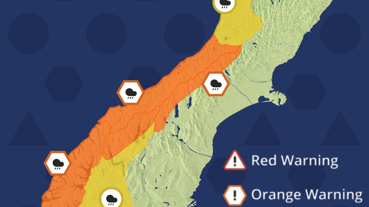
Warnings and watches have been issued for almost the entire South Island.
An orange heavy rain warning has been issued for Fiordland from 2am-9pm on Monday, moving up to the ranges of Westland from 6am with 200-300mm falling in places.
The headwaters of Otago lakes and rivers will also be under an orange heavy rain warning on Labour Day, with forecasters expecting 140-180mm of rain.
A strong wind warning is also in place for Otago from 11am-10pm on Monday, with northwesterly winds potentially reaching severe gale force in exposed areas.
Labour Day wind and rain warnings have also been issued for the headwaters of the Canterbury lakes and rivers near Arthurs Pass, as well as the high country and plains, the Grey District and the Buller District, Wellington and Southland and Stewart Island.
Watches have been announced for parts of the Queenstown Lakes District, Southland and Stewart Island, the Tararua Range and District, Wairarapa, Marlborough and Christchurch.
Watches and warnings issued across the country. Photo / MetService
Meteorologist Devlin Lynden told the Herald the threat from the Monday weather system had been signalled for several days.
“We have had the risk for this Monday event for a few days now. We’re now close enough to begin issuing the watches and warnings,” he said.
MetService is also monitoring Fiordland, Southland, Stewart Island and Clutha, where northwesterly winds could strengthen to severe gale force.
The heavy rain warnings say streams and rivers may rise rapidly, with surface flooding, slips and hazardous driving conditions possible.
Lynden said the system was typical of spring weather.
“This is probably our most common weather pattern,” he said.
“A big ridge of high pressure, then a cold front moving up the country, which brings those strong northwesterlies and then a band of heavy rain, followed by cooler southwesterlies.”
While no watches or warnings have been issued for the North Island, Lynden said that could change in the coming days as the front tracks north.
“We don’t have any watches or warnings in the North Island at the moment, but there’s a reasonable likelihood that we’ll be issuing some gale watches for at least the south of the North Island in the coming days.”
The front is expected to reach the North Island on Tuesday before moving away. Behind it, cooler southwesterly winds and more changeable weather are forecast across much of the country through the latter half of next week.