
In central New Zealand crews were called to deal with downed power lines and sparking street lights, according to a Fire and Emergency spokeswoman.
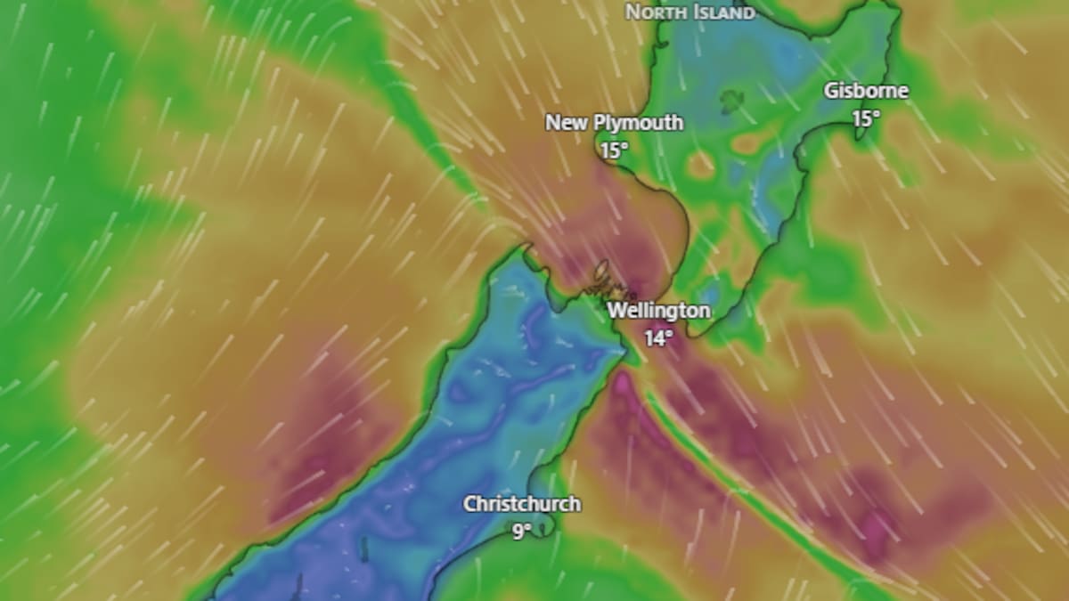
Severe northwest gales are forecast to bring gusts of up to 120km/h to exposed parts of Wellington, Wairarapa and Marlborough today. Image / Windy.com
Powerco’s website shows dozens of properties with unplanned outages in the lower North Island, while an earlier Wellington Electricity outage has been resolved.
Another 650 properties are without power this morning in Urenui, northeast of New Plymouth, due to a crash.
MetService meteorologist Devlin Lynden told the Herald incoming rain and easing winds were good news for areas affected by the fires.
Winds were expected to ease in Canterbury overnight, while the Central Plateau could see rain from midday today.
Orange strong wind warnings are in place for Wellington, Wairarapa and Marlborough, with severe northwest gales forecast to bring gusts of up to 130km/h in Wellington early this morning.
The warnings expire at 8am in Marlborough, 9am in Wellington and 11am in Wairarapa.
MetService warns the winds could damage trees, power lines and unsecured structures, while motorists, particularly those driving high-sided vehicles, could face difficult conditions.
Fierce winds have already caused havoc in Wellington, where flights were cancelled and cyclists were reportedly blown off their bikes and wing mirrors ripped from cars yesterday.
An orange heavy rain warning is also in place for the Tararua Range until 11am, with between 90mm and 130mm expected.
Strong wind watches are also in place for Horowhenua, Kāpiti and Tararua, where northwest winds could approach severe gale force.
Lynden said the strongest winds would ease as the weather system moved north.
“By midday or early afternoon winds will have eased and turned to lighter and cooler southwesterlies.”
Huge plumes of smoke drifted over the Desert Rd as firefighters battled a vegetation fire near Waiouru yesterday.
Further north, Aucklanders can expect a cloudy start with northerly winds and possible light showers.
Showers are expected to become heavier around midday before winds shift to cooler southwesterlies.
“[You] should start to see some fine breaks through the afternoon,” Lynden said.
Looking ahead, Lynden said the country was in for a cooler end to the week after a spell of relatively warm weather.
“I’d expect the general temperatures to drop from what we’ve seen recently.”
Western regions, particularly the West Coast, can expect more cloud and occasional showers as the country settles into a cooler westerly airflow.
Earth Sciences New Zealand is also forecasting another spell of rain later this week, with western regions expected to see the wettest conditions on Wednesday and Thursday.