
Snow is falling in parts of the South this morning, prompting warnings for motorists on the region’s roads.
The Queenstown Lakes District Council (QLDC) said about 10am rain and snow were falling across the district, and reminded road users to watch for surface flooding and increase following distances.
“Get those headlights on, be seen, be safe.”
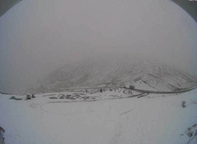
The MetService Crown Range webcam showed a decent dusting of snow, and the QLDC said chains now had to be carried by motorists using the road.
Snow was also visible on the Lindis Pass (State Highway 8) about 10.40am.
MetService meteorologist Devlin Lynden earlier said a frontal system would bring strong and cold southwesterlies to Southland tonight, which would make their way up the South Island, likely delivering snow to low levels in Southland, South Otago and Central Otago.
He said it was expected to continue through tomorrow until early on Friday.
While it may also snow in Dunedin, it was not expected to settle and would not affect the city or the rest of coastal Otago.
Another busy weather day is on the cards across NZ on Wednesday:
🌧️ Expect heavy rain in the West Coast with snow in the Southern Alps
⛈️ The western and central North Island will see showers and maybe isolated thunderstorms
🍃 In addition, gusty winds are expected across NZ pic.twitter.com/m2BHIIMuMl
— NIWA Weather (@NiwaWeather) September 9, 2025
“It will mainly affect those slightly more elevated areas around 200m in Southland and the Clutha area.
“Any snow or icy conditions have the potential to cause hazardous driving, so people out and about on the highways or more rural roads should take it easy and drive to the conditions.”
MetService has issued snow alerts and warnings for South Island mountain highways and alpine passes.
Some of the largest snowfalls were expected on the Milford Road (State Highway 94), and the route was closed by NZ Transport Agency Waka Kotahi (NZTA) last night in anticipation of the snow.
The forecast was for about 10cm-20cm to accumulate today near the Homer Tunnel entrance and 2cm-5cm at Knobs Flat from around dawn.
The road reopened about 9.30am today but will close again this evening. NZTA this morning said snow was now forecast every day through to Sunday, and further overnight closures should be expected.
The Crown Range Road, Haast Pass (SH6) and the Lindis Pass (SH8) were also forecast to get snow to a lesser degree, Mr Lynden said.
In addition to the snow, thunderstorms may also impact the South Island from tomorrow, while strong wind gusts and rain were also on the cards.
Mr Lynden said ice may also be an issue on some highways later this week after the snow and rain had moved through.
An NZTA spokesman said the organisation’s contractors would be monitoring the situation and working to keep the highways clear, or close roads for people’s safety, if necessary.
Road snowfall warnings
Crown Range Road, for 12 hours from 6am-6pm Wednesday.
Forecast: Snow showers are expected to affect the road Wednesday morning and afternoon. 1 to 2cm may accumulate about the summit with lesser amounts lower down.
Haast Pass (SH6), for six hours from 6am-noon Wednesday.
Forecast: Snow showers may affect the summit of the road Wednesday morning. Up to 2cm may accumulate.
Lindis Pass (SH8), for 10 hours from 7am-5pm Wednesday.
Forecast: Snow is expected to lower to 800 metres Wednesday morning and to 600 metres in the afternoon. 2 to 4cm may accumulate about the summit with lesser amounts lower down.
Milford Road (SH94), for 21 hours from 2am-11pm Wednesday.
Forecast: Snow is expected to lower to about 500 metres early Wednesday morning. 10 to 20cm may accumulate about Homer Tunnel during the morning and afternoon with lesser amounts down to 500 metres. In the evening, snow showers become confined south of Lake Gunn where a further 1 to 2cm may accumulate on the road above 300 metres.
john.lewis@odt.co.nz/additional reporting ODT Online