

Good Morning! Welcome to subscribers and visitors! This is post number 792. Author (in case you didn’t know): Dr. Ryan Maue (X @RyanMaue) no other titles (yet).
Lower 48 precipitation type + MSLP for the next 6-days | ECMWF 06z

Headlines Monday Morning
A parade of shortwave troughs keep breaking off the main polar front situated in the Gulf of Alaska (—> Rossby wave trough thinning) & spin down the West Coast. A surface circulation + cold air aloft = instability + Pacific moisture = mini-atmospheric river events for Southern California
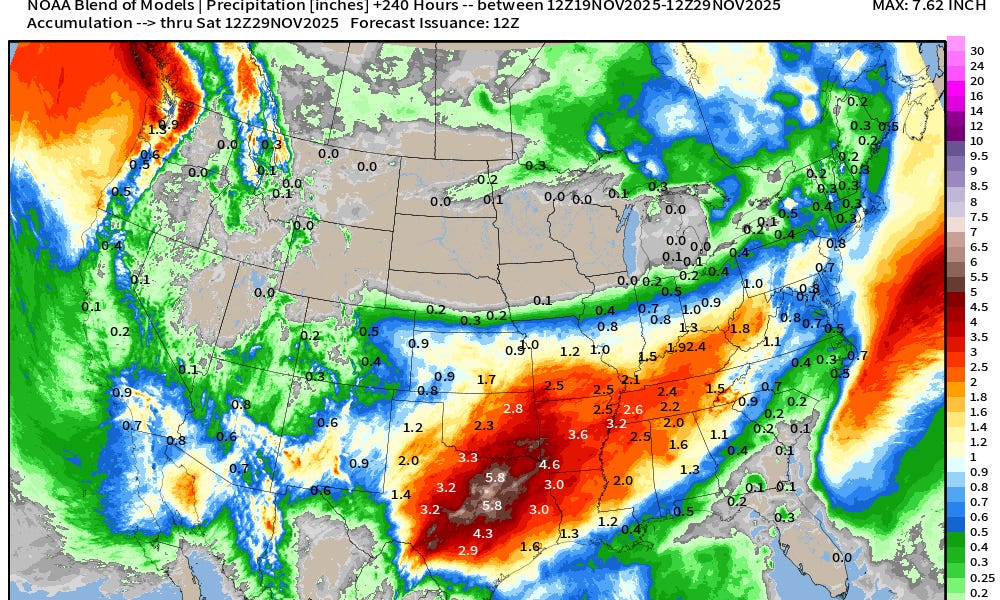
These weak cut-off lows migrate into the Southwest and then east into the central Rockies — pulling up moisture out of the subtropics = rainfall for Southwest into Texas by early next week — really will add up = boatloads.
Medium to long range: ongoing “stratospheric warming event” may see a wind reversal or split in the 10-50 mb level … but HIGH uncertainty about outcome of any tropospheric polar vortex disruptions. Cold period centered upon Thanksgiving/Black Friday weekend with a dip in the jet stream — but the remaining “fully loaded” Arctic polar vortex may remain locked up in Canada (for now).
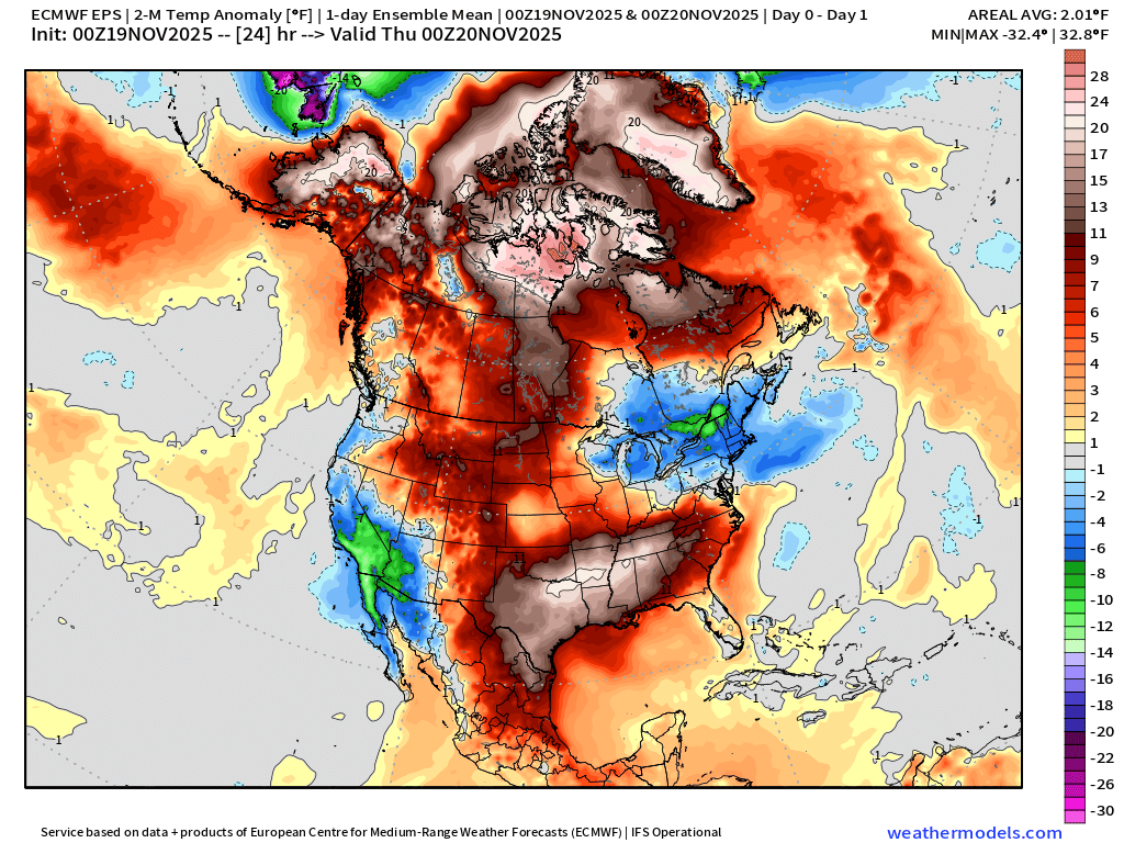
If there’s one animation that is the industry standard for monitoring cold air outbreaks, then it’s the ECMWF EPS full-physics ensemble mean 2-meter temperature anomaly.
Cold does filter east out of the Rockies with a typical Midwest/Great Lakes trough/PV event, but warmth /ridging quickly replaces the cold air mass into first week of December.