
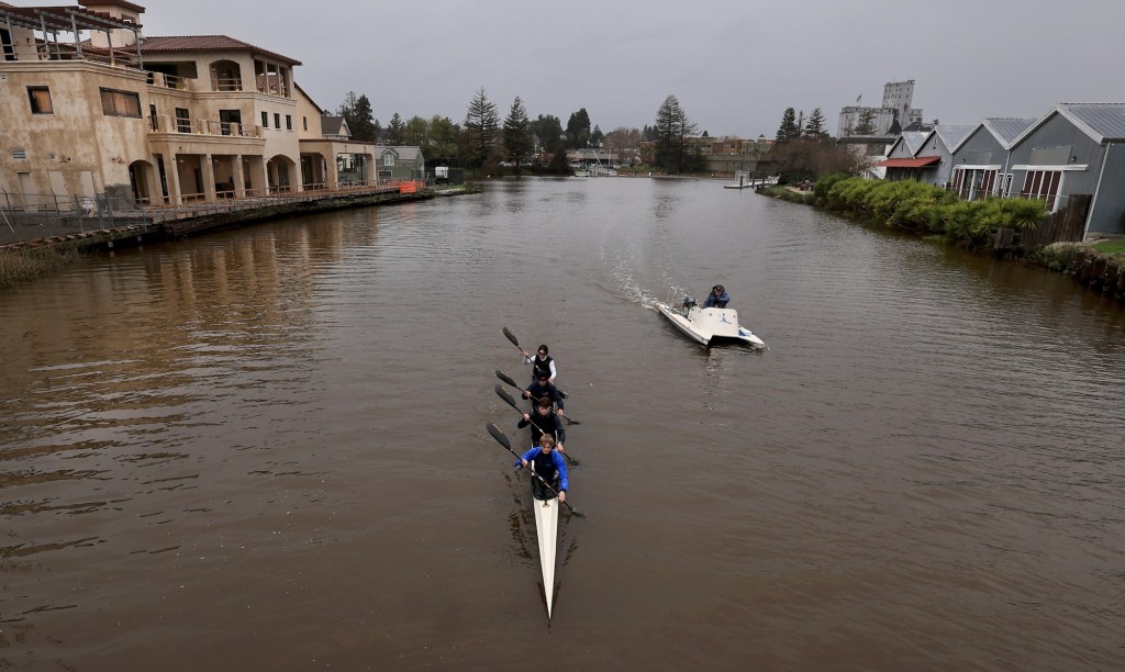
An extraordinarily strong bout of seasonal king tides and runoff from the latest rainstorm combined Friday to push the crest of the Petaluma River to the highest point in nearly the last three decades even as bay tides unleashed flooding in Marin County and other parts of the Bay Area before a weekend of rain and high winds.
The Petaluma River, one of Sonoma County’s largest tidal sloughs, had not topped its banks, but water levels surged to 8.33 feet by 1 p.m. Friday, according to a National Weather Service gauge at the D Street Bridge, where the previous recorded high was 6.4 feet in 1998.
The new record was likely to be broken again by late morning Saturday as the king tides were expected to peak amid the incoming rainstorm, said National Weather Service meteorologist Rachel Kennedy.
The agency issued a coastal flood warning for the San Francisco Bay that will last through Saturday afternoon.
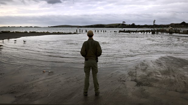 Matt Hyles with Sonoma County Regional Parks checks on the King Tide inundation of a parking lot Friday, Jan. 2, 2026, in Bodega Bay. (Kent Porter / The Press Democrat)
“The king tides are the result of three different lunar events going on, which is why (they) are so strong,” Kennedy said. Those lunar events are: A full moon on Saturday night; perihelion, also in full effect Saturday, meaning the sun and moon are in their closest alignment, combining their gravitational effects; and perigee, meaning the moon is at its closest point to Earth.
“At the same time, we have that storm system with 1.3 feet of storm surge coming in,” Kennedy said. “So that’s in combination with these king tides, they’re just unfortunately overlapping at the same time.”
Kennedy said the king tide is forecast to peak around 10:30 a.m. Saturday, when the tide could reach 2.5 feet above the average level, a height the agency hasn’t recorded since 1988. The tide level is anticipated to drop Sunday, but waters will still reach 1.9 feet above average along the San Francisco Bay shoreline.
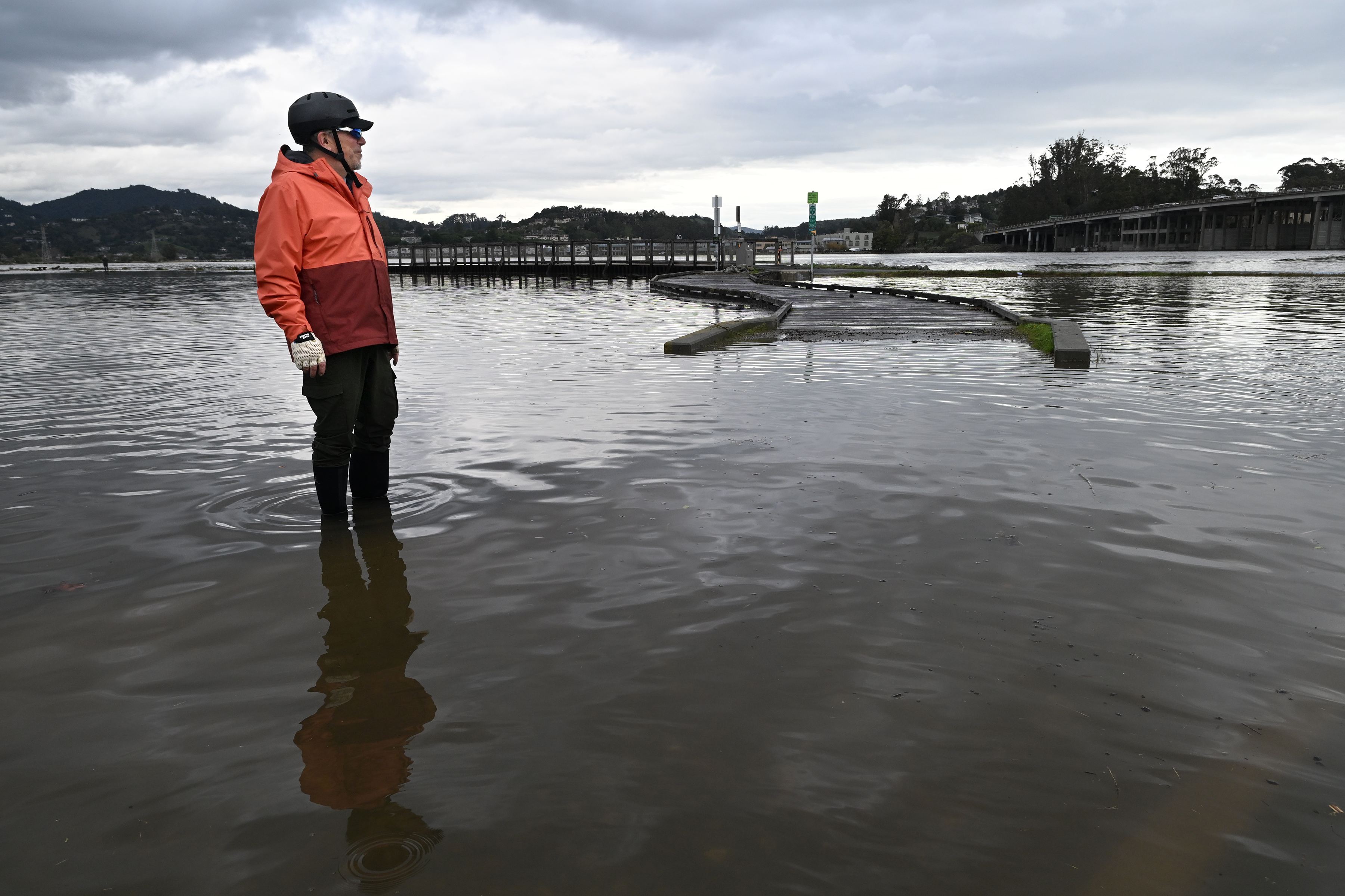
The flooding on Friday prompted the California Highway Patrol to close parts of Highway 101 at Lucky Drive in Corte Madera and Shoreline Highway in Mill Valley. A minor flood was reported at Coyote Creek in Tamalpais Valley, where the creek level reached 8 feet Friday morning, according to the county.
Jamie Lease of Mill Valley stands on the submerged San Francisco Bay Trail in Mill Valley, Calif., during a king tide on Friday, Jan. 2, 2026. (Alan Dep/Marin Independent Journal)

A car drives through water at the southbound Highway 101 offramp to the Shoreline Highway in Mill Valley, Calif., during a king tide on Friday, Jan. 2, 2026. (Alan Dep/Marin Independent Journal)

Jung Vu of Sausalito stands on his paddleboard as he chats with Kiefer Screyer of Caltrans near the southbound Highway 101 offramp to the Shoreline Highway in Mill Valley, Calif., during the king tide on Friday, Jan. 2, 2026. (Alan Dep/Marin Independent Journal)
Jessi Goldstein of Mill Valley walks along the San Francisco Bay Trail between Sausalito and Mill Valley, Calif. during a king tide on Friday, Jan. 2, 2026. (Alan Dep/Marin Independent Journal)
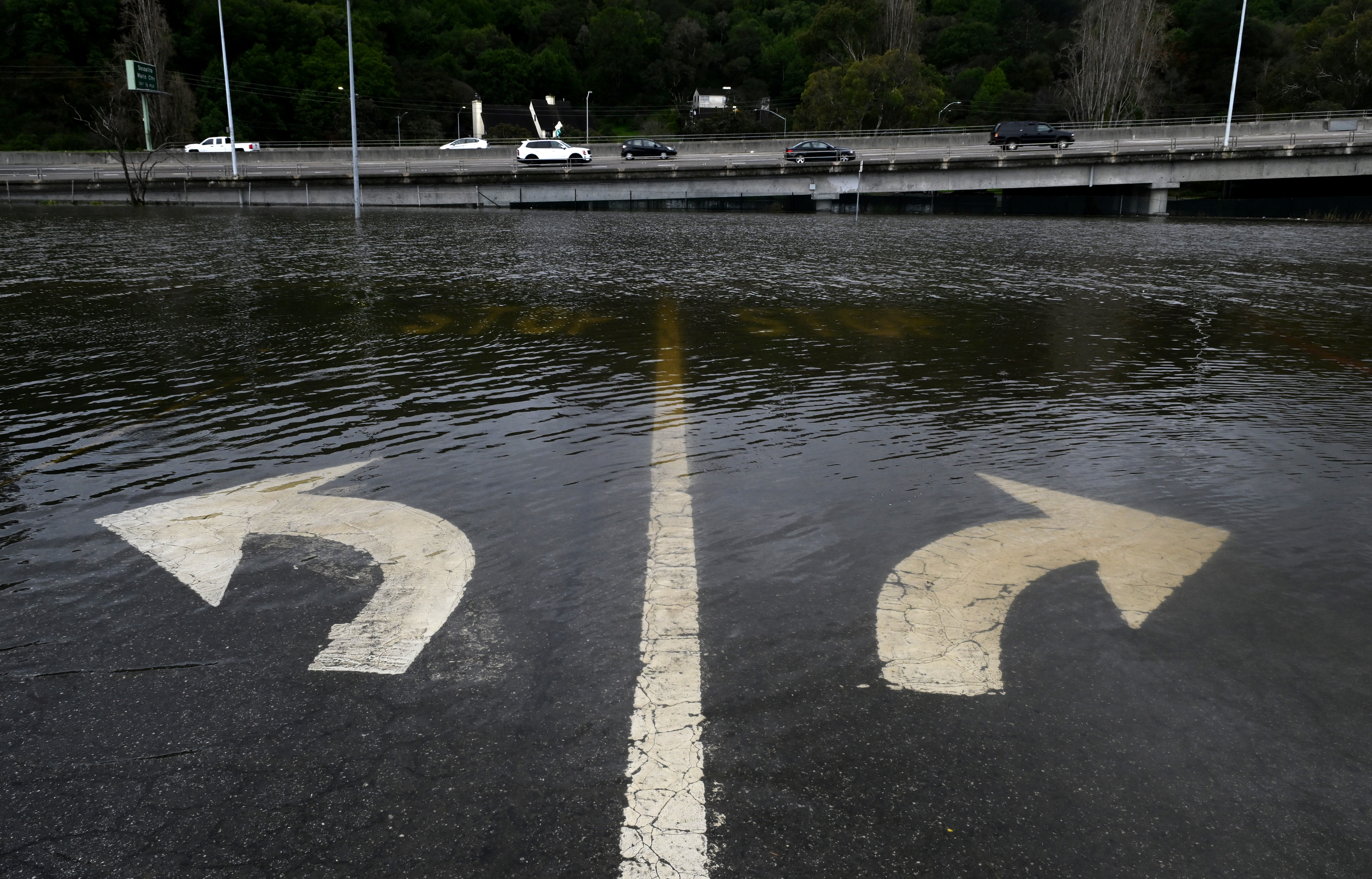
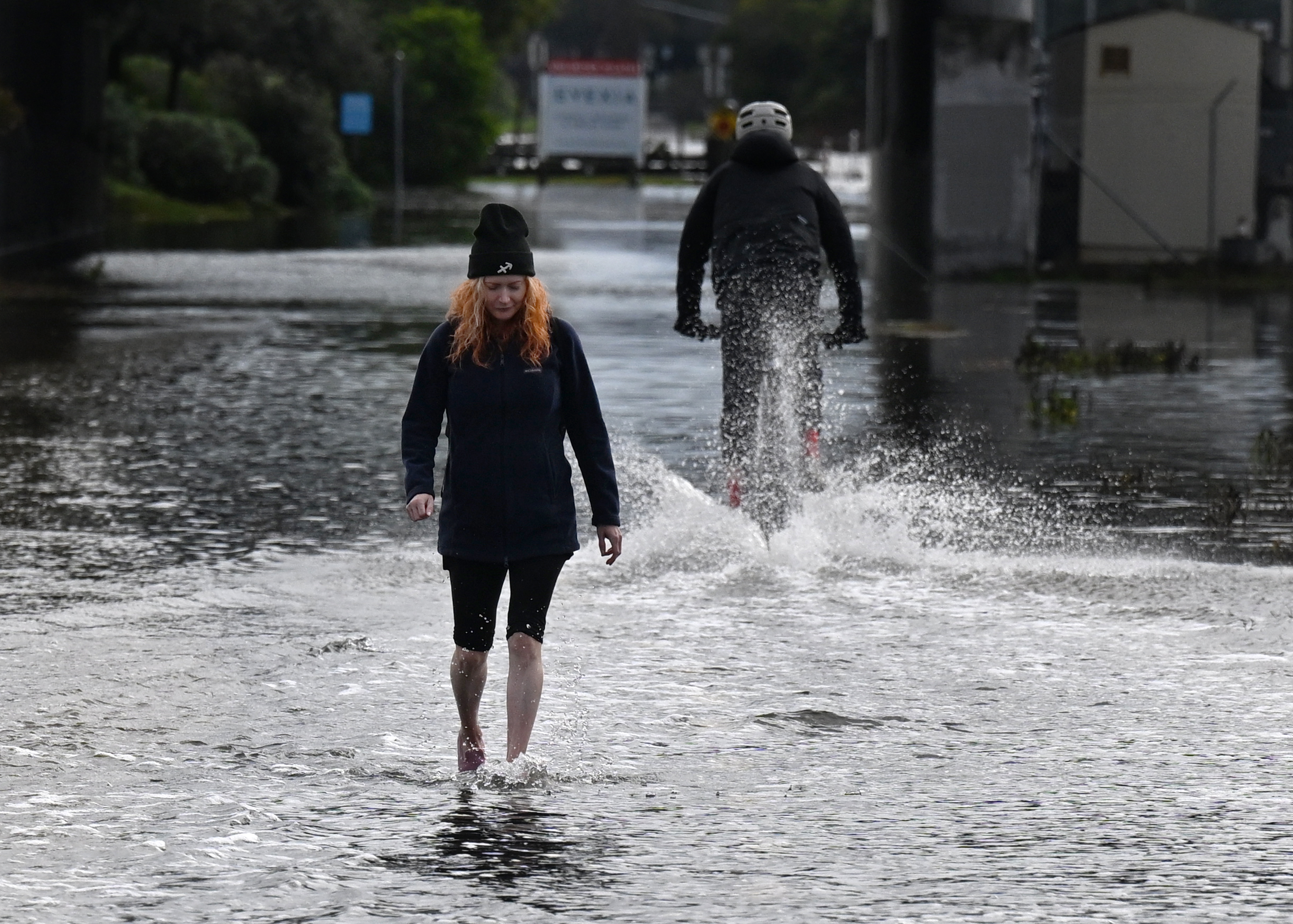
Flooding covers the intersection of Pohono Street and Shoreline Highway in Mill Valley, Calif., during a king tide as cars travel along Highway 101 in the background on Friday, Jan. 2, 2026. (Alan Dep/Marin Independent Journal)

Jung Vu of Sausalito takes his paddleboard on the Shoreline Highway underpass below Highway 101 in Mill Valley, Calif., during the king tide on Friday, Jan. 2, 2026. (Alan Dep/Marin Independent Journal)

A bus stop bench near Pohono Street is partially submerged during a king tide in Mill Valley, Calif., on Friday, Jan. 2, 2026. (Alan Dep/Marin Independent Journal)
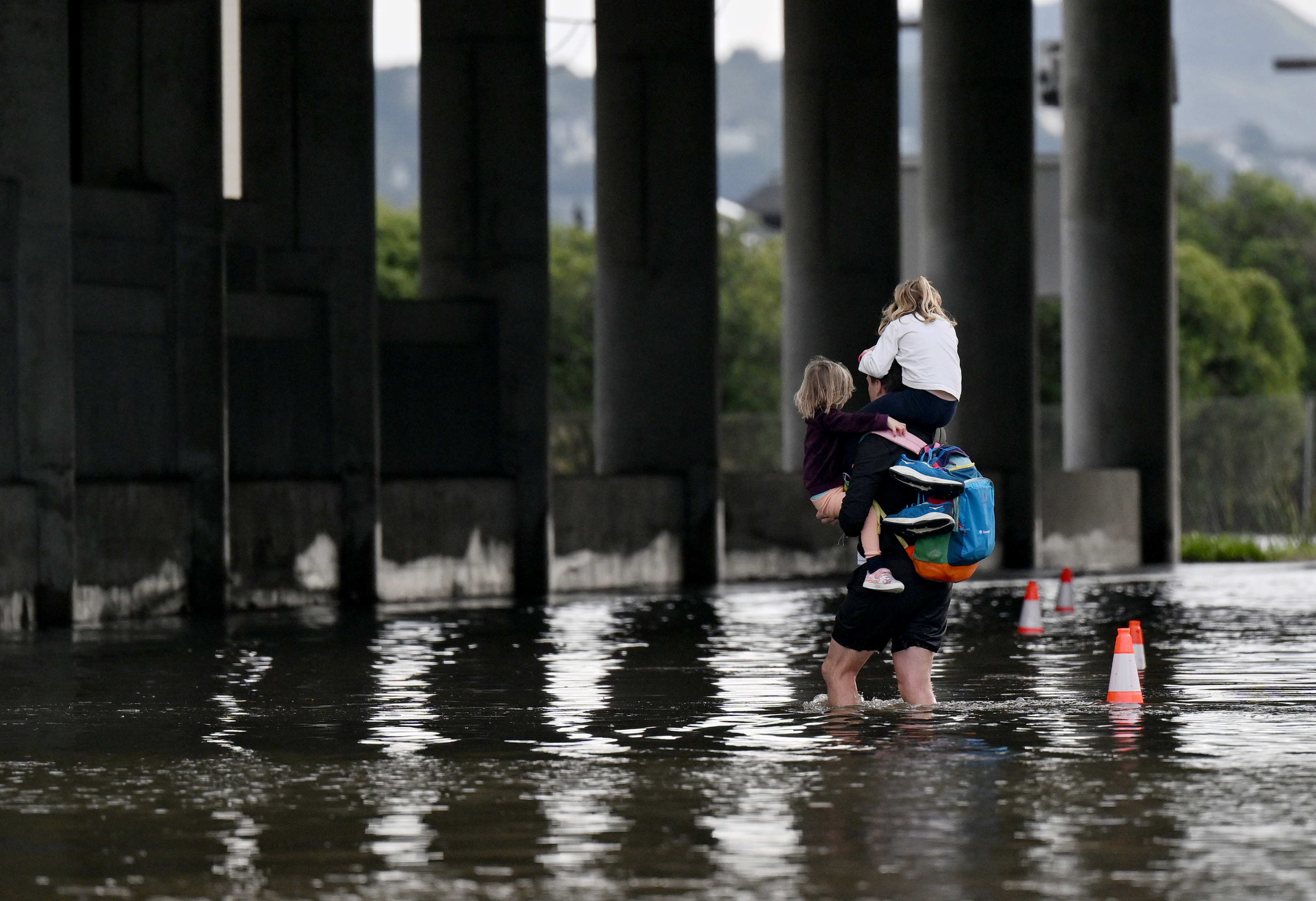
A man carries children through a flooded underpass near the Manzanita commuter parking lot in Mill Valley, Calif., during a king tide on Friday, Jan. 2, 2026. (Alan Dep/Marin Independent Journal)
Show Caption
1 of 8
Jamie Lease of Mill Valley stands on the submerged San Francisco Bay Trail in Mill Valley, Calif., during a king tide on Friday, Jan. 2, 2026. (Alan Dep/Marin Independent Journal)
Corte Madera resident Emily Drake paddled her kayak across flooded streets and parking lots along Lucky Drive on Friday to assist stranded people. She picked up someone who was stuck at a flooded gym and needed to go to work, kayaking her to a bus stop.
“I’ve been just going back and forth, talking to people and seeing if anybody knows anyone who needs to get to a dry spot,” Drake said.
She expects the tide to be “pretty bad” on Saturday morning, when there will be a full moon.
“I expect I’ll be doing a lot of rowing,” Drake said. “I’m hoping that it’s blocked off so not as many people need help.”
In Bodega Bay, the king tides resulted in minor inundation Friday of several shoreline parking lots.
In Petaluma, officials did not appear to be concerned about flood risk along the river, with no notifications or alerts sent out as of Friday afternoon. Most of the attention remained focused in Marin County, because “Typically Marin is our problem area for coastal flooding,” Kennedy said.
Petaluma City Manager Peggy Flynn said later Friday that “all precautions are being taken,” especially with a new storm coming in.
“These atmospheric rivers can be wetter than expected and the watershed precipitation, which is even more unpredictable, can affect flooding significantly,” Flynn said. For that reason city personnel were checking storm pumpstations, cleaning storm drain “hot spots” and remaining on standby, she said.
This week’s tidal event is expected to be in a class of its own.
“This is going to be the maximum tide for the whole year,” meteorologist Jan Null said. “Everything is lining up at once. It’s not going to be end-of-the-world sorts of stuff. All of the lower-tier parking lots will probably be covered with water. Maybe some of the upper-tier ones, too.”
On Saturday, tides are expected to be at their highest from around 9:30 a.m. near Pillar Point Harbor on the San Mateo County coast to 10:30 a.m. farther north in Marin, with measurements between about five and seven feet, according to the National Weather Service.
Beachgoers, beware: The combination of king tides and crashing waves sent by stormy seas will make for a hazardous coastline over the weekend.
The tides will be moving in amid rain that is expected to begin again Friday night and last into Saturday. A brief break will follow, before showers resume again on Sunday. Null said it’s likely that the places most susceptible to rain — the North Bay and Santa Cruz Mountains — could get as much as 4 inches in a 96-hour period.
Reach Petaluma Argus-Courier Editor Don Frances at donald.frances@pressdemocrat.com. Bay Area News Group contributed to this report.