
MetService issued a Red Warning for Heavy Rain for the Manawatū, Rangitīkei, and Ruapehu Districts north of Feilding and east of State Highway 1 at 14:36 NZDT (01:36 UTC) on February 15.
The alert was raised from an Orange Warning in coordination with Horizons Regional Council after forecast analysis indicated that sustained rainfall from a deep low-pressure system would have significant impacts across the region.
The Red Warning covers the period from 18:00 NZDT Sunday, February 15 to 14:00 NZDT Monday, February 16 (05:00 UTC Sunday to 01:00 UTC Monday).
MetService models indicate that the heaviest rainfall is expected overnight Sunday into Monday, as the low tracks southward along the eastern North Island and draws moist air onto the lower slopes of the Ruahine and Kaimanawa Ranges.
Strong southeasterly winds will accompany the system, adding further stress to trees and power lines and producing rough seas along the southern and eastern coasts of the North Island.
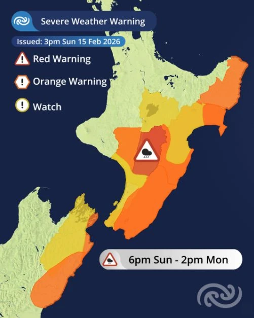 Image credit: MetService
MetService meteorologist John Law said the situation poses a clear threat to life in vulnerable areas.
“It will be a wet and windy night for many parts of the lower and eastern North Island tonight, with rain returning and persisting through the night. The rainfall around Taihape and the eastern areas of Manawatū is of particular concern, bringing a threat to life from dangerous river conditions, significant flooding, slips and disrupting travel,” he said.
Red Warnings are reserved for the most severe weather events where widespread impacts and major disruptions are expected. This is New Zealand’s second Red Warning in 2026 and the 21st since the alert tier was introduced in May 2019.
“A Red Warning signifies that people need to act now as immediate action is required to protect people, animals and property from the impact of the weather. People should also be prepared to follow the advice of official authorities and emergency services.”
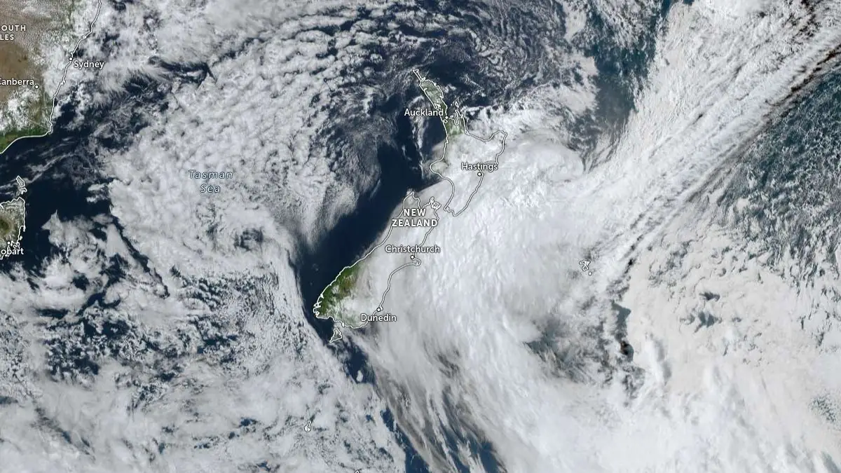
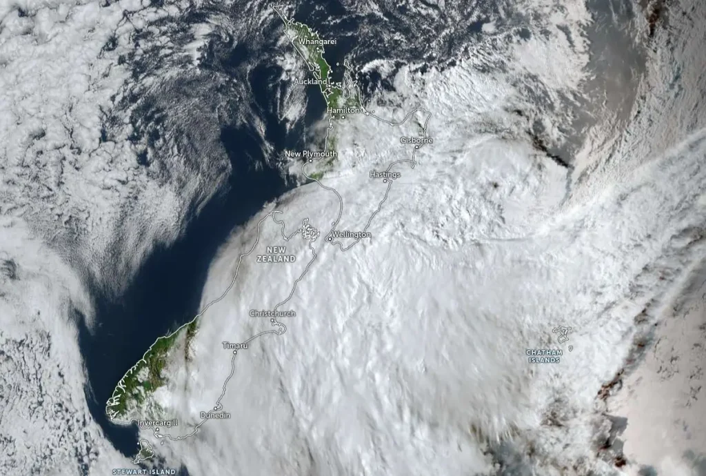 Image credit: JMA/Himawari-9, Zoom Earth, The Watchers. Acquired at 05:20 UTC on February 15, 2026
A pre-emptive state of emergency has been declared for the entire Horizons Region as of 18:37 LT on Sunday, February 15, for an initial period of seven days, as part of the response to the current weather event. The Horizons Region refers to New Zealand’s Manawatū–Whanganui region, which spans from the Ruapehu volcanic plateau to the Tararua Ranges and includes major river systems such as the Whanganui and Manawatū.
The emergency declaration was requested by group controller Michael McCartney and signed by Manawatū–Whanganui Civil Defence Emergency Management Group (MWCDEM) Group chair Nikki Riley after consultation with the region’s mayors. Tararua, Rangitīkei, and Manawatū district councils had declared a pre-emptive state of emergency earlier in the day.
The declaration gives access to emergency powers and grants authority to protect life and property in extraordinary events.
“Some of the most commonly used emergency powers include evacuating premises and places, entering premises, closing roads and public places, removing aircraft, vessels, vehicles etc and requisitioning property, equipment, material or supplies. Of these, enabling evacuations is often the key reason for an emergency declaration,” McCartney said.
“We don’t know for certain that we will need to make use of these emergency powers, but given the potential for the main impact of this event to happen overnight, we’ve made the declaration it now as a precautionary step so we have those powers available if they’re needed.”
“Although this weather event has begun with only moderate rainfall for most parts of the region and no further significant issues yet, we – along with all of the region’s emergency services and partner agencies – continue to urge people to take it seriously,” he said.
Severe Weather Warnings and Watches also cover much of the eastern and lower North Island, both for Heavy Rain and Strong Winds.
With strengthening winds forecast through the night, Strong Wind Warnings for severe gales extend from the Cook Strait coast right up the eastern coast, with a high chance that the warnings in Hawke’s Bay, eastern Taihape, the Tararua District, and Wairarapa could be upgraded to a Red Warning.
The strong winds will also be generating rough seas and large waves around the southern and eastern coasts of the North Island.
As the weather system sinks southwards, wind and rain will reach down to the top of the South Island, where some Severe Weather Warnings and Watches are also in place.
References:
1 MetService Red Warning for Manawatu, Rangitikei and Ruapehu Districts – MetService – February 15, 2026
2 State of Emergency declared across entire region – MWCDEM – February 15, 2026