
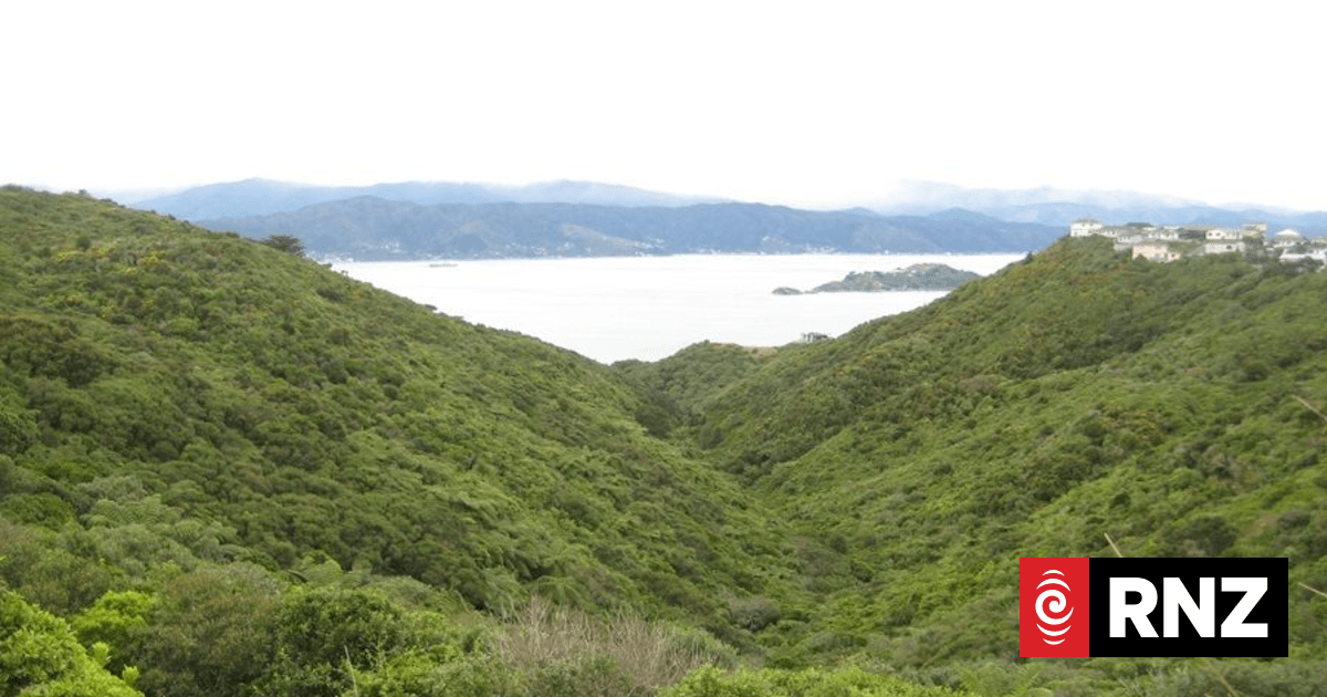
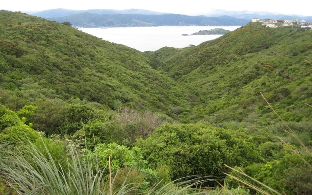
As it stands, the proposed motorway between Petone to Grenada would cut across two local reserves, including the Gilberd Bush Reserve.
Photo: LDR / SUPPLIED
About 200 properties in northern Wellington suburbs and Lower Hutt’s Petone could join two reserves in the firing line of the proposed Petone to Grenada road (P2G), according to new maps.
The latest details of the 5.5km four-lane highway, released by the New Zealand Transport Agency Waka Kotahi (NZTA) for four public engagement sessions, offer the route’s first details on its Lower Hutt side.
At Lower Hutt, there would be two ramps connecting P2G and State Highway 2, a link road to Hutt Rd and an intersection near Hector St, but the current Petone interchange would be untouched.
The proposed route would also run through what are now industrial areas between SH2 and Korokoro, which the map shaded parts of it under “P2G Footprint”.
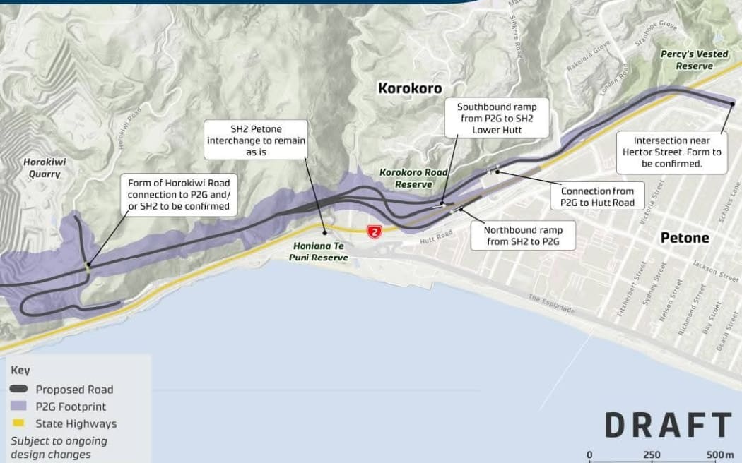
Photo: LDR / supplied / NZTA
The maps further revealed plans for a form of intersection between P2G and Horokiwi Rd, and shaded parts of Horokiwi Quarry.
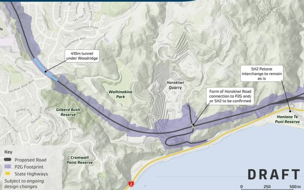
Photo: LDR / supplied / NZTA
In Wellington’s northern suburbs, P2G cuts through parts of Seton Nossiter Park, covering some of Lawson’s Track, the map shows. It would also cut through sections of Gilberd Bush Reserve, before it joins the section at Horokiwi.
The maps said the route was subject to ongoing design changes.
An NZTA spokesperson said the footprint on the map showed all landowners “who may be directly affected”, or the agency needed to acquire some or all of the property if the route was confirmed or consented. The project was still in an early design phase, the spokesperson added.
About 200 properties “may be directly affected”, 21 of which were already owned by the agency.
“However, specific property acquisition decisions will not be confirmed until more detailed design is complete later this year. This means the exact number of properties and/or land titles that may be affected by the project is still to be finalised.”
Earlier renditions of P2G route maps revealed plans for a 410m tunnel under Woodridge and another 230m tunnel under Mark Ave before it meets State Highway 1 at Grenada. It also left space for new link roads to the nearby Lincolnshire Farms development, where 2500 new houses would be built over the next 30 years.
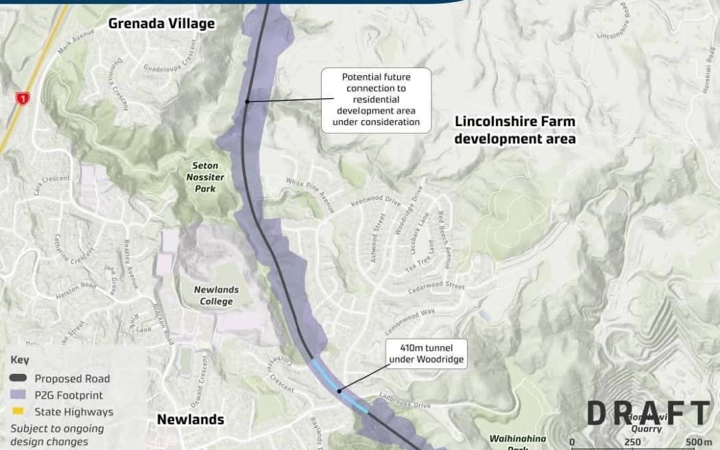
Photo: LDR / supplied / NZTA
Wellington’s deputy mayor and Tākapu/Northern Ward councillor Ben McNulty said on social media the deep cuts to build the Woodridge tunnel would mean compulsory property acquisitions in the area.
“For a lot of homeowners between Grenada Village to Newlands, it’ll be hard news to stomach,” he said. “I want a connection built but what’s proposed makes me uncomfortable. The potential loss of these pristine green spaces is devastating.”
NZTA picked the current route variation of P2G instead of three others that would have cut through Lincolnshire Farms.
Officials chose that design because it was less steep, could cut the most driving time between Lower Hutt and Porirua by 15 to 20 minutes, had the “least impact on housing growth areas”, and being the second cheapest option – made slightly more expensive because of the tunnels – was the best value for money.
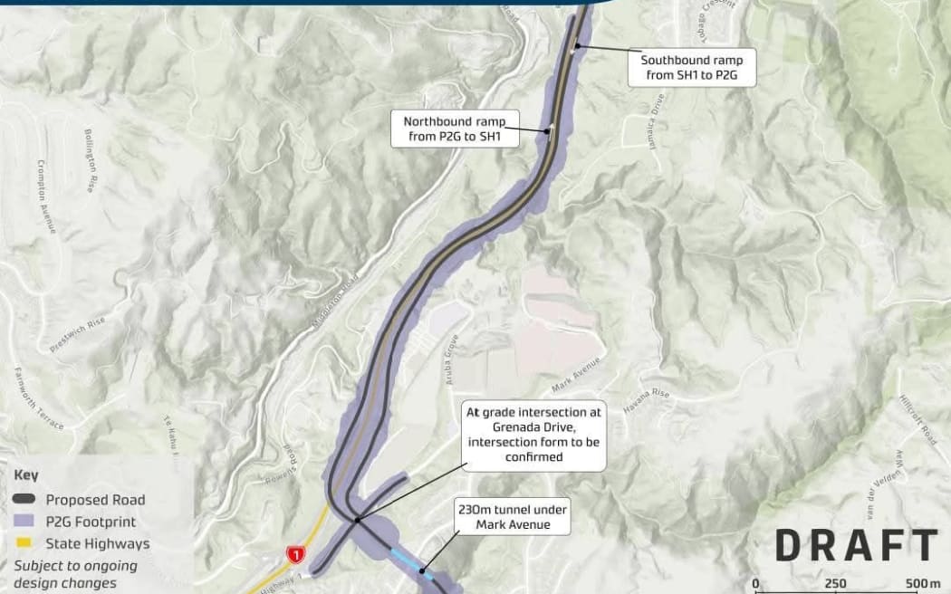
Photo: LDR / supplied / NZTA
But it had the “greatest ecological impacts on indigenous vegetation” and “moderate direct impact” on the Belmont Stream, a tributary that flows into the Porirua Stream.
The road’s investment case estimated the proposed route would affect about 85 houses, of which about 40 were located above the two tunnels. That was fewer than the 450 affected properties in a 2015 design but more than the 35 properties in the two alternatives that span Lincolnshire Farms.
Local Democracy Reporting (LDR) is local body journalism co-funded by RNZ and NZ On Air