
There’s a new way rangers are tracking what moves in the dark, and it’s quietly transforming how Australia tackles one of its most destructive environmental threats.
Long after sunset, teams working in remote reserves are scanning the landscape with thermal technology, picking up heat signatures that would otherwise go unnoticed.
The approach is giving land managers in Queensland a far clearer picture of just how many invasive animals, including feral pigs, cats, foxes and goats, are moving through fragile ecosystems.
And where they’re most concentrated.
In Culgoa Floodplain National Park, a key part of the Murray–Darling Basin close to the NSW border, the tech is already translating into results.
Speaking to Yahoo News Australia, a Queensland Department of the Environment, Tourism, Science and Innovation (DESTI) spokesperson said monitoring had recorded a 70 per cent reduction in feral pig numbers over the 2025–26 financial year, following a coordinated aerial and ground control program.
This marks a notable decline for a species known for its rapid breeding and ability to quickly rebound.
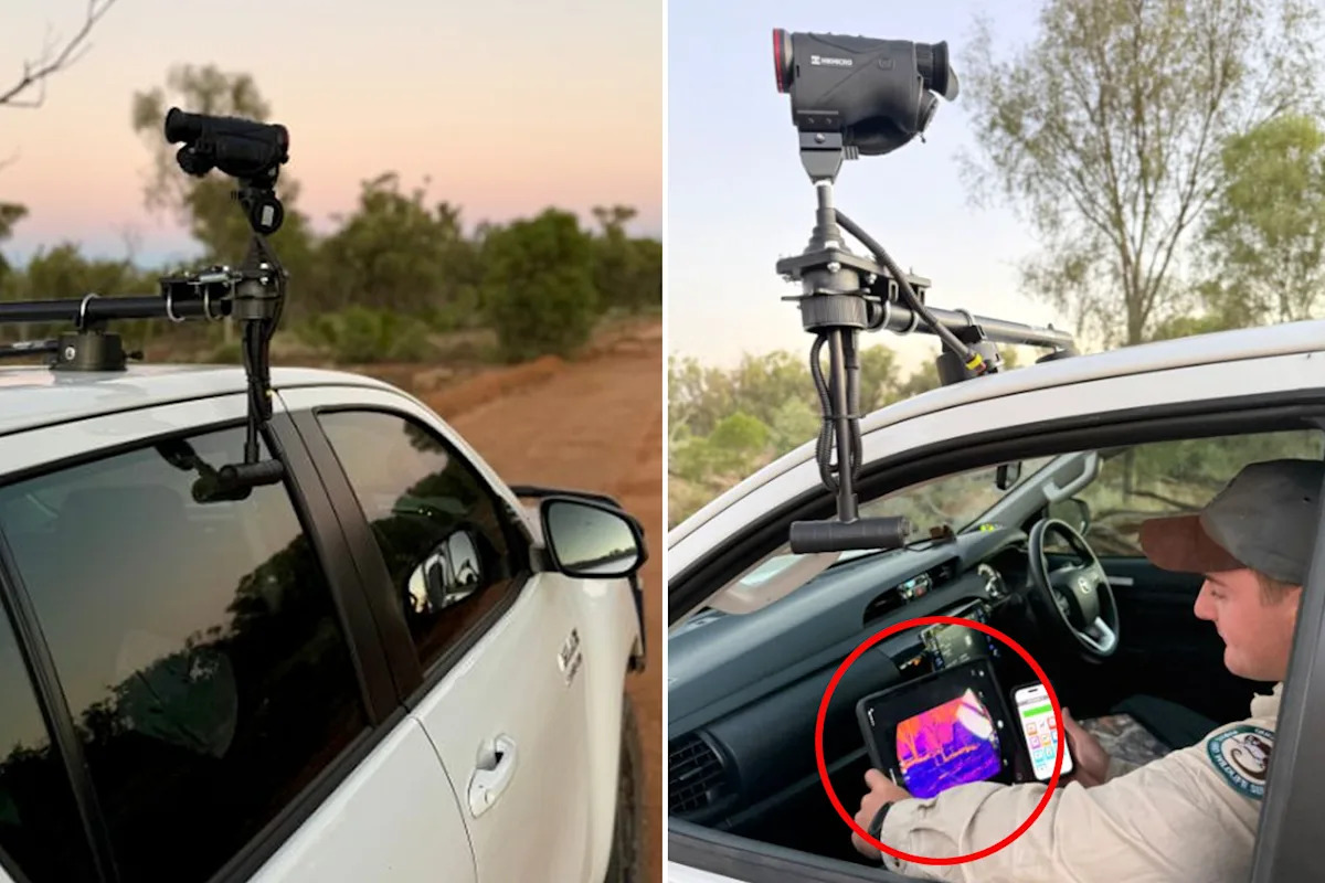
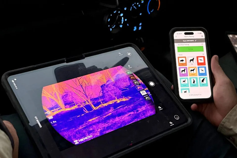
“Prior to the control program, we used remote cameras and equipment such as the thermal monocular to identify pest species, estimate their numbers, and guide our pest control methods,” they said.
“Collecting reliable data helps us improve our control methods based on the pest species and the landscape.”
Further pest control programs in Culgoa Floodplain National Park are planned for the future, the spokesperson added, and other protected areas in the region.
The approach is giving land managers in Queensland a far clearer picture of just how many invasive animals are moving through fragile ecosystems. Source: DESTI
How thermal technology is used to fight invasive species
By mounting thermal monoculars to vehicles and driving set transects, rangers can survey large areas quickly and consistently, detecting animals regardless of vegetation density or low light.
Unlike traditional methods such as spotlighting or camera trapping, which can be limited by visibility, terrain and even human fatigue, thermal surveys offer a more complete snapshot of what’s happening across the landscape.
That matters because pest management is only as effective as the data behind it.
Without accurate baseline numbers, it’s difficult to know whether control measures are working, or where to focus efforts next.
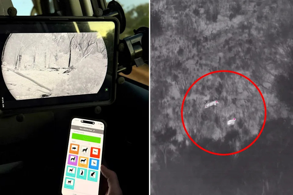
Monitoring had recorded a 70 per cent reduction in feral pig numbers over the 2025–26 financial year. Source: DETSI/PIRSA
Feral pigs, in particular, pose a major threat.
They tear up soil, damage native vegetation, prey on small animals and degrade waterways, often leaving long-lasting impacts on already stressed ecosystems.
In places like Culgoa’s floodplains, where biodiversity is closely tied to delicate water cycles, that damage can quickly compound.
Armed with clearer data, rangers can better tailor their response — whether that’s baiting, trapping, ground shooting or aerial culling — and then return to the same areas to measure the outcome.
The process turns what was once a reactive effort into a more strategic, evidence-based system.
As trials expand across other protected areas, the combination of technology and targeted action is offering something that has often proved elusive in pest management: measurable, repeatable success.
In Australia, the war against invasive and introduced species is a relentless problem wreaking havoc right across the country’s fragile landscapes.
Foxes, pigs, cats and rabbits, and cane toads are just a few that have wreaked havoc since being introduced by Europeans.
Do you have a story tip? Email: newsroomau@yahoonews.com.
You can also follow us on Facebook, Instagram, TikTok, Twitter and YouTube.