
Powerco said around 680 of their customers remained without power at 7.30am today, mainly in western Bay of Plenty and Coromandel Peninsula.
The storm caused chaos across the Bay of Plenty yesterday forcing people to flee their homes.
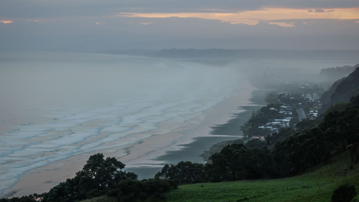
Ōhope and coastal Thornton residents were ordered to evacuate in Whakatāne.
Tauranga and Western Bay residents living in coastal and low-lying areas were told to seriously consider self-evacuating.
The evacuations came as conditions became life-threatening yesterday with destructive winds and large waves battering the coastline.
The cyclone downed trees, closed and flooded roads, forced major shopping centres to shut, and caused power cuts that affected thousands of people.
The cyclone shifted slightly east with its centre sitting just east of Tauranga at about 2pm as it headed down the North Island.
States of emergency were declared in Tauranga, Western Bay of Plenty, Whakatane and Waikato, including Coromandel with multiple warnings ahead of the cyclone.
Image 1 of 76: MOUNT MAUNGANUI, NEW ZEALAND – APRIL, 12: Crowds gather at Mount Maunganui’s main beach at high tide as Cyclone Vaianu passes through Mount Maunganui on April 12, 2026. Herald photograph by Alyse Wright
MetService had issued multiple red and orange weather warnings.
MetService meteorologist Devlin Lynden said late yesterday afternoon that the centre of Cyclone Vaianu was tracking south-southeast, sitting near Lake Waikaremoana.
He said the system was still generating significant rain and strong winds across much of the North Island, including the Bay of Plenty.
Rotorua Airport recorded 79.2mm of rain over the 24 hours to about 5pm, with higher inland totals reaching up to 120mm in exposed hill country.
Tauranga Airport recorded 31.1mm, while an inland station east of Whakatāne reached 40mm.
Ōpōtiki recorded 36mm.
Lynden said damaging wind gusts had been a major feature of the cyclone.
Whakatāne recorded a gust of 94km/h before its station stopped reporting at midday.
The cause was not yet confirmed but possibly linked to wind damage or a power outage.
Tauranga gusts peaked at 80km/h in the morning and were gusting around 60km/h late afternoon.
Rotorua reached 85km/h at midday, easing to 55km/h. Inland Mamaku recorded a peak gust of 125km/h earlier yesterday.
Air New Zealand cancelled flights to and from Tauranga and Rotorua yesterday.
Tauranga and Western Bay
Port of Tauranga recorded a maximum wave height of 11.4m in the afternoon.
People were out on Mount Maunganui’s Main Beach despite the wild weather and official advice to avoid coastal areas.
Tauranga City Council said it was concerned by reports of people breaching the Moturiki Island closure.
Emergency Operations Centre controller Gareth Wallis said this behaviour put lives at serious risk.
Police said officers spoke with four people on Marine Parade who were considering going surfing despite the severe weather.
Areas of flooding concern had included Fraser Cove, Burrows St, and 7th Avenue near Memorial Park.
Fraser Cove and Fraser St, between the traffic lights near Burger King and Lloyd St, were closed yesterday afternoon due to the risk of inundation.
Several marae were open, and an Emergency Assistance Centre was operating at Mercury Baypark.
Crowds gathered at Mount Maunganui’s main beach at high tide as Cyclone Vaianu passed through on Sunday. Photo / Alyse Wright
Tauranga City Council said at 4pm that around 80 people had sought shelter at marae across Tauranga, and five people self-evacuated to Mercury Baypark.
Western Bay District Council said 60 people sought shelter at marae in the district.
Police earlier door-knocked residents and businesses in high-risk, low-lying areas.
They were targeting Fraser Cove, Burrows St, 7th Ave alongside Memorial Park, and properties along the harbour edge between 1st and 5th Ave.
In Welcome Bay, a downed tree branch caused powerlines to come down on Waikete Rd. A photo sent to the Bay of Plenty Times showed flames as the branch was tangled up in the powerline.
A slip blocked Poripori Rd in Lower Kaimai.
Tauranga Crossing closed at midday yesterday and was to reopen at 9am today.
The main entrance to TECT Park was closed after trees came down across Weld Rd.
Meanwhile, some locals took the chance to get out and about yesterday afternoon.
Dylan Chivell and Adam Gilliland were at Mount Maunganui main beach about 3.30pm.
Gilliland said cabin fever had set in, so he decided to “get out and get amongst it”.
He said the weather was bad in the morning, but he thought it would have been worse.
He had grab bags packed for his family as a precaution.
The rest of his Sunday involved movies on the couch.
Felicity Hatcher and Carrick Corson were on their way to the gym and stopped at the beach to see the waves.
Hatcher said the weather had been what she expected due to weather warnings.
“We had Sunday admin planned, so the weather didn’t really disrupt that.
“We can always postpone that for tomorrow. It’s better to be safe than sorry.”
A yacht grounded at Pilot Bay in Cyclone Vaianu. Photo / Rosalie Liddle Crawford
Corson said they didn’t have any grab bags packed but were ready to get up and go if they needed to evacuate.
The Wave Cafe owner Guido Bachmann opened his beachfront, mobile cafe despite Cyclone Vaianu.
“I got overrun by demand for ice cream.
“I didn’t realise that Kiwis need ice cream to watch hurricanes.”
He said most of his customers thanked him for being open and told him it was a good idea.
“Nobody seemed too worried about the alert and the waves.”
Bachmann said he was slightly worried about his site being damaged.
But if the weather worsened, he would consider closing the cafe for the day.
Whakatāne District
Conditions in Whakatāne had been expected to become life-threatening as Cyclone Vaianu intensified.
The forecast had warned of destructive winds gusting up to 150km/h, combined with waves of about 12m.
High tide at 2.20pm had posed the greatest risk, when coastal flooding could peak and flood vulnerable areas.
Clean-up work begins in Ohope after debris was blown around and washed up on the foreshore. Photo / Mike Scott
Ōhope and Coastal Thornton communities faced a dangerous combination of storm surge, large swells and strong onshore winds.
New Zealand Herald multimedia journalist Mike Scott was in Ōhope yesterday and described it as being “like a ghost town”.
A large tree fell across the road near the intersection of Hillcrest Rd and Gorge Rd, the routes between Ōhope and Whakatāne.
Whakatāne acting mayor Julie Jukes said yesterday the situation had escalated significantly overnight Saturday as Cyclone Vaianu tracked closer to the coast.
“This is not the storm we were preparing for yesterday – it is worse. The track has shifted and we are now directly in the firing line.”
Emergency officials said the overlap of these factors had significantly increased the risk to life, particularly for those near the coast or in low-lying areas.
The main street of Whakatāne as Cyclone Vaianu hits. Photo / Mike Scott
The Whakatāne War Memorial Hall was opened as a welfare centre.
The New Zealand Defence Force was deployed to the area, Whakatāne District Council said.
The team included HS60 vehicles, Swift Water Rescue Team, and Surf Lifesaving New Zealand team with IRBs (inflatable rescue boats).
Rotorua
Two key routes into Rotorua were closed yesterday afternoon.
Flooding closed SH30 in both directions from the intersection of SH33 and SH30 to the intersection of SH30 and SH34.
SH33 was also closed due to fallen trees at Paengaroa.
A family told of seeing a “massive” tree coming down in front of them on SH33 between Te Puke and Rotorua about 11am.
Cameron Pardoe was in a car with his mum, Paula, and sister, Chloe.
He described the situation as “crazy”.
“It was massive.”
A large truck became stuck on the other side of the blocked road, he said.
NZTA said yesterday afternoon many trees were down and blocking both SH33 and SH30.
The wind was making it too dangerous for crews to clear.
“At first light, crews will assess the road and advise when it’s safe to reopen.”
Residents near the Ngongotahā Stream were advised to stay on high alert as water levels rose on Sunday. Photo / Annabel Reid
Residents near the Ngongotahā Stream were on high alert as water levels rose yesterday.
Resident Jacky James said the stream had risen to about 3m, with the capacity to reach around 5m.
The council later said the rate of flows into the stream was beginning to slow, according to data from Bay of Plenty Regional Council and intel from locals on the ground.
The council’s Emergency Operations staff continued to monitor the situation and liaise with Bay of Plenty Regional Council overnight.
“While we are feeling more sure that the risk has reduced, we encourage Ngongotahā residents to remain alert and keep watch on council’s Facebook page and website in case of any changes.”
Coromandel
Severe flooding completely covered Rhodes Park Reserve, Thames.
The Coromandel Peninsula had expected gusts of up to 130km/h in exposed areas, RNZ reported.
Wade Rd heading south to Tairua showed signs of flooding and Prescotts Hikuwa, the turn-off on State Highway 25a to Pāuanui, also flooded.
NZTA said SH25 in Thames reopened.
Contractors were leading vehicles through the centre of the road as light flooding remains.
Thames Rugby and Sports Club became inundated by floodwaters.
NZ got ‘lucky’ cyclone moved out to the east – Mark Mitchell
Emergency Management Minister Mark Mitchell says New Zealand was “lucky” that Cyclone Vaianu moved out to the east, which meant the weather wasn’t as “intense as what we were anticipating”.
“That is a really good thing. The fact of the matter is it was still a major event for us,” he told Ryan Bridge TODAY.
He said work around recovery starts now after 10 areas went into local states of emergency, including those in the Bay of Plenty, 14,000 people were without power and 3000 people were moved to safe areas.
“We have had surface flooding, inundation and damage. We’ll start to work on that now and identify what we need to do in terms of recovery, bearing in mind that this is the third major weather event that we’ve had in a matter of months and a lot of these areas are still in recovery, so there’s still quite a bit of work to be done.
Asked whether any of the 800 or so homes that were evacuated were flooded, Mitchell said he will be announcing those numbers through today.
“I don’t have the exact number in terms of inundation and flooding. I know that we’re heading over to Ōhope, there has been – without a doubt – damage over there. Whakatāne as well and Ōpōtiki.
“But I will have a much clearer [idea] on actual numbers around flooding categorisations, those sort of things, in the daylight hours as we start to get those reports coming in from the local mayors and CDEM [Civil Defence Emergency Management] teams.”