
Reading Time: 3 minutes
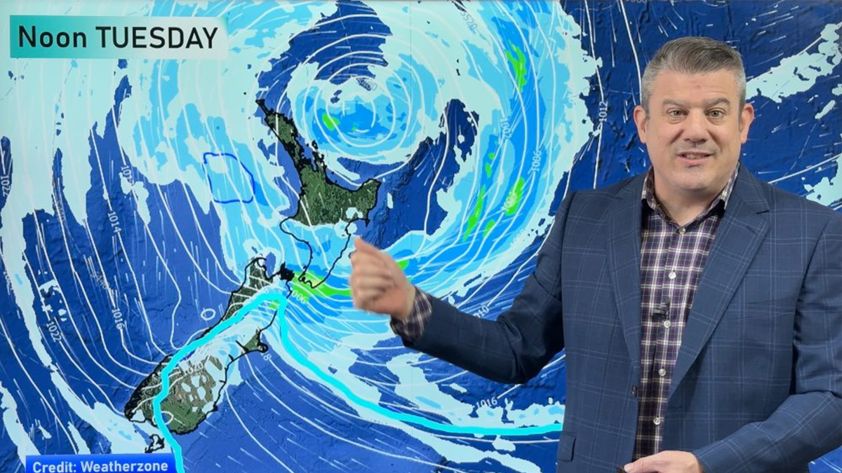
Forget El Niño (for now) – SAM is writing our weather forecasts at the moment.
What is SAM? It’s the Southern Annular Mode. It serves a role influencing New Zealand’s weather and right now it’s doing something that Australian weather forecaster Weatherzone describes as a “rare atmospheric event”.
You know all about El Niño and La Niña – well, that is just one of a handful of climate drivers that can influence NZ’s weather.
The acronym for both El Niño & La Niña is ENSO (El Niño-Southern Oscillation) . ENSO is measured at the equator in the Pacific. Over in the Indian Ocean there is the Indian Ocean Dipole (IOD) and that is like a smaller version of ENSO. It effects Australia’s weather more than ours, but it can occasionally throw us some weather.
But the main climate driver that has a bigger influence on our weather all year round is SAM. Right now SAM is taking the driver’s seat and controlling our weather the most.
Unlike ENSO and the IOD (which can reverse or weaken the trade winds at the equator), SAM is all about the position and strength of the windy westerlies that circle Antarctica all year round.
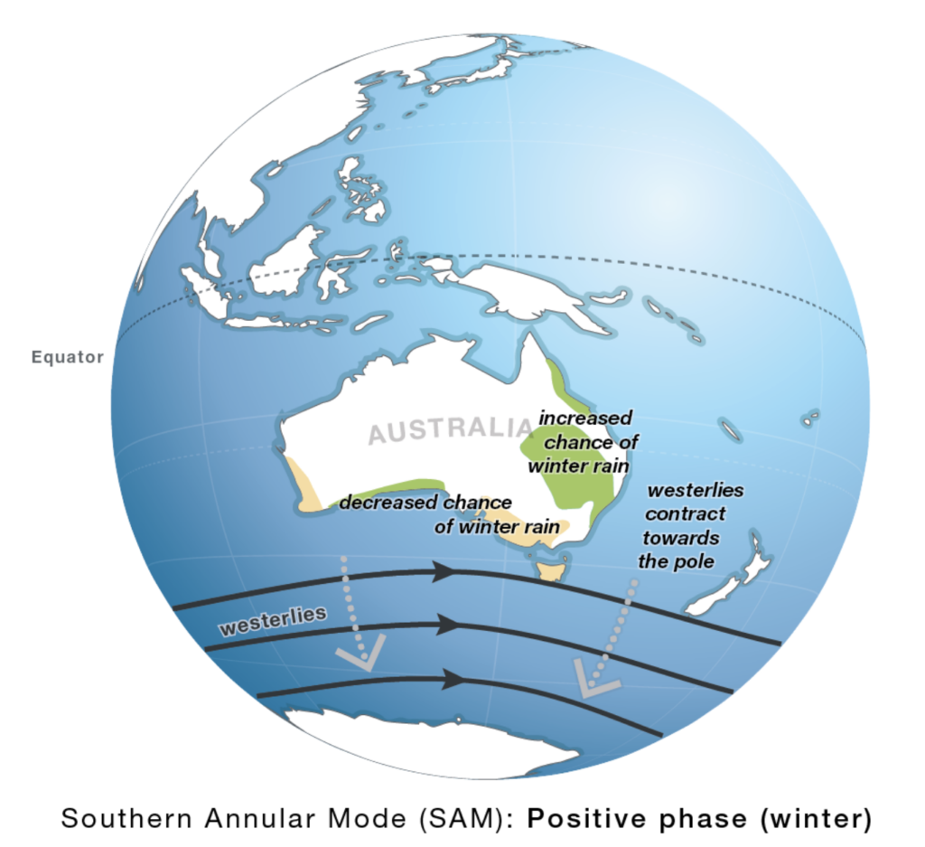 A positive SAM means the Roaring Forties don’t roar so much over NZ. Graphic by Australia’s Bureau of Meteorology.
When it’s positive, that means the westerly belt is close to Antarctica and farther from NZ and Australia. When it’s negative, it’s usually bringing us damaging winds and can pull up bitterly cold southerlies from Antarctica itself and more low pressure to our south.
Right now SAM is in a positive phase and on the index used to measure it, it’s +5. This hasn’t happened in three years, according to Weatherzone.
As a result of this “exceptionally strong positive phase”, we’re seeing the high-pressure zones head much further southwards than usual for this time of year around the southern hemisphere – and this is doing a few things to New Zealand’s weather.
The main feature is that these high-pressure zones mean we’re having a number of calm days as they cross us to the south – but this southern placement also dredges up east to southeast winds, which explains why eastern parts of both NZ and Australia have had more cloud and more rain recently.
Not for everyone (Canterbury and Otago, for example, could do with more rain – and may well get it this week due to another easterly set-up) but certainly the eastern side of the North Island has had plenty of wet easterly flows of late. And yes, this is the opposite of what El Niño does; it usually encourages more westerlies.
This is a prime example of how NZ’s weather is influenced by more than just El Niño, which is measured a long way from NZ, north of Tahiti.
The positive SAM is also limiting snow on NZ and Australian skifields – although again, this week snow looks more likely in NZ with polar air and moisture meeting over us due to low pressure.
According to Weatherzone, “sustained SAM index values above +1 represent a positive SAM event, while sustained values below -1 reflect a negative SAM”. So the +5.06 index reached on Friday June 26 was “exceptionally strong” and “one of the highest SAM values in modern records”.
As I’ve been saying for months, El Niño is only one climate driver that influences our weather – so the interaction between El Niño and SAM will likely be what shapes our weather going into spring.
El Niño is often less noticeable to us in the depths of winter, but may play more of a role once we get into spring and summer.