
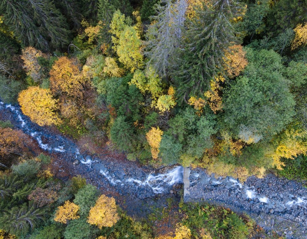
There’s something almost magical about watching a forest from orbit. Satellites hundreds of miles above Earth can now track its canopy, estimate its biomass, and even reveal how it breathes and recovers after a storm.
Scientists are getting remarkably good at this. But a major new review makes clear there’s a catch: for all that satellites can now see, they’re still mostly blind to some of the most fundamental questions about what actually lives down there.
The review was led by Jesús Aguirre-Gutiérrez, an associate professor at the University of Oxford. Co-authors span the UK, Mexico, the USA, South Africa, and Japan.
Countries have a data problem
Underneath the science is a fairly practical headache.
Countries that signed onto the Kunming–Montreal Global Biodiversity Framework, the agreement behind the well-known goal of protecting 30 percent of land and sea by 2030, need some consistent way to track whether biodiversity is actually improving.
That’s hard enough in your own backyard. It’s a nightmare across landscapes that are remote, enormous, or nearly impossible to walk through on foot.
Satellites, LiDAR, radar, and airborne sensors are stepping into that gap.
The review pulls together what’s currently known about how these tools are being used to track ecosystem change at scale, offering something field surveys simply can’t match: consistent, near-continuous eyes on huge swaths of the planet at once.
Why rainforests get the spotlight
Tropical forests anchor the review as its central example, and it’s easy to see why. They hold something like half the world’s terrestrial biodiversity while covering only a sliver of Earth’s land surface.
At the same time, these forests are absorbing mounting pressure from climate change, land clearing, and general disturbance.
What satellites are getting genuinely good at is tracking forest structure, biomass, canopy traits, and how these ecosystems actually function.
That data lets researchers answer a question that’s otherwise very hard to measure: how well a forest bounces back after damage, resists further disturbance, and adapts as conditions shift around it.
That’s essentially what ecologists mean by resilience, and space is turning out to be a surprisingly good vantage point for watching it happen.
Reading between the pixels
Satellites can also work as a kind of stand-in for biodiversity itself, offering indirect clues about functional and taxonomic diversity.
To a smaller extent, satellite data hints at genetic and evolutionary diversity too.
These proxy signals are becoming genuinely useful for frameworks like Essential Biodiversity Variables, an effort to standardize how biodiversity gets measured no matter what tools or data sources are being used.
But a proxy is still just a proxy. The review is upfront that remote sensing, however good it’s getting, doesn’t add up to a full picture of biodiversity on its own.
What satellites still can’t see
Some of the most fundamental questions about biodiversity remain essentially invisible from orbit.
Species turnover, evolutionary history, or genetic diversity don’t show up clearly in satellite data with current technology. They still require boots on the ground, researchers physically counting, sampling, and observing.
Thus, satellite data and field ecology aren’t competing methods, they’re complementary ones. Leave either out, and biodiversity assessments start to fall apart.
“Remote sensing is transforming how we can observe biodiversity and ecosystem change at large scales,” Aguirre-Gutiérrez said.
“Satellites now provide unprecedented information on forest structure and function, helping us understand how ecosystems respond to disturbance.”
“However, this is not a complete solution. Many dimensions of biodiversity are still difficult to observe directly from space, which is why combining satellite data with field observations remains essential.”
“Future satellite missions will continue to expand what we can measure, but biodiversity monitoring will always depend on integrating multiple sources of evidence.”
The next generation of satellites
The review points to a new wave of satellite missions and sharper sensor technology on the way, better hyperspectral imaging, more advanced LiDAR, and improved radar systems.
These upgrades should meaningfully expand what’s measurable from orbit in the coming years, chipping away at some current blind spots in structural and functional monitoring.
The deepest genetic and evolutionary questions, though, will likely stay out of satellite reach for a while yet.
Why a study like this matters
Forests cover roughly 31 percent of the planet’s land and play a massive role in regulating climate, which makes their health central to whether the world hits its conservation targets at all.
Yet right now, global biodiversity monitoring remains patchy and incomplete, especially in tropical regions, exactly the places where satellite data could theoretically help the most.
The authors don’t pretend satellites are a silver bullet, no matter how fast the technology improves.
Making the Global Biodiversity Framework actually work will mean weaving together remote sensing, field ecology, and newer frameworks like Essential Biodiversity Variables, rather than betting everything on any single approach.
As Aguirre-Gutiérrez concluded, biodiversity monitoring will always come down to combining multiple sources of evidence, no matter how sharp the view from space eventually gets.
The study is published in the journal Nature Reviews Biodiversity.
—-
Like what you read? Subscribe to our newsletter for engaging articles, exclusive content, and the latest updates.
Check us out on EarthSnap, a free app brought to you by Eric Ralls and Earth.com.
——