

Heavy rain warnings have extended up the West Coast as a “significant winter storm” grinds to a halt over the South Island today, bringing prolonged downpours and heavy snow to inland areas.
A complex low-pressure and frontal system is expected to remain slow-moving over the South Island, producing persistent rain and snow through Wednesday and into Thursday.
Roads in the Canterbury high country and Otago could be treacherous with road snowfall warnings. (Source: 1News)
MetService has upgraded a heavy rain watch to an orange-level warning for the Grey District and Buller south of Westport, with up to 90mm of rain expected in 12 hours.
It joins a warning issued for Westland yesterday, with up to 450mm of rain forecast for the ranges and up to 200mm closer to the coast.
Heavy rain watches are also in place for parts of Canterbury and Otago, while heavy snow is expected to fall above 800m, with lesser amounts as low as 400m. That’s prompted a heavy snow watch for the Canterbury high country south of the Rangitata River and parts of Otago.
Milford Sound road shut, flooding on SH1 and SH6
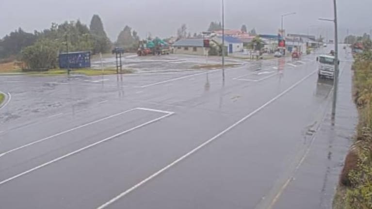
NZTA has an area warning in place for State Highway 6 between Makarora and Fox Glacier due to surface flooding, with flooding also affecting State Highway 1 in south Dunedin.
State Highway 94 between Te Anau and Milford Sound is closed from the Lower Hollyford Rd intersection to the Donne River due to avalanche risk, with an escorted convoy out of Milford Sound planned for 3pm. The road is expected to stay closed through Thursday, with a possible reopening Friday.
Heavy snow is forecast from tonight across the Canterbury high country south of the Rangitata River and Otago north of Arrowtown to Ranfurly, with up to 20cm expected on State Highway 73 and 15cm over the Lindis Pass summit on State Highway 8. State Highways 8 and 80 through the Mackenzie Basin could be hit hardest overnight.
An NZTA spokesperson said road users needed to think carefully before heading out.
“We urge road users to consider the risks of travelling, especially inland and via alpine passes, while the storm is in progress and state highways are affected,” the spokesperson said.
“Sections of highway may be closed or restrictions imposed where necessary to keep people safe and avoid vehicles and their occupants becoming trapped.”
Do you have photos or videos of the weather? Email us at news@tvnz.co.nz
Full list of weather warnings and watches
Heavy Rain Warning – Orange
Grey and Buller south of Westport – 12 hours from 6pm Wednesday to 6am Thursday
Westland – 54 hours from 9am Wednesday to 3pm Friday
Heavy Rain Watch
Headwaters of the Canterbury lakes and rivers about and south of Arthur’s Pass – 10 hours from 9am to 7pm Wednesday
Otago Headwaters – 9 hours from 9am to 6pm Wednesday
Heavy Snow Watch
Canterbury High Country south of the Rangitata River and Otago north of Arrowtown to Ranfurly – 18 hours from 12am Wednesday to 6pm Thursday
Road Snowfall Warning
Lewis Pass (SH7) – 9 hours from 3am to 12pm Thursday
Arthur’s Pass (SH73) – 11 hours from 1am to 12pm Thursday
Porters Pass (SH73) – 14 hours from 10pm Wednesday to 12pm Thursday
Lindis Pass (SH8) – 13 hours from 2am to 3pm Thursday
Crown Range Rd – 28 hours from 11am Wednesday to 3pm Thursday