

El Niño is forecast to be the strongest since comparable records began four decades ago, the United Nations’ climate agency warned, with the UN chief saying the world was in the “danger zone of extreme weather”.
Explainer: What is El Niño and how it might impact New Zealand’s weather
The weather phenomenon is set to become “very strong” in the months ahead and is near certain to persist through to February, the World Meteorological Organisation said on Thursday (all times local).
“If this trajectory continues, it may be stronger than anything since our monitoring began,” WMO chief Celeste Saulo told reporters in Geneva.
El Niño will peak towards the end of this year though its knock-on impacts for the climate will continue well into 2027, said the WMO.
El Niño warms surface temperatures in the central and eastern equatorial Pacific Ocean, bringing worldwide changes in winds, pressure and rainfall.
Heat in the oceans releases more slowly into the atmosphere, pushing up global temperatures the year after it develops.
The powerful 2023-24 El Niño contributed to 2024 being the warmest year on record, and “we should not be surprised if this record is broken”, Saulo added.
“El Niño is firmly established and will intensify into a very strong event in the coming months, with big impacts on rainfall and temperature patterns and associated risks of floods, drought and extreme heat,” the WMO said.
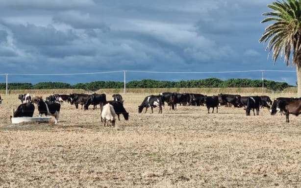
Drought on a farm in South Taranaki, in March 2025.
RNZ / Robin Martin
Highway to the danger zone
El Niño is a naturally occurring phenomenon and is not caused by climate change.
But scientists expect it will exacerbate the heat of a planet already warming from burning fossil fuels, while amping up weather extremes.
“El Niño is being supersized before our eyes,” said UN chief Antonio Guterres.
“The science leaves no room for doubt: the planet is in uncharted waters, and those waters are heating up. Sea surface temperatures are rising, temperatures keep climbing, and the world is in the danger zone of extreme weather.”
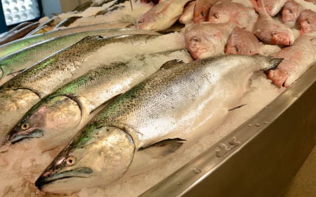
The fishing industry is among those that could be affected, the UN warns.
123RF
WMO chief Saulo urged disaster management authorities and climate-sensitive sectors like agriculture, fisheries health, energy and water to prepare themselves.
“This exceptional El Niño… has the potential to deliver a massive blow to communities and economies across the world”, she said.
“We are already seeing disruption and devastation from droughts and floods, and we expect these impacts to increase as El Niño intensifies.”
El Niño typically takes place every two to seven years and lasts around nine to 12 months.
Conditions oscillate between El Niño and its opposite La Niña, with neutral conditions in between.
El Niño can reshape weather and climate patterns thousands of kilometres away from the tropical Pacific.
El Niño can affect weather and climate patterns far away from the tropical Pacific.
123rf.com
Pacific Ocean heating up
Wilfran Moufouma-Okia, the WMO’s climate prediction chief, said some places would be affected before, some during and some after the peak later this year – though the strength of the peak is not an indicator of the severity of the impact.
For September-November, WMO forecasts indicate an increased likelihood of above-normal temperatures “across almost all land areas”.
The index which measures sea surface temperature anomalies in the central eastern equatorial Pacific has strengthened from an average 1.5degC above normal between May and July.
Weekly values between late July and mid-August ranged from around 2.2C to 2.6C above average, indicating continued El Niño intensification.
The UN agency classifies El Niño events as weak, moderate, strong or very strong – meaning this one is set to reach the highest level out of four.
Moufouma-Okia said the classification meant a sea surface temperature anomaly of more than plus 2C.
“That category is open: we know where it starts; we don’t know where it ends,” he told AFP.
The average forecast is pointing towards an anomaly peaking at plus 3.6C – way higher than the last two very strong El Ninos in 1997-98 and 2015-16.
In some areas, sub-surface ocean temperatures were more than 8C above average during July and early August.
Saulo called this a huge reservoir of “very warm ocean waters that will fuel the intensity of El Niño”.
The UN’s International Organisation for Migration agency appealed on Thursday for US$110 million (NZ$186m) to protect 4.9 million people from the potentially severe impacts of the phenomenon.