HHeadlines Read More SARP East 2025 Ecohydrology GroupNovember 19, 2025 Faculty Advisor: Dom Ciruzzi, William & Mary Graduate Mentor: Sarah Payne, University of California, Santa Barbara Ethan Bledsoe,…
HHeadlines Read More SARP West 2025 Aerosols GroupNovember 19, 2025 Faculty Advisors: Andreas Beyersdorf, California State University, San Bernardino Graduate Mentor: Bradley Ries, University of California, Riverside Martha…
HHeadlines Read More SARP East 2025 Oceans GroupNovember 19, 2025 Faculty Advisors: Tom Bell, Woods Hole Oceanographic Institute Graduate Mentor: Sarah Lang, University of Rhode Island Isabella Showman,…
HHeadlines Read More SARP West 2025 Whole Air Sampling GroupNovember 19, 2025 Faculty Advisor: Donald Blake, University of California, Irvine Graduate Mentor: Oluwaseun Moses Akinola, University of Connecticut Sarah Kinlaw,…
HHeadlines Read More SARP West 2025 Oceans GroupNovember 19, 2025 Faculty Advisor: Henry Houskeper, Woods Hole Oceanographic Institute Graduate Mentor: Camille Pawlak, University of California, Los Angeles Maria…
HHeadlines Read More SARP East 2025 Atmospheric Chemistry GroupNovember 19, 2025 Faculty Advisor: Stacey Hughes, University of New Hampshire Graduate Mentor: Katherine Paredero, Georgia Institute of Technology Kaylena Pham,…
HHeadlines Read More NASA, SpaceX Launch US-European Satellite to Monitor Earth’s OceansNovember 17, 2025 About the size of a full-size pickup truck, a newly launched satellite by NASA and its partners will…
HHeadlines Read More NASA, European Partners Set to Launch Sentinel-6B Earth SatelliteNovember 16, 2025 Set to track sea levels across more than 90% of Earth’s ocean, the mission must first get into…
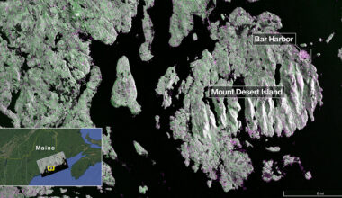
HHeadlines Read More NASA-ISRO Satellite Sends First Radar Images of Earth’s SurfaceSeptember 25, 2025 The NISAR (NASA-ISRO Synthetic Aperture Radar) Earth-observing radar satellite’s first images of our planet’s surface are in, and…
TTop stories Read More NASA-ISRO Satellite Lifts Off to Track Earth’s Changing SurfacesJuly 30, 2025 Carrying an advanced radar system that will produce a dynamic, three-dimensional view of Earth in unprecedented detail, the…
HHeadlines Read More NASA Tests Scalable Satellite Tech to Launch Sensors QuickerJuly 18, 2025 NASA’s Athena Economical Payload Integration Cost mission, or Athena EPIC, is a test launch for an innovative, scalable…