
Met Office forecasters predict the weather with take a turn this weekChiara Fiorillo and Ashlie Blakey Live and breaking news reporter
07:08, 20 Oct 2025Updated 07:08, 20 Oct 2025
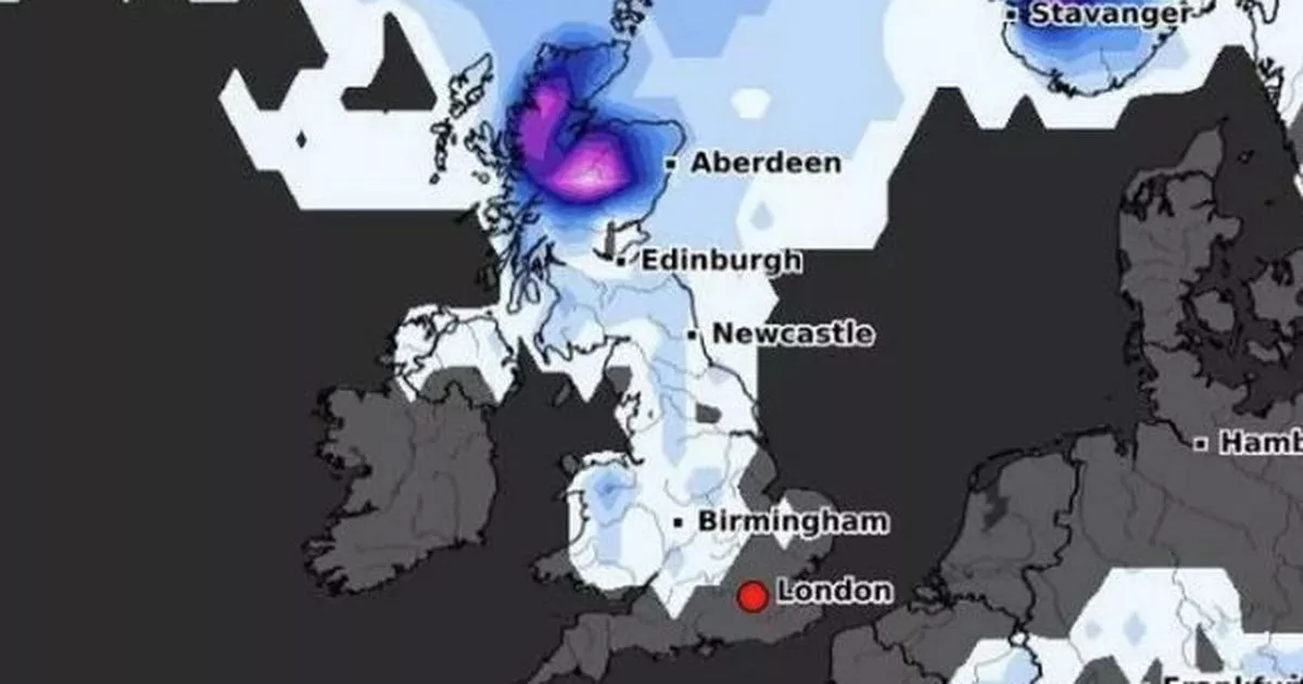
 Snow is set to fall over several parts of the country on October 26(Image: WXCharts)
Forecasters predict snow could fall in Greater Manchester as early as this week as temperatures plummet across the UK.
The first cold spell of the year is expected towards the end of the week, with freezing conditions predicted over the coming weekend.
Snowfall is most likely over our region on Sunday or Monday as temperatures look to drop to 0C. The latest weather maps from WXCharts, which uses Metdesk data, show snow over Greater Manchester at the end of the week into next week.
Join the Manchester Evening News WhatsApp group HERE
The maps show the snowfall is expected across other regions in the UK as early as Thursday, the Mirror reports. This includes parts of Wales, northern England and parts of Scotland.
Scotland is likely to be blanketed by snow flurries through Friday, with the chance of snowfall across the country then increasing through the weekend.
On Sunday, even more regions including Northern Ireland and the Midlands, could experience snowfall, according to the weather maps. The entirety of Wales, northern England, and Scotland are likely to experience snowfall starting from 6am on October 26, the weather maps show.
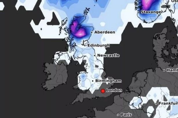
Further snowfall is also likely on Monday, October 27, with coastal areas in eastern and western England expected to be blanketed too. Next Monday, lows of -2C are expected in the North Pennines, according to the maps, with North Yorkshire, Durham and Northumberland set to also experience freezing temperatures.
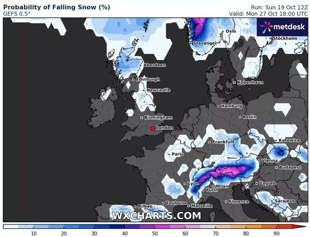 The snowfall map for Monday, October 27
The Met Office said this week’s unsettled conditions will continue until November. Temperatures are set to be ‘slightly below normal’ for the time of year.
The long-range forecast from Friday, October 24 to Sunday, November 2 says: “Remaining unsettled to start the period as an area of low pressure clears into the North Sea. Outbreaks of rain, heavy at times, and strong winds will likely ease through Friday as the low continues to move eastwards.
“This will leave a colder northerly flow for a time at the weekend which will be showery around the coasts but with sunny spells inland. Into the following week, conditions are expected to be changeable with showers or longer spells of rain across many parts of the UK.
“The cold northerly will likely give way to a more changeable westerly pattern and the wettest weather will probably be in parts of the north and west. Temperatures are expected to be close to or slightly below normal for the time of year.”