
The UK is set to be hit by a cold snap this weekend, with snow forecast in parts of the country and temperatures expected to plunge as low as -4C in some areas.Eliana Nunes News Reporter, Chris Riches and Emma O’Neill Assistant Live News Editor
10:34, 25 Oct 2025
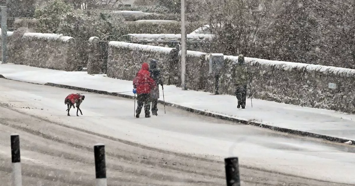
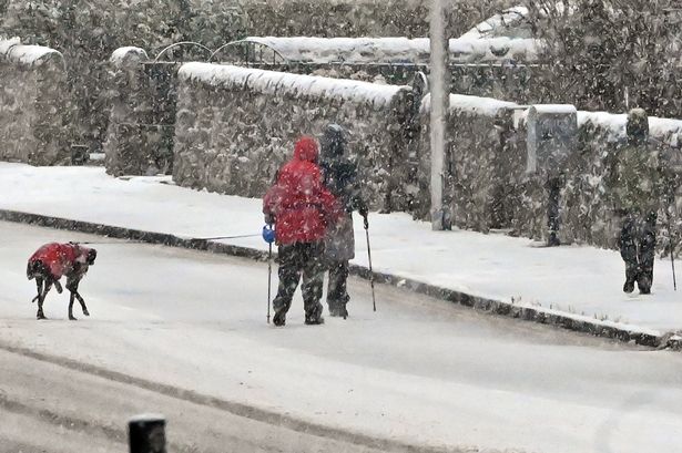 Some Scots are predicted to see snowfall this weekend(Image: Ken Jack/Getty Images)
Scotland could face a bitter blast over the coming days, with 3cm of snow predicted before temperatures tumble to as low as -4C in certain regions.
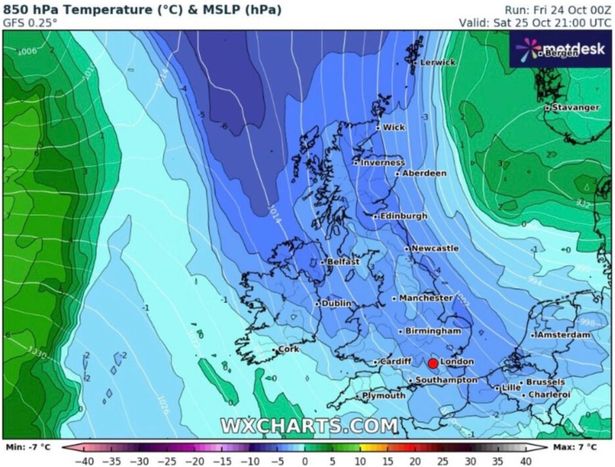
Sophisticated weather modelling charts from WXCharts reveal the mercury beginning to fall on Saturday evening with sections of the Scottish Highlands and Cumbria’s Lake District potentially reaching 0C. The freeze could expand, bringing snow flurries settling to 3cm across northern Scotland’s elevated terrain on Sunday.
The Met Office cautions of a “cold and rather changeable few days to come”, with Saturday anticipated to be a “cold feeling day” and Sunday predicted to begin cool but dry, with rainfall moving in from the northwest during the day.
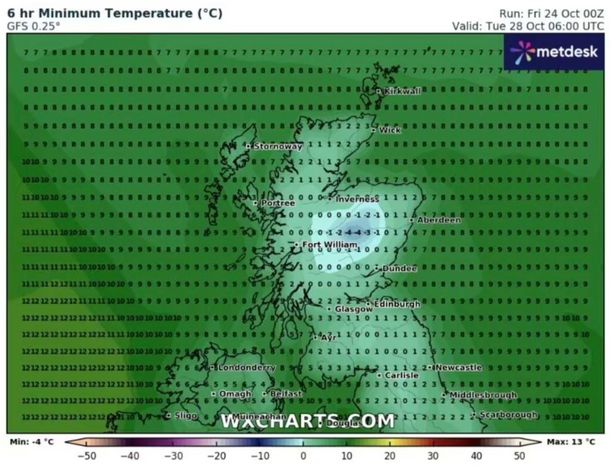
At the start of next week, conditions will stay “changeable”, especially in the northwest, the Met Office states. Tuesday’s projection from WXCharts suggests Scotland and northern England will experience the harshest temperatures, with numerous counties expected to witness sub-zero conditions, Express reports.
 (Image: WXCharts)
Areas of the Scottish Highlands, Aberdeenshire, Tyne and Wear and West Yorkshire, may drop beneath 0C, with the Highlands possibly diving to -4C, the charts indicate. Moving southward, temperatures will linger just above freezing, spanning from 2C and 4C until midday, before climbing to 7C to 10C by 6pm throughout most areas, reports the Mirror.
The Met Office’s long-range forecast for October 29 to November 7 predicts “below average” temperatures for this time of year. It reads: “A changeable start to the period with low pressure near to the UK bringing periods of rain and strong winds.
“The wettest and windiest conditions are likely to be across the northwest with perhaps some decent drier interludes across the south and east. Around the turn of the month or into early November, wetter and windier conditions across the north and west are likely to extend more widely across the country.
“The detail is somewhat uncertain but it is likely that low pressure becomes established to the west of the UK allowing bands of rain to spread across the country at times. Temperatures perhaps little below average at the start of the period, but likely trending upwards with potential for a mild spell around the turn of the month.”
 (Image: WXCharts)
Weather experts warn the bitter conditions will arrive following Storm Benjamin, dragging freezing Arctic air southwards and leaving much of Britain feeling bitter. Deputy Chief Meteorologist Chris Bulmer said on Friday: “As Storm Benjamin clears the UK and heads towards Denmark late tomorrow cold Arctic air will sweep across the country, bringing a noticeably chilly weekend as temperatures fall below average.
“Although many areas will see dry weather with sunny spells, it will feel cold in the brisk northerly winds. Showers are expected in the north and west, some of these falling as snow over Scottish mountains.”
Don’t miss the latest news from around Scotland and beyond – Sign up to our daily newsletter here.