The Arctic is fast becoming a potential battleground—and Russia has spent years preparing for it. From icebreakers to underwater sensors and satellites, Moscow is building a military and surveillance network across its 24,000 kilometers (15,000 miles) of northern coastline, determined to dominate the top of the world.
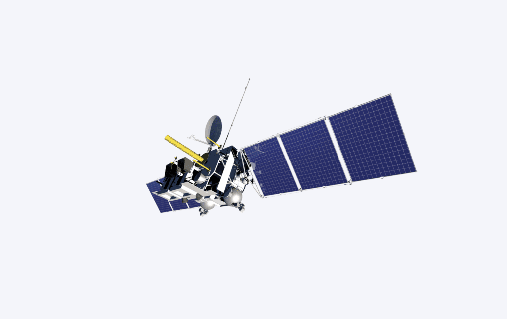
In February 2021, the Russian satellite named Arktika-M No. 1 was launched from the Baikonur Cosmodrome. Two years later, in December 2023, Arktika-M No. 2 was launched. Over the next five years, Russia plans to launch four more such satellites, expanding the constellation to six units.
The stated purpose of these satellites is observation of the Arctic, in particular, the study of regional weather conditions. Their task spectrum is broad:
weather analysis and forecasting;
monitoring and forecasting sea and ocean conditions;
aviation-grade atmospheric and flight-condition forecasting;
climate monitoring and study of global changes;
detection and monitoring of emergencies and natural hazards;
environmental control and related tasks.
The project contractor is an entity with an exceptionally long and complex name—difficult even for its own staff to pronounce—the Special Design Bureau for Space Instrument Engineering of the Federal State Budgetary Institution of Science, the Space Research Institute of the Russian Academy of Sciences (SKB KP IKI RAS). Russian Space Systems placed the order.
Related articles
Satellites that appear to be purely meteorological in nature, in fact, serve a dual purpose—their secondary function is military, according to sources within the Cyber Forces of the Ukrainian Armed Forces cited by UNITED24 Media,
Arktika-M equals Arctic monitoring
The Arktika-M No. 1 and Arktika-M No. 2 satellites operate in a highly elliptical “Molniya”-type orbit. This orbit allows continuous coverage of Russia’s northern territories and the Arctic—something geostationary satellites cannot provide.
The satellites are equipped with MSU-GS hydro-meteorological cameras capable of imaging Earth in 10 spectral bands (visible + infrared) with spatial resolutions of 1–4 km.
At present, the satellites alternate coverage, collecting meteorological data every 30 minutes. Expanding the constellation to six satellites will reduce the observation interval for polar regions by a factor of 2–6, and will also enable:
more detailed very-short-term weather forecasts,
imaging from different angles,
improved detection of hazardous natural phenomena and emergencies,
increased accuracy in identifying clouds over snow and ice cover in the Arctic and adjacent territories.
A project of this kind is logical, but it raises many additional questions. For example, the Arctic shipping route is not particularly active today because of its complexity. Dozens of icebreakers have operated in the region for many decades, and they are unlikely to require such highly detailed, near-minute weather analysis. Even the most pessimistic scientific forecasts indicate that the ice cover will persist in the region for another 20+ years, meaning a normal commercial shipping route is unlikely to appear before then—while Russia’s project is slated for full deployment by 2031. So what is the idea?
Preparing for war
While Russian leader Vladimir Putin conducts pseudo-negotiations about the possibility of a ceasefire in Ukraine, he is simultaneously testing Europe: airspace incursions, cyberattacks, hybrid warfare in the Baltic Sea, jamming, sabotage, and the construction of additional military bases near European borders. In the same vein are tests of the intercontinental Oreshnik missile and the Burevestnik missile.
Another region Russia is watching closely is the Arctic. There have been reports on how Russia’s defense complex adapts weapons to operate in exceptionally harsh weather conditions and is creating a range of dual-use systems for the region. One recent investigation revealed that Moscow has also deployed a system called “Garmoniya” in the area. This is a secret underwater surveillance system consisting of a network of hydrophones and sonar devices, along with other technologies that enable tracking movements of NATO submarines.
Related articles
Although the Arktika-M satellite constellation is officially presented as a hydrometeorological system for Roshydromet, its technical capabilities make it useful for military tasks as well. The order to launch these satellites is military in nature, according to documents examined by Ukrainian intelligence.
Key aspects of potential military use include:
meteorological support for combat operations—providing precise weather forecasts for aviation, naval forces, missile launches, and unmanned aerial systems;
monitoring of water areas and ice conditions—planning routes for warships and submarines, controlling the Northern Sea Route;
helio-geophysical information for equipment protection—forecasting disruptions in navigation, communications, and radar systems caused by space weather;
communications and signal relay—transmitting military data from remote Arctic regions inaccessible to geostationary orbits;
search-and-rescue operations in combat conditions—using COSPAS-SARSAT for evacuation and rescue of personnel;
dual-use infrastructure—integrating ground stations and data-processing centers into military surveillance and command systems.
Thus, Russia aims to monitor everything happening beneath the water and above the surface across the Arctic region. The new system will enable near-real-time tracking of enemy transport, civilian, and military vessels/submarines, the creation of operational maps, and the planning of military operations.
Read more
All of this should be considered against the backdrop that Russia already possesses the world’s largest fleet of icebreakers by a large margin. At the same time, its Pacific Fleet is substantial and is being replenished with new submarines year after year; over the next few years, it is expected to nearly double. There is also a desire to expand its maritime zone of influence and talk of a possible seizure of Svalbard.
The Arctic is rich in resources and is one of the future trade routes. Instead of building port infrastructure, harbors, and logistics for that trade, Russia is constructing observation systems and developing war technologies, militarizing an entire region.
-eb7edb96910950cec5bac8be9d6cbf71.jpg)
Support our frontline reporters
We report from the front lines to show the reality of war. Your support helps us stay there and tell the stories that matter.


