
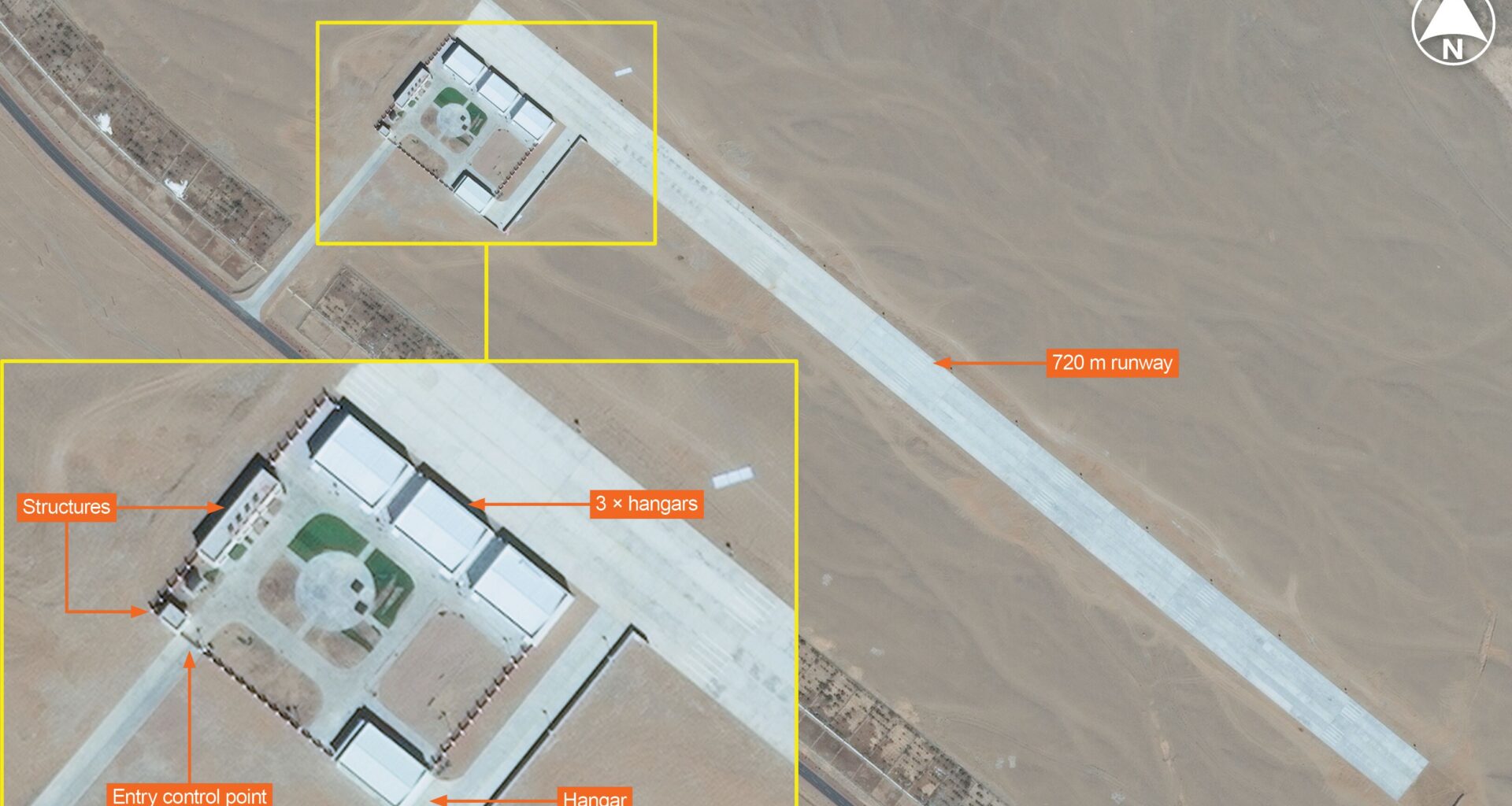

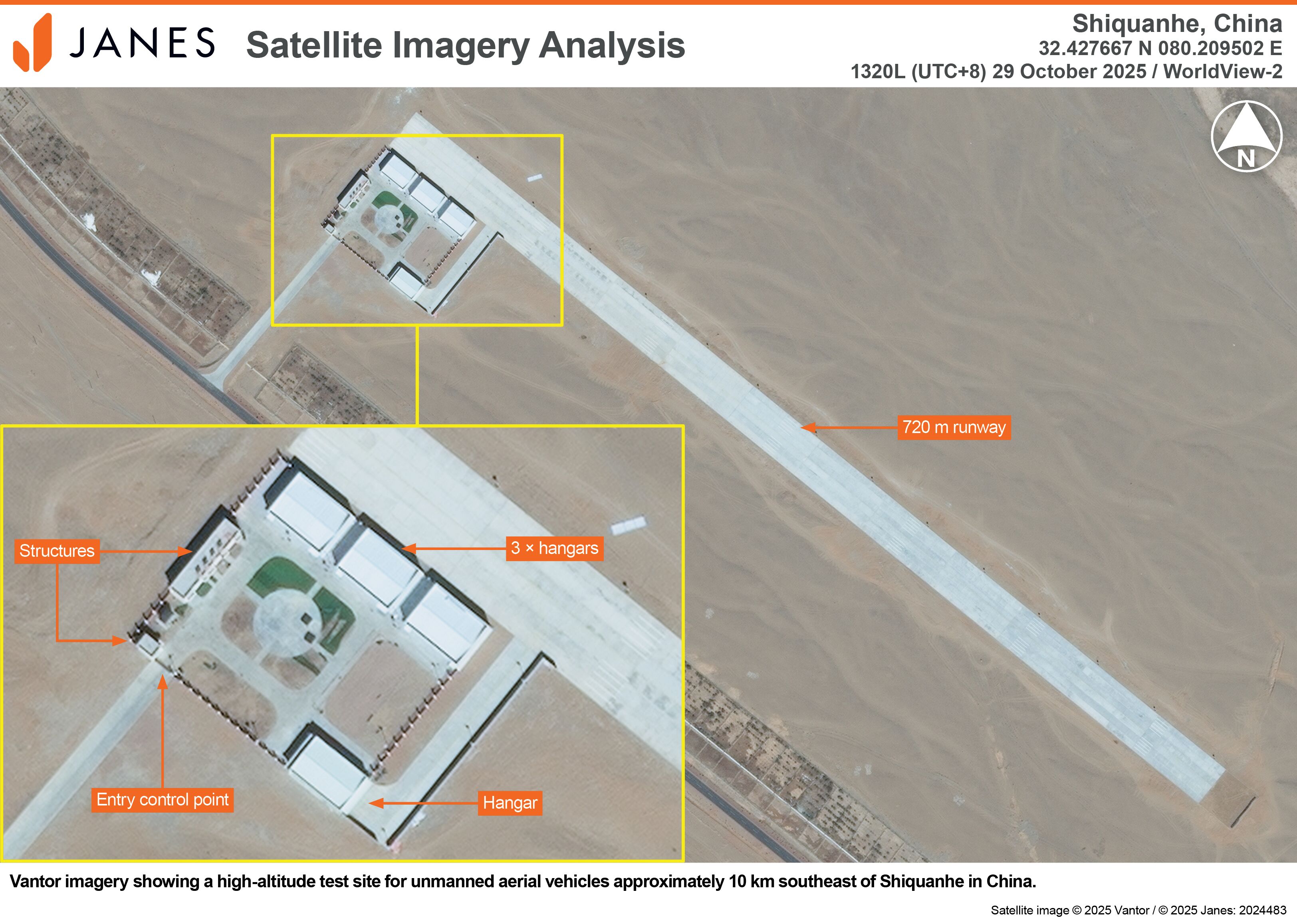
Vantor imagery showing a high-altitude test site for unmanned aerial vehicles approximately 10 km southeast of Shiquanhe in China. (Vantor/Janes)
Satellite imagery has revealed details of a new high-altitude unmanned aerial vehicle (UAV) testing site established by China in Tibet to improve the ability of unmanned platforms to operate in mountainous areas such as the Himalayas.
The testing facility, which was inaugurated on 28 September 2025, is located at an altitude of over 4,300 m (14,100 ft) above mean sea level, about 10 km southeast of Shiquanhe in Ngari Prefecture (also known as Ali Prefecture) in the Tibet Autonomous Region (TAR).
According to Shi Yuhui, deputy secretary of the Ngari Prefectural Party Committee, the “diverse topography” of the prefecture, plus its “low oxygen content and complex air currents”, renders the testing facility as “the ultimate testing ground for UAVs”.
The satellite imagery, dated 29 October, shows that the facility is equipped with a 720 m-long runway for flight operations and three 20×14.5 m hangars and one 20×12.5 m hangar. Historical satellite imagery shows that the test facility was set up on previously undeveloped land.
The testing facility will enable China to conduct “UAV assembly, trials, and high-altitude flight-testing”, according to the state-owned broadcaster China Central Television (CCTV).
According to Chen Liang, deputy director of the National Key Laboratory of High-Energy High-Power Pulse Power Supplies, his laboratory will conduct research and development (R&D) at the testing facility to “overcome bottlenecks” associated with adapting low-altitude aircraft to the region’s “unique [high-altitude] environment”.
Data generated at the facility will support the development of larger UAVs capable of high-altitude operations, the Xinhua News Agency added.
High-altitude UAV
Go beyond the headlines — with direct links to interconnected entities
Get full access to validated equipment, military capabilities, and market insights.