
The Environment Agency has announced significant upgrades to three flood storage reservoirs across the Somerset Levels and Moors, in a £90m programme designed to strengthen protection for homes, farms, and transport routes in one of the UK’s most flood-prone regions.
Work at West Moor, Curry Moor, and Southlake Moor Reservoirs began in 2022 and is scheduled to finish by October 2026. The improvements form part of the Government’s £5.2bn investment to protect 336,000 properties from flooding and coastal erosion by 2027.
At West Moor Reservoir, near Langport, engineers have installed new inlet and outlet spillways and replaced a connecting pipe between moors. The site can store up to 8.5 million cubic metres of water – the equivalent of 3,400 Olympic swimming pools – helping to protect Thorney village and surrounding farmland.

Curry Moor Reservoir, west of Langport, has seen embankment repairs, a new debris screen, and spillway works along the River Tone. These measures will safeguard local farms and settlements, as well as the busy A361 Taunton–Glastonbury road.
At Southlake Moor Reservoir, teams have reinforced river banks and built a new spillway to manage overflow. Further perimeter works are planned for spring 2026.
Ian Withers, Wessex Area Director for the Environment Agency, said: “These vital maintenance investments represent a significant step forward in continuing to protect Somerset communities from flooding. By strengthening these reservoirs, we’re ensuring homes, businesses, and transport links are better prepared for future flood events.”
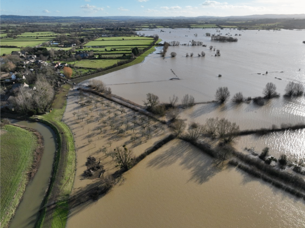
The Somerset Levels and Moors, where 18% of land lies below average tide level, have a long history of flooding – with major events recorded in 2014, 2012, and earlier decades. The upgrades form part of an interconnected floodwater management system, meaning improvements at individual sites benefit the wider network.

Environmental safeguards have also been built into the programme. Teams have relocated fish, created artificial badger setts, and carried out bat and water vole surveys to protect local wildlife. Reed canary-grass habitats, vital for rare hairy click beetles, have been preserved along the River Tone.
Catchment Engineer Jason Flagg added: “The technical complexity of these upgrades has been immense, but every element has been designed to work as part of the wider flood management network. These reservoirs are now in a strengthened condition to serve communities for decades to come.”
The Somerset Levels and Moors consist of ‘The Levels’ (the higher coastal clay belt) and the ‘Moors’ (the low-lying basin into which rivers overspill and flood). Much of the area has been historically drained for agricultural and residential purposes.
The EA is the largest undertaker of reservoirs in England with over 200 in their portfolio. These reservoirs assist in protecting large areas of the Somerset Levels and Moors from flooding and are a means of managing flooding in an effective way in what would otherwise be a constantly wet marsh land.
The flood storage areas are dry most of the time and only fill up during flood conditions.
West Moor, Curry moor, and Southlake reservoirs are classified as a ‘large raised’ reservoir under the Reservoirs Act 1975 and are maintained by the Environment Agency as part of its flood risk management responsibilities. Curry Moor Reservoir has a capacity of 10.8million m3. Southlake Reservoir has a capacity of 1.6million m3. West Moor Reservoir has a capacity of 8.5million m3.