
The Environment Agency (EA) issued a notice just after midnight this morning (December 1) for the Upper River Ouse in the city.
The government agency said flooding is possible for riverside footpaths and low-lying land in York including King’s Staith, Queen’s Staith, and South Esplanade, and to the south as far as Naburn Lock.
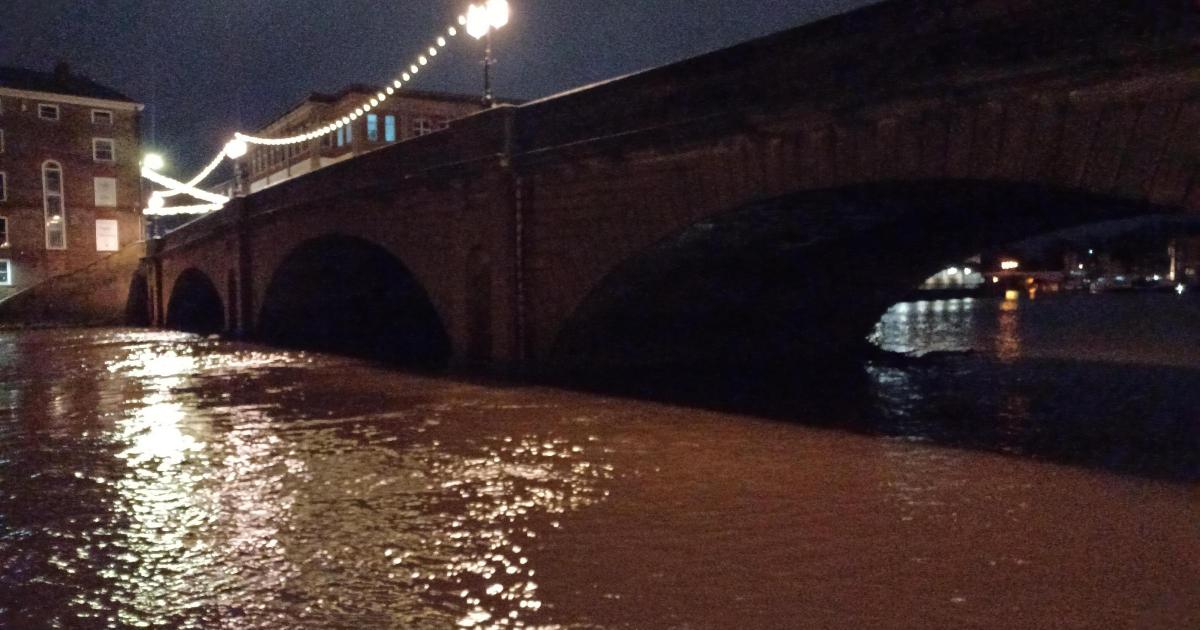
Water was lapping over Queen’s Staith in the centre of York around 7am (December 1) as levels are predicted to rise in the vicinity by another 1.75 metres this week. (Image: Kevin Glenton)
Some further showers are expected in York today and tomorrow.
At 7.10am this morning, water was lapping over Queens Staith in places and was high close to King’s Staith on the opposite bank, although at the time the path was clear to Tower Gardens.
At the Viking Recorder in North Street Gardens the River Ouse level, measured at 7.30am, stood at 2.12 metres and falling, above its normal range of 1.9 metres.
It peaked at 2.25 metres around 8.45 last night but the Environment Agency data predicts it rising to over four metres on the evening of December 2.
Water was lapping over parts of South Esplanade in the centre of York around 7am (December 1) as levels are predicted to rise in the vicinity by another 1.75 metres this week. (Image: Kevin Glenton)
The EA says property flooding is possible above three metres.
A flood warning – meaning flooding is possible – is usually issued between 30 minutes and two hours before it occurs, the agency said.
Residents are urged to regularly check warnings for their area and follow official advice.
At the Foss Barrier close to the confluence of the two principal rivers in York, the level at 7.30am was 7.04 metres and currently falling, below the top of the normal range of 7.9 metres.
The highest level recorded here was 10.2 metres on November 4, 2000.
The EA also issued a flood alert for the Lower and Upper River Derwent.
This is aimed at low lying land and roads near rivers, especially around Elvington, Stamford Bridge, Pocklington and Wilberfoss for the Lower Derwent and for the Upper Derwent, around the Malton and Low Marishes area.
In Pocklington, there were puddles building close to roadside drains in the town and a risk of spray onto pavement areas.
The agency’s advice in a flood alert – which means flooding is possible – is to avoid walking, cycling or driving through any flood water and highlights other at-risk areas such as fields, recreational land and car parks, minor roads, farmland and coastal areas affected by spray of waves overtopping.
All areas are being assessed by the Environment Agency, it said.